- Population
- 14,573
- 14.6K
- Elevation
- 18 m
- above sea level
- Local time
- UTC+00:00
- Europe/London · UTC+00:00
- Airports
- LCY London City Airport7 km
- LHR London Heathrow Airport32 km
About Lee
Lee is a town. Location: Lewisham, Greater London. Population: 14,573. Elevation: 18 m.
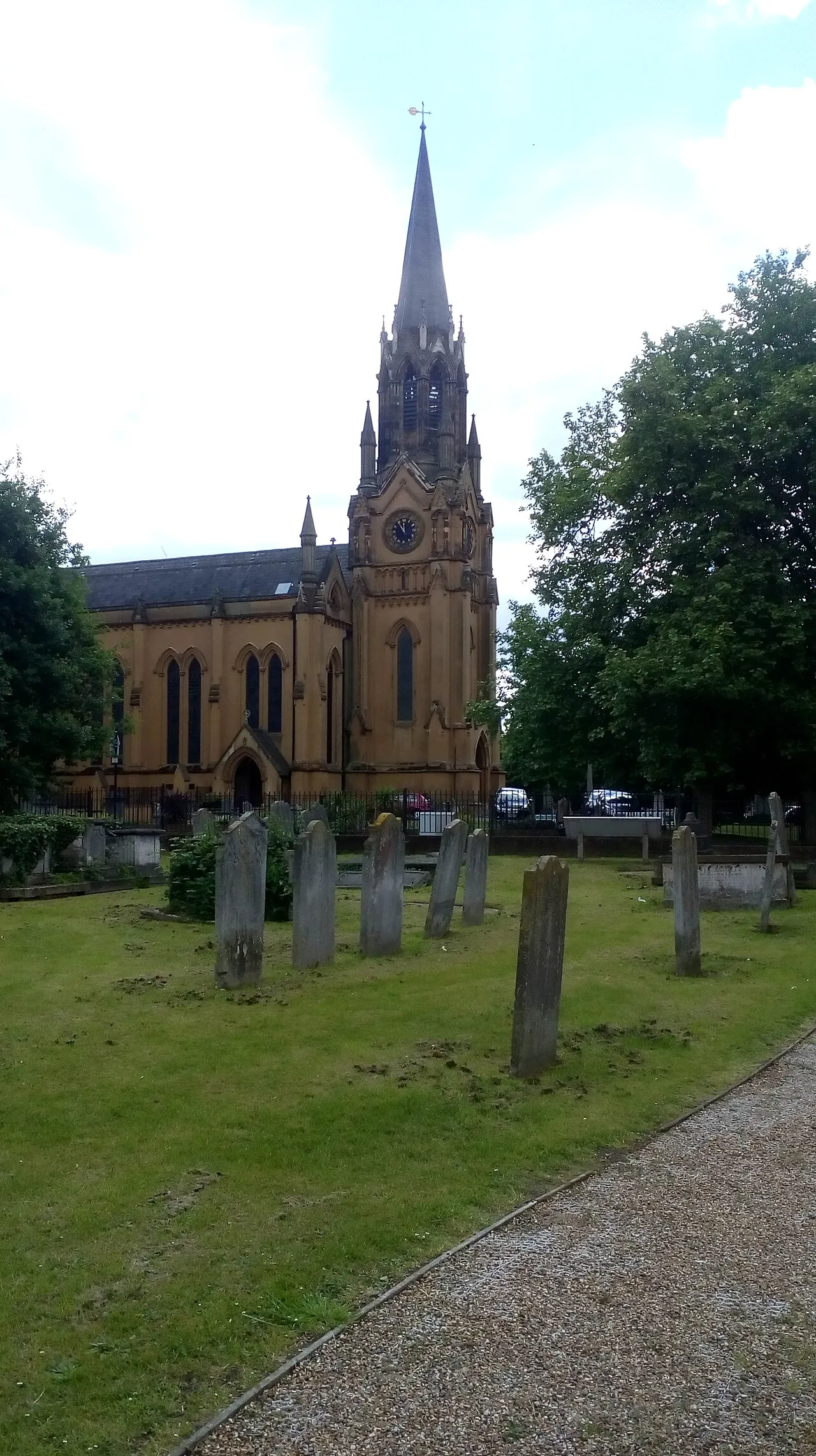
Lee, also known as Lee Green, is an area of South East London, England, straddling the border of the London Borough of Lewisham and the Royal Borough of Greenwich. It is located northwest of Eltham and southeast of Lewisham. It was in Kent before becoming part of the County of London in 1889, and then Greater London in 1965. The churchyard of St Margaret's Church (current church rebuilt 1839–41, architect: John Brown) is the burial place of three Astronomers Royal: Edmond Halley, Nathaniel Bliss and John Pond.
Source: Wikipedia · CC BY-SA 4.0
Photos of Lee
-

London Less Travelled · CC BY 2.0 -

Bill Boaden · CC BY-SA 2.0 -

Bill Boaden · CC BY-SA 2.0 -

Ethan Doyle White · CC BY-SA 4.0 -

Ethan Doyle White · CC BY-SA 4.0


Places bordering Lee
- Blackheath
Climate of Lee
Best months for sightseeingBest months for sightseeing: June–August.
This month · November
A cold month
Day 11° · Night 4° · Rain 68 mm
- Hottest month
- July (day 23°)
- Coldest month
- February (night 2°)
- Wettest month
- January (70 mm)
- Driest month
- July (42 mm)
Bars: average monthly low and high temperature. Below: precipitation. Monthly averages for 1970–2000 at about 18 km resolution, adjusted for elevation. Highlighted months are mild and relatively dry. Source: WorldClim 2.1 (CC BY 4.0).
Show values as a table
| Month | Jan | Feb | Mar | Apr | May | Jun | Jul | Aug | Sep | Oct | Nov | Dec |
|---|---|---|---|---|---|---|---|---|---|---|---|---|
| Average high (°C) | 8° | 8° | 10° | 13° | 17° | 20° | 23° | 22° | 19° | 15° | 11° | 8° |
| Average low (°C) | 2° | 2° | 3° | 4° | 7° | 10° | 13° | 12° | 10° | 7° | 4° | 3° |
| Precipitation (mm) | 70 | 44 | 51 | 46 | 48 | 54 | 42 | 50 | 60 | 65 | 68 | 67 |
How to get to Lee
The nearest airport is London City Airport (LCY), 7 km to the northeast as the crow flies. For international flights: London Heathrow Airport (LHR) (32 km). The nearest large city is Bexley, 10 km to the east.
Airports
- London City Airport (LCY) London 7 kmnortheast
- London Heathrow Airport (LHR) London 32 kmwest
- London Gatwick Airport (LGW) London 37 kmsouth
Nearby large cities
- Bexley Population: 228K 10 kmeast
- Barking Population: 218.5K 10 kmnortheast
- London Population: 9M 11 kmnorthwest
- City of Westminster Population: 247.6K 11 kmnorthwest
- Croydon Population: 173.3K 11 kmsouthwest
Straight-line distances; road distances are longer. Airport data: OurAirports.
Day trips from Lee
Within 100 km: 810 historic and cultural sites, 579 natural sites, 327 lakes, rivers and coasts.
0–25 km414 places
- White Hart Lane Landmark 17 kmN
- Lot's Ait Island 21 kmW
- Ravens Ait Island 23 kmW
- Rook Island Island 13 kmN
25–60 km507 places
- Isle of Sheppey Island 58 kmE
- Spotlites @ Kings Theatre Attraction 38 kmE
- Yantlet beach Beach 46 kmE
- Northey Island Island 57 kmNE
60–100 km795 places
- St Nicholas Church Shoreham Attraction 71 kmS
- The Marlipins Museum Museum 72 kmS
- Camber Sands Beach 80 kmSE
- West Mersea Beach Beach 73 kmNE
Straight-line distances.
Nearby attractions & nature
Everything nearby-
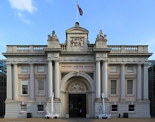 National Maritime Museum Museum, Greenwich2.9 km N
-
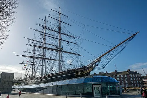 Cutty Sark Museum, Greenwich3.2 km N
-
Greenwich Park Natural site, Greenwich2.4 km N
-
 The Valley Landmark, Greenwich4.1 km NE
-
Royal Observatory Attraction, Greenwich2.4 km N
-
Diddy Harrison Planetarium Museum, Greenwich2.4 km N
-
General James Wolfe Statue Landmark, Greenwich2.5 km N
-
 The Den Landmark, Lewisham5.2 km NW
Sources & licences
Data last updated: · 2 independent sources