- Population
- 95,961
- 96K
- Elevation
- 138 m
- above sea level
- Local time
- UTC+00:00
- Europe/London · UTC+00:00
- Airports
- LTN London Luton Airport15 km
- LHR London Heathrow Airport31 km
About Hemel Hempstead
Hemel Hempstead is a town. Location: Dacorum District, Hertfordshire. Population: 95,961. Elevation: 138 m.
Hemel Hempstead ( ) is a town in the Dacorum district of Hertfordshire, England. It is located 24 miles (39 km) north-west of London; nearby towns and cities include Watford, St Albans and Berkhamsted. The population at the 2021 census was 95,961. Hemel Hempstead has existed since at least the 8th century and was granted its town charter by Henry VIII in 1539. It has expanded and developed in recent decades after being designated as a New Town after the end of the Second World War.
Source: Wikipedia · CC BY-SA 4.0
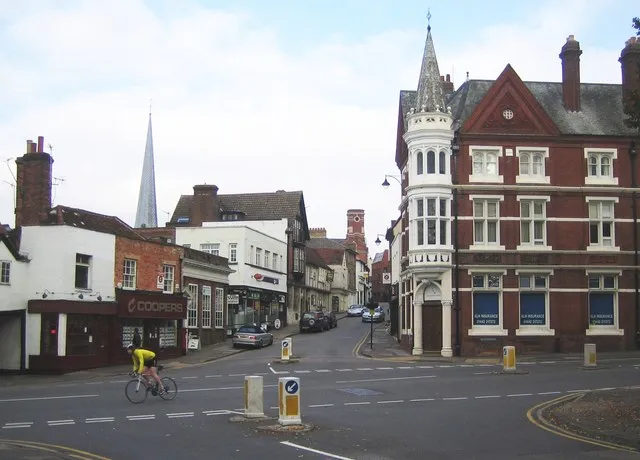
Photos of Hemel Hempstead
-

Lewis Clarke · CC BY-SA 2.0 -

Bryn Holmes · CC BY-SA 2.0 -

Lewis Clarke · CC BY-SA 2.0


Travel notes for Hemel Hempstead
From Wikivoyage
Hemel Hempstead is a town in Hertfordshire with a population of almost 100,000 (2011).
Understand+
Developed after World War II as a new town, the town has existed as a settlement since the 8th century and has a picturesque old town and a fine Norman church. The new town centre is a planned shopping area with an indoor Mall called Marlowes Centre and an outdoor market. There is extensive, though not free, town centre parking. The town has the only real snow indoor ski centre in the south east.
"Magic Roundabout":
Officially named 1 The Plough and sometimes known as "Moor End Roundabout", a road roundabout made up of 6 small roundabouts arranged in a circle around a single large roundabout. Drivers either love or hate navigating it - in 2005 it was voted second worst roundabout in the UK (the "worst" being its sister roundabout in Swindon); yet by 2011 it was voted the best (in a different poll). Probably not something learner drivers look forward to at rush-hour!
Get in+
By road:
The town is served by the M1 and M25 motorways and the A41 and A414 trunk roads.
By train:
2 Hemel Hempstead railway station, London Road, HP3 9BQ. It is 35 minutes away from London Euston. Trains go about every 20 minutes to and from Hemel Hempstead on Monday to Friday and about every 30 minutes on weekends. (updated Jun 2022)
Check the National Rail website before you go, as sometimes (especially on weekends) there is engineering work and trains are replaced by buses. Travelling is cheaper on weekdays after 9:30AM. The cheapest ticket for a single person is a Day Travelcard, which is around £14, and gets you into London and is valid for all Underground lines all day.
By bus:
There are coaches to and from London and other towns as well as various airports. National Express coaches go direct to Luton, Heathrow and Stansted airports.
To go to/from Gatwick Airport, best go by train; you will have to change once, in Watford. For London City Airport, you will have to go to London by train, then take the Underground.
By air:
The town is 11 miles from Luton Airport and 25 miles from Heathrow Airport.
By narrowboat:
The Grand Union Canal passes close to the west of the town, and through the southern suburb of Apsley.
By bicycle:
The town is on National Cycle Route 57 that runs from Welwyn Garden City in Hertfordshire to Farmington, Gloucestershire near Northleach.
Source: Wikivoyage · CC BY-SA 4.0 · abridged
Climate of Hemel Hempstead
Best months for sightseeingBest months for sightseeing: June–August.
This month · November
A cold month
Day 10° · Night 4° · Rain 65 mm
- Hottest month
- July (day 22°)
- Coldest month
- February (night 1°)
- Wettest month
- October (69 mm)
- Driest month
- July (43 mm)
Bars: average monthly low and high temperature. Below: precipitation. Monthly averages for 1970–2000 at about 18 km resolution, adjusted for elevation. Highlighted months are mild and relatively dry. Source: WorldClim 2.1 (CC BY 4.0).
Show values as a table
| Month | Jan | Feb | Mar | Apr | May | Jun | Jul | Aug | Sep | Oct | Nov | Dec |
|---|---|---|---|---|---|---|---|---|---|---|---|---|
| Average high (°C) | 7° | 7° | 10° | 12° | 16° | 19° | 22° | 22° | 18° | 14° | 10° | 8° |
| Average low (°C) | 1° | 1° | 3° | 4° | 7° | 10° | 12° | 12° | 10° | 7° | 4° | 2° |
| Precipitation (mm) | 67 | 47 | 53 | 50 | 52 | 57 | 43 | 55 | 60 | 69 | 65 | 68 |
How to get to Hemel Hempstead
The nearest airport is London Luton Airport (LTN), 15 km to the northeast as the crow flies. The nearest large city is Watford, 12 km to the south.
Airports
- London Luton Airport (LTN) Luton, Luton 15 kmnortheast
- London Heathrow Airport (LHR) London 31 kmsouth
- London City Airport (LCY) London 45 kmsoutheast
Nearby large cities
- Watford Population: 125.7K 12 kmsouth
- Luton Population: 225.3K 14 kmnorth
- Harrow Population: 149.2K 21 kmsoutheast
- High Wycombe Population: 133.2K 25 kmsouthwest
- Enfield Population: 156.9K 28 kmsoutheast
Straight-line distances; road distances are longer. Airport data: OurAirports.
Day trips from Hemel Hempstead
Within 100 km: 878 historic and cultural sites, 605 natural sites, 305 lakes, rivers and coasts.
0–25 km143 places
- Bradbury's Island Island 20 kmS
- Broad Water Island Island 22 kmE
- Heron Island Island 7 kmE
- Chantry Island Island 10 kmSE
25–60 km848 places
- White Hart Lane Landmark 31 kmSE
- The Lynch Island 42 kmSW
- Holm Island Island 36 kmS
- Sunbury Court Island 38 kmS
60–100 km797 places
- Isle of Sheppey Island 97 kmSE
- Spotlites @ Kings Theatre Attraction 80 kmSE
- West Mersea Beach Beach 95 kmE
- Yantlet beach Beach 84 kmE
Straight-line distances.
Hemel Hempstead and similar cities
Side by side with cities of similar size in the same country: population, elevation and climate.
| Measure | Hemel Hempstead | Rochdale | Darlington | Southport |
|---|---|---|---|---|
| Population | 96K | 97.6K | 92.4K | 91.7K |
| Elevation | 138 m | 127 m | 40 m | 9 m |
| Summer day (hottest month) | 22° | 20° | 20° | 20° |
| Winter night (coldest month) | 1° | 2° | 1° | 2° |
| Annual rainfall | 686 mm | 1,134 mm | 674 mm | 800 mm |
| Best months | Jun–Aug | Jun–Aug | Jun–Sep | Jun–Sep |
| Distance | — | 237 km | 317 km | 273 km |
Climate values are 1970–2000 monthly averages; straight-line distance.
Nearby attractions & nature
Everything nearby-
Golden Parsonage Historic site, Great Gaddesden5.5 km N
-
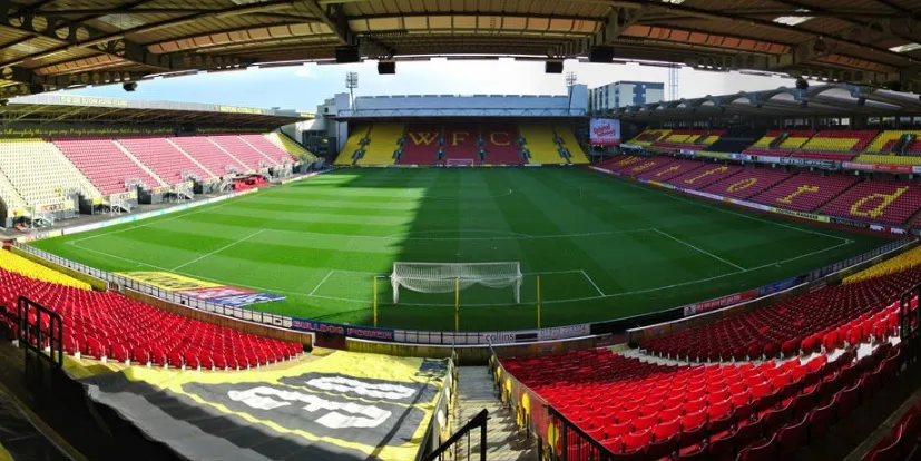 Vicarage Road Landmark, Watford District12 km S
-
Cathedral and Abbey Church of Saint Alban Attraction, City and District of St. Albans7.4 km E
-
Heron Island Island, City and District of St. Albans7 km E
-
The Lake Lake, City and District of St. Albans7 km E
-
Berkhamsted Castle Historic site, Berkhamsted7.7 km W
-
Ss Alban & Stephen Catholic Church Attraction, City and District of St. Albans8.4 km E
-
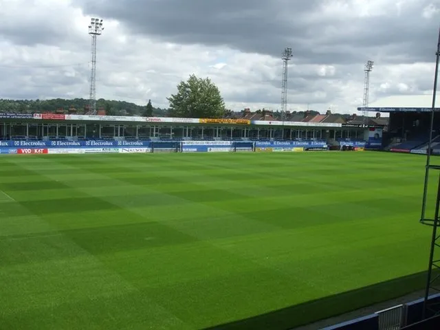 Kenilworth Road Landmark, Luton15 km N
Sources & licences
Data last updated: · 2 independent sources