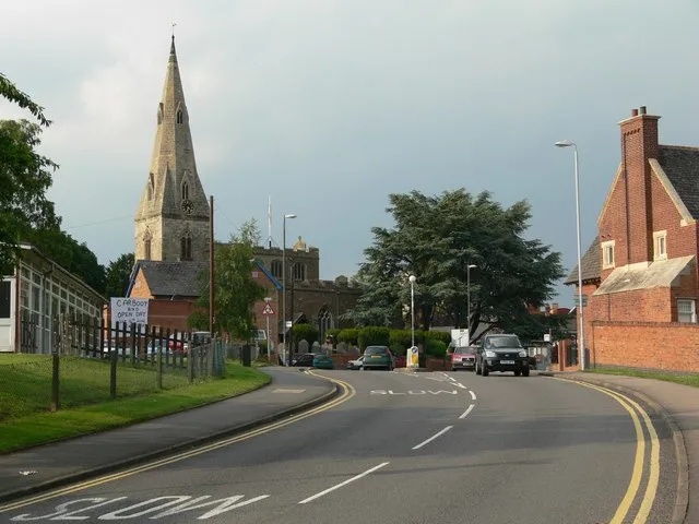
- Population
- 23,849
- 23.8K
- Elevation
- 104 m
- above sea level
- Local time
- UTC+00:00
- Europe/London · UTC+00:00
- Airports
- EMA East Midlands Airport30 km
- BHX Birmingham Airport48 km
About Oadby
Oadby is a town. Location: Oadby and Wigston, Leicestershire. Population: 23,849. Elevation: 104 m.
Oadby is a town in the borough of Oadby and Wigston in Leicestershire, England, located 4 miles (6.4 km) south-east of Leicester on the A6 road. Leicester Racecourse is situated on the border between Oadby and Stoneygate. The University of Leicester Botanical Garden is in Oadby. Oadby had a population of 23,849 in 2011, and like its neighbour Wigston is made up of five wards. The Borough of Oadby and Wigston is twinned with Maromme in France, and Norderstedt in Germany.
Source: Wikipedia · CC BY-SA 4.0
Climate of Oadby
Best months for sightseeingBest months for sightseeing: June–August.
This month · November
A cold month
Day 9° · Night 3° · Rain 58 mm
- Hottest month
- July (day 22°)
- Coldest month
- February (night 1°)
- Wettest month
- December (61 mm)
- Driest month
- February (44 mm)
Bars: average monthly low and high temperature. Below: precipitation. Monthly averages for 1970–2000 at about 18 km resolution, adjusted for elevation. Highlighted months are mild and relatively dry. Source: WorldClim 2.1 (CC BY 4.0).
Show values as a table
| Month | Jan | Feb | Mar | Apr | May | Jun | Jul | Aug | Sep | Oct | Nov | Dec |
|---|---|---|---|---|---|---|---|---|---|---|---|---|
| Average high (°C) | 7° | 7° | 10° | 12° | 16° | 19° | 22° | 21° | 18° | 14° | 9° | 7° |
| Average low (°C) | 1° | 1° | 2° | 3° | 6° | 9° | 11° | 11° | 9° | 6° | 3° | 2° |
| Precipitation (mm) | 57 | 44 | 50 | 48 | 49 | 57 | 50 | 58 | 57 | 56 | 58 | 61 |
How to get to Oadby
The nearest airport is East Midlands Airport (EMA), 30 km to the northwest as the crow flies. The nearest large city is Leicester, 5 km to the northwest.
Airports
- East Midlands Airport (EMA) Nottingham, Leicestershire 30 kmnorthwest
- Birmingham Airport (BHX) Birmingham, West Midlands 48 kmwest
- London Luton Airport (LTN) Luton, Luton 95 kmsoutheast
Nearby large cities
- Leicester Population: 368.6K 5 kmnorthwest
- Coventry Population: 345.3K 37 kmsouthwest
- Nottingham Population: 323.6K 39 kmnorth
- Northampton Population: 245.9K 42 kmsouth
- Burton-on-Trent Population: 122.2K 44 kmnorthwest
Straight-line distances; road distances are longer. Airport data: OurAirports.
Nearby attractions & nature
Everything nearby-
 Bait-ul-Ikram Attraction, Leicester2.6 km W
-
Freemen's Common Mediumwave Transmitter Landmark, Leicester3.5 km NW
-
Welford Road Landmark, Leicester3.9 km NW
-
The King Power Stadium Landmark, Leicester4.3 km W
-
 Leicester Castle Historic site, Leicester4.8 km NW
-
Scraptoft Historic site, Scraptoft5.6 km NE
-
The Islands Island, Wistow5.1 km S
-
Leicester Abby Attraction, Leicester6 km NW
Sources & licences
Data last updated: · 2 independent sources