
- Elevation
- 28 m
- above sea level
- Local time
- UTC+00:00
- Europe/London · UTC+00:00
- Airports
- NWI Norwich Airport44 km
- STN London Stansted Airport76 km
About West Tofts
West Tofts is a village. Location: Lynford, Breckland District. Elevation: 28 m.
West Tofts is a deserted medieval village in the civil parish of Lynford, within the Breckland district, in the county of Norfolk, England. It is within the Stanford Training Area, an army training area. In 1931 the parish had a population of 332. On 1 April 1935 the parish was abolished and merged with Lynford. St Mary's Church is a Grade I listed building with chancel and south chapel designed by A. W. N. Pugin c.1850 for the Rev. Augustus Sutton. The village was emparked in the 18th century.
Source: Wikipedia · CC BY-SA 4.0
Photos of West Tofts
-

Nicholas Mutton · CC BY-SA 2.0 -

Nicholas Mutton · CC BY-SA 2.0 -
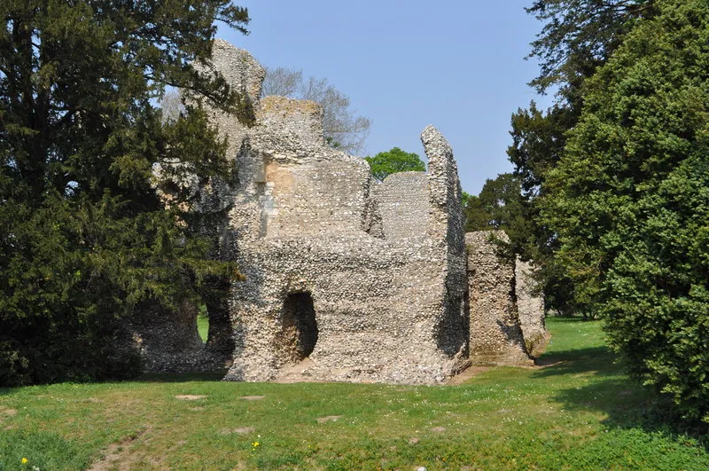
Weeting Castle Ashley Dace · CC BY-SA 2.0


Climate of West Tofts
Best months for sightseeingBest months for sightseeing: June–September.
This month · November
A cold month
Day 10° · Night 4° · Rain 68 mm
- Hottest month
- August (day 21°)
- Coldest month
- February (night 1°)
- Wettest month
- November (68 mm)
- Driest month
- February (45 mm)
Bars: average monthly low and high temperature. Below: precipitation. Monthly averages for 1970–2000 at about 18 km resolution, adjusted for elevation. Highlighted months are mild and relatively dry. Source: WorldClim 2.1 (CC BY 4.0).
Show values as a table
| Month | Jan | Feb | Mar | Apr | May | Jun | Jul | Aug | Sep | Oct | Nov | Dec |
|---|---|---|---|---|---|---|---|---|---|---|---|---|
| Average high (°C) | 7° | 7° | 10° | 12° | 16° | 19° | 21° | 21° | 18° | 14° | 10° | 7° |
| Average low (°C) | 1° | 1° | 2° | 4° | 7° | 10° | 12° | 12° | 10° | 7° | 4° | 2° |
| Precipitation (mm) | 60 | 45 | 50 | 45 | 46 | 57 | 56 | 58 | 60 | 64 | 68 | 60 |
Other places to visit in this season: June July August September
How to get to West Tofts
The nearest airport is Norwich Airport (NWI), 44 km to the northeast as the crow flies. For international flights: London Stansted Airport (STN) (76 km). The nearest large city is Norwich, 43 km to the east.
Airports
- Norwich Airport (NWI) Norwich, Norfolk 44 kmnortheast
- London Stansted Airport (STN) London, Essex 76 kmsouthwest
- London Luton Airport (LTN) Luton, Luton 101 kmsouthwest
Nearby large cities
- Norwich Population: 143.1K 43 kmeast
- Cambridge Population: 145.7K 52 kmsouthwest
- Ipswich Population: 178.8K 58 kmsoutheast
- Peterborough Population: 163.4K 65 kmwest
- Colchester Population: 130.2K 69 kmsouth
Straight-line distances; road distances are longer. Airport data: OurAirports.
Day trips from West Tofts
Within 100 km: 383 historic and cultural sites, 130 natural sites, 160 lakes, rivers and coasts.
0–25 km42 places
- Dog Island Island 13 kmSE
- Long Island Island 13 kmSE
- Butten Island Island 10 kmS
- Birdcage Island Island 7 kmNW
25–60 km204 places
- Snettisham Beach Beach 45 kmNW
- Weybourne Beach Beach 58 kmNE
- Scolt Head Island Island 54 kmN
- Warham Salt Marsh - West Island 54 kmN
60–100 km427 places
- Sheringham Beach Beach 60 kmNE
- Hemsby Beach Beach 71 kmE
- Aldeburgh's Beach Beach 72 kmSE
- West Mersea Beach Beach 82 kmS
Straight-line distances.
Nearby attractions & nature
Everything nearby-
Thetford Forest Park Natural site, Lynford3.9 km SW
-
Weeting Castle Historic site, Weeting-with-Broomhill6.9 km SW
-
Stanton Downham Park Natural site, Santon Downham5.5 km SW
-
Birdcage Island Island, Didlington7.2 km NW
-
Thetford Priory Historic site, Thetford9.7 km S
-
Thetford Red Castle Historic site, Thetford9.9 km S
Sources & licences
Data last updated: · 2 independent sources