- Elevation
- 196 m
- above sea level
- Local time
- UTC+00:00
- Europe/London · UTC+00:00
- Airports
- MME Teesside International Airport41 km
- LBA Leeds Bradford Airport69 km
About Riccal Heads
Riccal Heads is a mountain. Location: Spaunton, Ryedale District. Elevation: 196 m. The best months to visit are June–September. The nearest airport is Teesside International Airport (41 km). Nearby sights include Shepherd's Nab and Ryedale Folk Museum.
Climate of Riccal Heads
Best months for sightseeingBest months for sightseeing: June–September.
This month · November
A cold month
Day 8° · Night 2° · Rain 66 mm
- Hottest month
- July (day 19°)
- Coldest month
- January (night 0°)
- Wettest month
- December (68 mm)
- Driest month
- February (45 mm)
Bars: average monthly low and high temperature. Below: precipitation. Monthly averages for 1970–2000 at about 18 km resolution, adjusted for elevation. Highlighted months are mild and relatively dry. Source: WorldClim 2.1 (CC BY 4.0).
Show values as a table
| Month | Jan | Feb | Mar | Apr | May | Jun | Jul | Aug | Sep | Oct | Nov | Dec |
|---|---|---|---|---|---|---|---|---|---|---|---|---|
| Average high (°C) | 5° | 6° | 8° | 10° | 14° | 17° | 19° | 19° | 16° | 12° | 8° | 6° |
| Average low (°C) | 0° | 0° | 1° | 2° | 5° | 8° | 10° | 10° | 8° | 5° | 2° | 1° |
| Precipitation (mm) | 67 | 45 | 55 | 46 | 49 | 57 | 54 | 61 | 60 | 66 | 66 | 68 |
Other places to visit in this season: June July August September
How to get to Riccal Heads
The nearest airport is Teesside International Airport (MME), 41 km to the northwest as the crow flies. For international flights: Leeds Bradford Airport (LBA) (69 km). The nearest large city is Middlesbrough, 37 km to the northwest.
Airports
- Teesside International Airport (MME) Darlington, Durham 41 kmnorthwest
- Leeds Bradford Airport (LBA) Leeds, West Yorkshire 69 kmsouthwest
- Humberside Airport (HUY) Grimsby, Lincolnshire 89 kmsoutheast
Nearby large cities
- Middlesbrough Population: 142.7K 37 kmnorthwest
- York Population: 156.1K 40 kmsouth
- Leeds Population: 536.3K 70 kmsouthwest
- Hull Population: 314K 72 kmsoutheast
- Sunderland Population: 170.1K 74 kmnorthwest
Straight-line distances; road distances are longer. Airport data: OurAirports.
Day trips from Riccal Heads
Within 100 km: 414 historic and cultural sites, 550 natural sites, 117 lakes, rivers and coasts.
0–25 km125 places
- St Thomas's Island Island 17 kmNE
- Cherry Islands Island 22 kmS
- North York Moors Mountain 16 kmNE
- Hambleton Hills Mountain 19 kmW
25–60 km290 places
- Seaton Carew Beach Beach 44 kmNW
- Redcar Beach Beach 37 kmN
- Whitby Beach Beach 27 kmNE
- North Beach Beach 53 kmSE
60–100 km666 places
- Great Britain Island 79 kmSW
- Sunk Island Island 91 kmSE
- Saint Mary’s Island Island 93 kmN
- Read's Island Island 73 kmS
Straight-line distances.
Nearest towns and villages
-
Lastingham Village, Lastingham1.5 km E
-
Spaunton Village, Spaunton1 km E
-
Kirkbymoorside Village, Kirkbymoorside4 km SW
-
Hutton-le-Hole Village, Ryedale District1.3 km NW
-
Cropton Village, Cropton4.5 km E
-
Hutton le Hole Village, Hutton-le-Hole2.2 km S
Nearby attractions & nature
Everything nearby-
Shepherd's Nab Mountain, Hutton-le-Hole1.4 km W
-
Ryedale Folk Museum Museum, Hutton-le-Hole0.8 km W
-
Sinnington Hill Mountain, Sinnington5 km S
-
Boon Hill Mountain, Gillamoor5.2 km W
-
Rosedale Natural site, England5.5 km N
-
Edstone Hill Mountain, Edstone6 km S
-
Riccal Dale Natural site, England8.6 km W
-
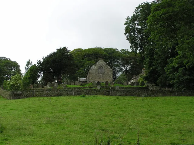 Bransdale Natural site, England11 km NW
Sources & licences
Data last updated: