Rushcliffe Country Park
Located in Ruddington, Rushcliffe Coordinates: 52°52′59″ N 1°08′53″ W
- Elevation
- 42 m
- above sea level
- Local time
- UTC+00:00
- Europe/London · UTC+00:00
- Airports
- EMA East Midlands Airport13 km
- BHX Birmingham Airport63 km
About Rushcliffe Country Park
Rushcliffe Country Park is a natural site. Location: Ruddington, Rushcliffe. The best months to visit are June–August. The nearest airport is East Midlands Airport (13 km). Nearby sights include Nottingham Transport Heritage Centre and Wilford Hill.
Photos of Rushcliffe Country Park
-
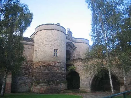
Nottingham Castle Cosmicutencil · CC0 -
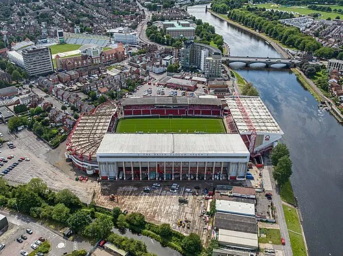
City Ground Arne Müseler · CC BY-SA 3.0 de -
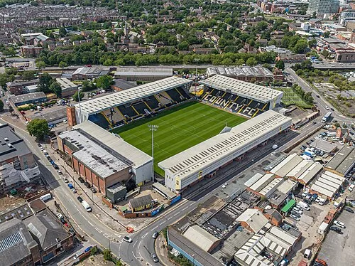
Meadow Lane Arne Müseler · CC BY-SA 3.0 de


Climate of Rushcliffe Country Park
Best months for sightseeingBest months for sightseeing: June–August.
This month · November
A cold month
Day 10° · Night 4° · Rain 54 mm
- Hottest month
- July (day 22°)
- Coldest month
- February (night 1°)
- Wettest month
- December (59 mm)
- Driest month
- February (43 mm)
Bars: average monthly low and high temperature. Below: precipitation. Monthly averages for 1970–2000 at about 18 km resolution, adjusted for elevation. Highlighted months are mild and relatively dry. Source: WorldClim 2.1 (CC BY 4.0).
Show values as a table
| Month | Jan | Feb | Mar | Apr | May | Jun | Jul | Aug | Sep | Oct | Nov | Dec |
|---|---|---|---|---|---|---|---|---|---|---|---|---|
| Average high (°C) | 7° | 7° | 10° | 12° | 16° | 19° | 22° | 21° | 18° | 14° | 10° | 8° |
| Average low (°C) | 1° | 1° | 3° | 4° | 7° | 10° | 12° | 11° | 9° | 7° | 4° | 2° |
| Precipitation (mm) | 55 | 43 | 47 | 46 | 45 | 58 | 46 | 53 | 52 | 53 | 54 | 59 |
How to get to Rushcliffe Country Park
The nearest airport is East Midlands Airport (EMA), 13 km to the southwest as the crow flies. The nearest large city is Nottingham, 8 km to the north.
Airports
- East Midlands Airport (EMA) Nottingham, Leicestershire 13 kmsouthwest
- Birmingham Airport (BHX) Birmingham, West Midlands 63 kmsouthwest
- Manchester Airport (MAN) Manchester, Greater Manchester 92 kmnorthwest
Nearby large cities
- Nottingham Population: 323.6K 8 kmnorth
- Derby Population: 270.5K 23 kmwest
- Leicester Population: 368.6K 27 kmsouth
- Mansfield Population: 172K 28 kmnorth
- Burton-on-Trent Population: 122.2K 34 kmwest
Straight-line distances; road distances are longer. Airport data: OurAirports.
Day trips from Rushcliffe Country Park
Within 100 km: 584 historic and cultural sites, 649 natural sites, 125 lakes, rivers and coasts.
0–25 km76 places
- Barton Island Island 5 kmW
- Holme Nook Island 23 kmW
- Bardon Hill Mountain 22 kmSW
- Ramsdale Hill Mountain 17 kmN
25–60 km398 places
- Newark Island Island 30 kmNE
- Horninglow island Island 33 kmW
- Torksey Island Island 54 kmNE
- The Islands Island 36 kmS
60–100 km884 places
- Read's Island Island 98 kmNE
- Whitton Island Island 97 kmN
- Inner Tidal Bank Island 97 kmE
- Howden Dyke Island Island 96 kmN
Straight-line distances.
Nearest towns and villages
-
Ruddington Town, Ruddington1.1 km N
-
Keyworth Town, Keyworth4.1 km E
-
Bradmore Village, Bradmore1.3 km SE
-
Gotham Village, Gotham4.2 km SW
-
West Bridgford Town, Rushcliffe5.4 km N
-
Bradmore Village, Rushcliffe1.7 km E
Nearby attractions & nature
Everything nearby-
Nottingham Transport Heritage Centre Museum, Ruddington0.2 km N
-
Wilford Hill Mountain, Rushcliffe3.1 km N
-
Brands Hill Mountain, Barton in Fabis4.4 km W
-
Court Hill Mountain, Gotham5 km SW
-
Gotham Hill Mountain, Thrumpton5.5 km W
-
Barton Island Island, Barton in Fabis5.2 km W
-
Burnt Hill Mountain, Broxtowe District8.6 km NW
-
City Ground Landmark, Rushcliffe6.4 km N
Sources & licences
Data last updated: