- Elevation
- 17 m
- above sea level
- Local time
- UTC+00:00
- Europe/London · UTC+00:00
- Places inside
- 1
- listed under Sibthorpe
- Airports
- EMA East Midlands Airport37 km
- HUY Humberside Airport73 km
About Sibthorpe
Sibthorpe is a village. Location: Rushcliffe, Nottinghamshire. Elevation: 17 m. The best months to visit are June–August. The nearest airport is East Midlands Airport (37 km). Nearby sights include Aslockton Cranmers Mound and Old Hill.
Climate of Sibthorpe
Best months for sightseeingBest months for sightseeing: June–August.
This month · November
A cold month
Day 10° · Night 4° · Rain 52 mm
- Hottest month
- July (day 21°)
- Coldest month
- February (night 1°)
- Wettest month
- June (56 mm)
- Driest month
- February (40 mm)
Bars: average monthly low and high temperature. Below: precipitation. Monthly averages for 1970–2000 at about 18 km resolution, adjusted for elevation. Highlighted months are mild and relatively dry. Source: WorldClim 2.1 (CC BY 4.0).
Show values as a table
| Month | Jan | Feb | Mar | Apr | May | Jun | Jul | Aug | Sep | Oct | Nov | Dec |
|---|---|---|---|---|---|---|---|---|---|---|---|---|
| Average high (°C) | 7° | 7° | 10° | 12° | 16° | 19° | 21° | 21° | 18° | 14° | 10° | 8° |
| Average low (°C) | 1° | 1° | 3° | 4° | 6° | 9° | 12° | 11° | 9° | 7° | 4° | 2° |
| Precipitation (mm) | 52 | 40 | 45 | 46 | 45 | 56 | 44 | 52 | 51 | 51 | 52 | 56 |
How to get to Sibthorpe
The nearest airport is East Midlands Airport (EMA), 37 km to the southwest as the crow flies. The nearest large city is Nottingham, 20 km to the west.
Airports
- East Midlands Airport (EMA) Nottingham, Leicestershire 37 kmsouthwest
- Humberside Airport (HUY) Grimsby, Lincolnshire 73 kmnortheast
- Birmingham Airport (BHX) Birmingham, West Midlands 86 kmsouthwest
Nearby large cities
- Nottingham Population: 323.6K 20 kmwest
- Mansfield Population: 172K 27 kmnorthwest
- Lincoln Population: 103.8K 33 kmnortheast
- Derby Population: 270.5K 42 kmwest
- Leicester Population: 368.6K 44 kmsouthwest
Straight-line distances; road distances are longer. Airport data: OurAirports.
Day trips from Sibthorpe
Within 100 km: 527 historic and cultural sites, 554 natural sites, 124 lakes, rivers and coasts.
0–25 km49 places
- Newark Island Island 9 kmN
- Ramsdale Hill Mountain 17 kmW
- Waltham on the Wolds Hill Mountain 21 kmS
- Normanton Hill Mountain 19 kmE
25–60 km314 places
- Horninglow island Island 56 kmW
- Park Island Island 55 kmSE
- Don Island Island 58 kmNW
- Torksey Island Island 34 kmN
60–100 km842 places
- Snettisham Beach Beach 89 kmE
- Sunk Island Island 89 kmNE
- Read's Island Island 79 kmN
- Spurn Island Island 91 kmNE
Straight-line distances.
Places in Sibthorpe
1 placeCities & villages1
- Sibthorpe · Village
Nearby attractions & nature
Everything nearby-
Aslockton Cranmers Mound Historic site, Aslockton5.8 km SW
-
Old Hill Mountain, East Bridgford6.7 km W
-
East Bridgeford Historic site, East Bridgford8.4 km W
-
Gunthorpe Henge Historic site, Gunthorpe8.9 km W
-
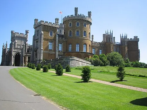 Belvoir Castle Historic site, Belvoir13 km SE
-
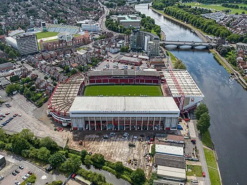 City Ground Landmark, Rushcliffe20 km W
Sources & licences
Data last updated: