- Elevation
- 9 m
- above sea level
- Local time
- UTC+00:00
- Europe/London · UTC+00:00
- Airports
- SEN London Southend Airport6 km
- LCY London City Airport49 km
About Thorpe Bay
Thorpe Bay is a village. Location: Southend-on-Sea, England. Elevation: 9 m.
Thorpe Bay is an area of the city of Southend-on-Sea, in the City of Southend-on-Sea, in the ceremonial county of Essex, England. located on the Thames Estuary. Thorpe Bay is situated within the Thorpe ward of Southend-on-Sea. It is around 4 miles to the east of Southend. Originally the area was called Thorpe, but it was renamed Thorpe Bay, after the railway station. The station had been given the name to indicate that it was a seaside settlement.
Source: Wikipedia · CC BY-SA 4.0
Photos of Thorpe Bay
-
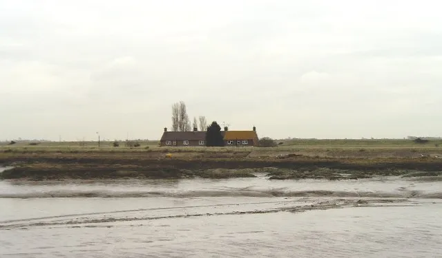
Potton Island David Kemp · CC BY-SA 2.0 -
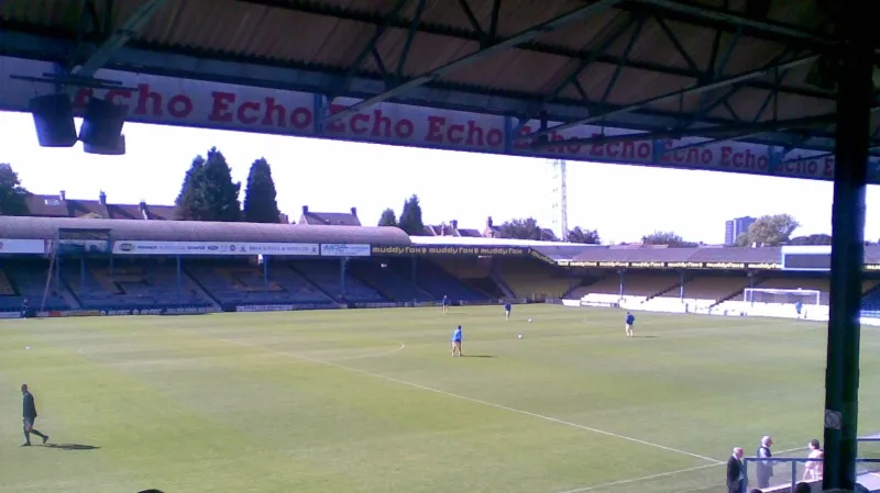
Roots Hall Jimbo online · Public domain


Climate of Thorpe Bay
Best months for sightseeingBest months for sightseeing: June–September.
This month · November
A cold month
Day 10° · Night 4° · Rain 53 mm
- Hottest month
- August (day 22°)
- Coldest month
- February (night 2°)
- Wettest month
- October (53 mm)
- Driest month
- February (30 mm)
Bars: average monthly low and high temperature. Below: precipitation. Monthly averages for 1970–2000 at about 18 km resolution, adjusted for elevation. Highlighted months are mild and relatively dry. Source: WorldClim 2.1 (CC BY 4.0).
Show values as a table
| Month | Jan | Feb | Mar | Apr | May | Jun | Jul | Aug | Sep | Oct | Nov | Dec |
|---|---|---|---|---|---|---|---|---|---|---|---|---|
| Average high (°C) | 7° | 7° | 10° | 12° | 16° | 19° | 22° | 22° | 19° | 15° | 10° | 8° |
| Average low (°C) | 2° | 2° | 3° | 4° | 7° | 10° | 13° | 13° | 11° | 8° | 4° | 3° |
| Precipitation (mm) | 45 | 30 | 38 | 34 | 37 | 51 | 38 | 46 | 47 | 53 | 53 | 47 |
Other places to visit in this season: June July August September
How to get to Thorpe Bay
The nearest airport is London Southend Airport (SEN), 6 km to the northwest as the crow flies. For international flights: London Stansted Airport (STN) (53 km). The nearest large city is Southend-on-Sea, 3 km to the west.
Airports
- London Southend Airport (SEN) Southend-on-Sea, Essex 6 kmnorthwest
- London City Airport (LCY) London 49 kmwest
- London Stansted Airport (STN) London, Essex 53 kmnorthwest
Nearby large cities
- Southend-on-Sea Population: 295.3K 3 kmwest
- Basildon Population: 144.9K 21 kmwest
- Gillingham Population: 101.2K 22 kmsouthwest
- Chelmsford Population: 111.5K 30 kmnorthwest
- Maidstone Population: 107.6K 35 kmsouthwest
Straight-line distances; road distances are longer. Airport data: OurAirports.
Day trips from Thorpe Bay
Within 100 km: 686 historic and cultural sites, 404 natural sites, 243 lakes, rivers and coasts.
0–25 km77 places
- Isle of Sheppey Island 16 kmS
- Spotlites @ Kings Theatre Attraction 24 kmSW
- Yantlet beach Beach 9 kmSW
- Central Beach Beach 19 kmSE
25–60 km432 places
- White Hart Lane Landmark 58 kmW
- West Mersea Beach Beach 29 kmNE
- Sunny Sands Beach 59 kmSE
- Isle of Oxney Island 58 kmS
60–100 km824 places
- Camber Sands Beach 67 kmS
- Aldeburgh's Beach Beach 90 kmNE
- Hastings Beach Beach 78 kmS
- Holm Island Island 90 kmW
Straight-line distances.
Nearby attractions & nature
Everything nearby-
Roots Hall Landmark, Southend-on-Sea4.4 km W
-
Prittlewell Camp Historic site, Southend-on-Sea3.4 km NW
-
Southend Pier Lighthouse (historical) Landmark, Southend-on-Sea3.7 km SW
-
Pig's Bay Natural site, Southend-on-Sea3.7 km E
-
Brimstone Hill Historic site, Barling Magna4.7 km NE
-
Potton Island Island, England6.4 km NE
Other cities and towns in Southend-on-Sea
-
 Chalkwell Village, Southend-on-Sea6.2 km W
-
Cambridge Town Neighbourhood, Southend-on-Sea1.7 km SE
-
North Shoebury Neighbourhood, Southend-on-Sea2 km E
-
Porters Town Neighbourhood, Southend-on-Sea3.2 km W
-
Suttons Neighbourhood, Southend-on-Sea3.3 km E
-
Clifftown Neighbourhood, Southend-on-Sea3.8 km W
Sources & licences
Data last updated: · 2 independent sources