- Elevation
- 190 m
- above sea level
- Local time
- UTC+00:00
- Europe/London · UTC+00:00
- Airports
- BHX Birmingham Airport23 km
- EMA East Midlands Airport45 km
About Shireoak Hill
Shireoak Hill is a mountain. Location: Walsall, England. Elevation: 190 m. The best months to visit are June–August. The nearest airport is Birmingham Airport (23 km). Nearby sights include Barr Beacon and Chasewater.
Climate of Shireoak Hill
Best months for sightseeingBest months for sightseeing: June–August.
This month · November
A cold month
Day 9° · Night 3° · Rain 85 mm
- Hottest month
- July (day 20°)
- Coldest month
- February (night 1°)
- Wettest month
- December (86 mm)
- Driest month
- April (57 mm)
Bars: average monthly low and high temperature. Below: precipitation. Monthly averages for 1970–2000 at about 18 km resolution, adjusted for elevation. Highlighted months are mild and relatively dry. Source: WorldClim 2.1 (CC BY 4.0).
Show values as a table
| Month | Jan | Feb | Mar | Apr | May | Jun | Jul | Aug | Sep | Oct | Nov | Dec |
|---|---|---|---|---|---|---|---|---|---|---|---|---|
| Average high (°C) | 6° | 6° | 9° | 11° | 15° | 18° | 20° | 20° | 17° | 13° | 9° | 7° |
| Average low (°C) | 1° | 1° | 2° | 3° | 6° | 9° | 11° | 11° | 9° | 6° | 3° | 2° |
| Precipitation (mm) | 83 | 60 | 66 | 57 | 60 | 71 | 60 | 75 | 72 | 78 | 85 | 86 |
How to get to Shireoak Hill
The nearest airport is Birmingham Airport (BHX), 23 km to the southeast as the crow flies. The nearest large city is Walsall, 7 km to the southwest.
Airports
- Birmingham Airport (BHX) Birmingham, West Midlands 23 kmsoutheast
- East Midlands Airport (EMA) Nottingham, Leicestershire 45 kmnortheast
- Manchester Airport (MAN) Manchester, Greater Manchester 84 kmnorth
Nearby large cities
- Walsall Population: 172.1K 7 kmsouthwest
- Sutton Coldfield Population: 109.9K 10 kmsoutheast
- West Bromwich Population: 103.1K 14 kmsouthwest
- Wolverhampton Population: 263.7K 15 kmwest
- Birmingham Population: 1.2M 17 kmsouth
Straight-line distances; road distances are longer. Airport data: OurAirports.
Day trips from Shireoak Hill
Within 100 km: 889 historic and cultural sites, 1,271 natural sites, 122 lakes, rivers and coasts.
0–25 km104 places
- Crescent Wood Island Island 24 kmSE
- Brown's Island Island 16 kmNE
- Withymoor Island Island 19 kmSW
- Bromford Stop Island 15 kmSW
25–60 km539 places
- Horninglow island Island 28 kmNE
- Glover's Island Island 59 kmS
- Barton Island Island 56 kmNE
- The Islands Island 59 kmE
60–100 km1,639 places
- Alney Island Island 88 kmS
- Newark Island Island 88 kmNE
- Saint George's Island Island 97 kmN
- Don Island Island 96 kmN
Straight-line distances.
Nearest towns and villages
-
Brownhills Town, Walsall1.3 km W
-
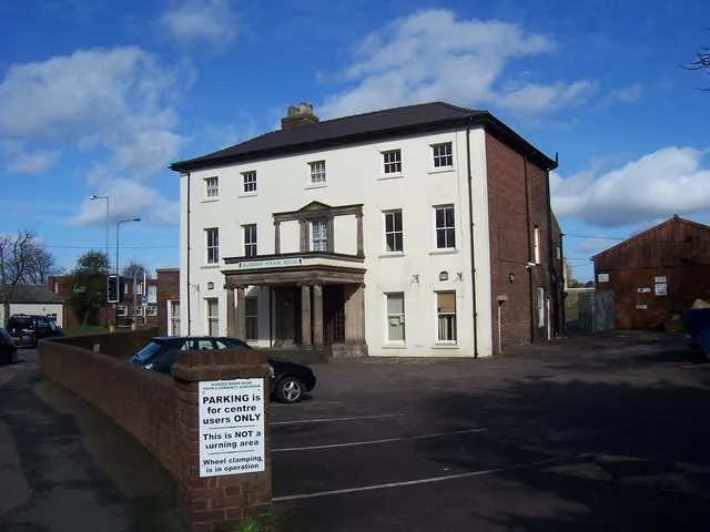 Aldridge Town, Walsall2.8 km S
-
Pelsall Town, Walsall3.6 km W
-
Holly Bank Neighbourhood, Walsall0.8 km SW
-
Shire Oak Neighbourhood, Walsall1 km NW
-
Vigo Neighbourhood, Walsall1.1 km SW
Nearby attractions & nature
Everything nearby-
Barr Beacon Mountain, Walsall6.3 km S
-
Chasewater Lake, England4.8 km NW
-
Sutton Coldfield Hill Mountain, Birmingham6.6 km SE
-
Kings Standing Wood Natural site, England7.4 km S
-
Wimblebury Hill Mountain, Cannock Chase8.5 km NW
-
Baitul Muqeet Mosque Attraction, Walsall7.2 km SW
-
Castle Ring Mountain, Cannock Wood9.4 km N
-
Hednesford Hills Mountain, Hednesford9.6 km NW
Sources & licences
Data last updated: