Ash Green
Located in Nuneaton and Bedworth District, Warwickshire Coordinates: 52°27′44″ N 1°30′36″ W
- Elevation
- 106 m
- above sea level
- Local time
- UTC+00:00
- Europe/London · UTC+00:00
- Airports
- BHX Birmingham Airport16 km
- EMA East Midlands Airport43 km
About Ash Green
Ash Green is a village. Location: Nuneaton and Bedworth District, Warwickshire. Elevation: 106 m. The best months to visit are June–August. The nearest airport is Birmingham Airport (16 km). Nearby sights include Coventry City Football Club and Coventry Cathedral.
Photos of Ash Green
-

Coventry Cathedral DeFacto · CC BY-SA 4.0 -
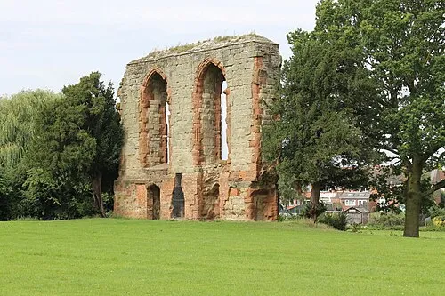
Caludon Castle Mum's taxi · CC BY-SA 3.0 -
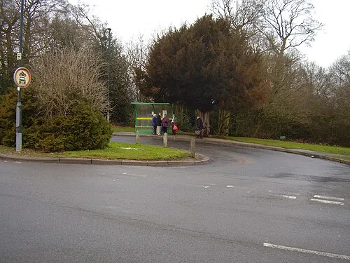
Allesley Ringwork Anthony Vosper · CC BY-SA 2.0 -
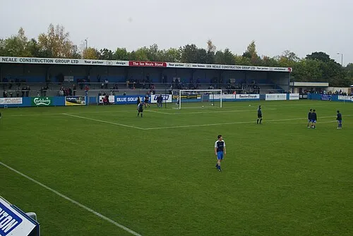
Liberty Way BruceyNBFC · CC BY-SA 3.0 -

Coventry Transport Museum Jim Linwood from London · CC BY 2.0


Climate of Ash Green
Best months for sightseeingBest months for sightseeing: June–August.
This month · November
A cold month
Day 10° · Night 3° · Rain 63 mm
- Hottest month
- July (day 21°)
- Coldest month
- February (night 1°)
- Wettest month
- December (65 mm)
- Driest month
- February (47 mm)
Bars: average monthly low and high temperature. Below: precipitation. Monthly averages for 1970–2000 at about 18 km resolution, adjusted for elevation. Highlighted months are mild and relatively dry. Source: WorldClim 2.1 (CC BY 4.0).
Show values as a table
| Month | Jan | Feb | Mar | Apr | May | Jun | Jul | Aug | Sep | Oct | Nov | Dec |
|---|---|---|---|---|---|---|---|---|---|---|---|---|
| Average high (°C) | 7° | 7° | 10° | 12° | 16° | 19° | 21° | 21° | 18° | 14° | 10° | 8° |
| Average low (°C) | 1° | 1° | 2° | 3° | 6° | 9° | 11° | 11° | 9° | 6° | 3° | 2° |
| Precipitation (mm) | 64 | 47 | 51 | 47 | 51 | 58 | 49 | 61 | 59 | 58 | 63 | 65 |
How to get to Ash Green
The nearest airport is Birmingham Airport (BHX), 16 km to the west as the crow flies. The nearest large city is Coventry, 6 km to the south.
Airports
- Birmingham Airport (BHX) Birmingham, West Midlands 16 kmwest
- East Midlands Airport (EMA) Nottingham, Leicestershire 43 kmnorth
- London Luton Airport (LTN) Luton, Luton 102 kmsoutheast
Nearby large cities
- Coventry Population: 345.3K 6 kmsouth
- Solihull Population: 126.6K 19 kmwest
- Sutton Coldfield Population: 109.9K 24 kmnorthwest
- Birmingham Population: 1.2M 27 kmwest
- Leicester Population: 368.6K 32 kmnortheast
Straight-line distances; road distances are longer. Airport data: OurAirports.
Day trips from Ash Green
Within 100 km: 764 historic and cultural sites, 867 natural sites, 120 lakes, rivers and coasts.
0–25 km100 places
- Crescent Wood Island Island 14 kmW
- Lake Lake 14 kmS
- Oldbury Hill Mountain 10 kmN
- South Hill Mountain 23 kmN
25–60 km403 places
- Horninglow island Island 39 kmN
- Glover's Island Island 51 kmSW
- Barton Island Island 52 kmN
- The Islands Island 33 kmE
60–100 km1,248 places
- Alney Island Island 84 kmSW
- Andersey Island Island 90 kmS
- Newark Island Island 82 kmNE
- Rose Isle Island 85 kmS
Straight-line distances.
Nearby attractions & nature
Everything nearby-
Coventry City Football Club Landmark, Coventry1.8 km SE
-
 Coventry Cathedral Attraction, Coventry6 km S
-
Coventry Transport Museum Museum, Coventry5.7 km S
-
Allesley Ringwork Historic site, Coventry6.1 km SW
-
Caludon Castle Historic site, Coventry6.3 km SE
-
Astley Castle Historic site, Astley4.9 km NW
Sources & licences
Data last updated: