Nuneaton and Bedworth District
Located in Warwickshire, England Coordinates: 52°30′02″ N 1°28′41″ W
- Population
- 127,019
- 127K
- Elevation
- 97 m
- above sea level
- Local time
- UTC+00:00
- Europe/London · UTC+00:00
- Places inside
- 35
- listed under Nuneaton and Bedworth District
- Airports
- BHX Birmingham Airport19 km
- EMA East Midlands Airport38 km
About Nuneaton and Bedworth District
Nuneaton and Bedworth District is a municipality. Location: Warwickshire, England. Population: 127,019. Elevation: 97 m. The best months to visit are June–August. The nearest airport is Birmingham Airport (19 km). Nearby sights include Astley Castle and Coventry Cathedral.
Photos of Nuneaton and Bedworth District
-
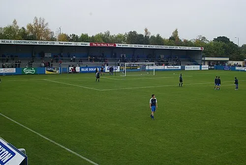
Liberty Way BruceyNBFC · CC BY-SA 3.0

Climate of Nuneaton and Bedworth District
Best months for sightseeingBest months for sightseeing: June–August.
This month · November
A cold month
Day 10° · Night 3° · Rain 62 mm
- Hottest month
- July (day 21°)
- Coldest month
- February (night 1°)
- Wettest month
- December (64 mm)
- Driest month
- February (45 mm)
Bars: average monthly low and high temperature. Below: precipitation. Monthly averages for 1970–2000 at about 18 km resolution, adjusted for elevation. Highlighted months are mild and relatively dry. Source: WorldClim 2.1 (CC BY 4.0).
Show values as a table
| Month | Jan | Feb | Mar | Apr | May | Jun | Jul | Aug | Sep | Oct | Nov | Dec |
|---|---|---|---|---|---|---|---|---|---|---|---|---|
| Average high (°C) | 7° | 7° | 9° | 12° | 16° | 18° | 21° | 21° | 18° | 14° | 10° | 8° |
| Average low (°C) | 1° | 1° | 2° | 3° | 6° | 9° | 11° | 11° | 9° | 6° | 3° | 2° |
| Precipitation (mm) | 60 | 45 | 50 | 47 | 50 | 56 | 49 | 61 | 59 | 59 | 62 | 64 |
How to get to Nuneaton and Bedworth District
The nearest airport is Birmingham Airport (BHX), 19 km to the west as the crow flies. The nearest large city is Coventry, 11 km to the south.
Airports
- Birmingham Airport (BHX) Birmingham, West Midlands 19 kmwest
- East Midlands Airport (EMA) Nottingham, Leicestershire 38 kmnorth
- London Luton Airport (LTN) Luton, Luton 103 kmsoutheast
Nearby large cities
- Coventry Population: 345.3K 11 kmsouth
- Solihull Population: 126.6K 23 kmsouthwest
- Sutton Coldfield Population: 109.9K 24 kmwest
- Leicester Population: 368.6K 28 kmnortheast
- Birmingham Population: 1.2M 29 kmwest
Straight-line distances; road distances are longer. Airport data: OurAirports.
Day trips from Nuneaton and Bedworth District
Within 100 km: 724 historic and cultural sites, 853 natural sites, 124 lakes, rivers and coasts.
0–25 km92 places
- Crescent Wood Island Island 17 kmW
- Lake Lake 18 kmSW
- Oldbury Hill Mountain 7 kmNW
- The Devil's Dressing Room Mountain 24 kmNW
25–60 km407 places
- Horninglow island Island 36 kmN
- Glover's Island Island 55 kmSW
- Barton Island Island 48 kmN
- The Islands Island 29 kmE
60–100 km1,202 places
- Alney Island Island 89 kmSW
- Andersey Island Island 94 kmS
- Newark Island Island 78 kmNE
- Rose Isle Island 89 kmS
Straight-line distances.
Nuneaton and Bedworth District and similar cities
Side by side with cities of similar size in the same country: population, elevation and climate.
| Measure | Nuneaton and Bedworth District | Solihull | Newcastle-under-Lyme | Watford |
|---|---|---|---|---|
| Population | 127K | 126.6K | 127.7K | 125.7K |
| Elevation | 97 m | 132 m | 160 m | 77 m |
| Summer day (hottest month) | 21° | 21° | 20° | 23° |
| Winter night (coldest month) | 1° | 1° | 0° | 2° |
| Annual rainfall | 662 mm | 715 mm | 744 mm | 629 mm |
| Best months | Jun–Aug | Jun–Aug | Jun–Aug | Jun–Aug |
| Distance | — | 23 km | 75 km | 120 km |
Climate values are 1970–2000 monthly averages; straight-line distance.
Places in Nuneaton and Bedworth District
35 placesBar: population relative to the most populous place in this list.
Cities & villages28
- Ash Green · Village
- Bedworth Heath · Neighbourhood
- Bedworth Woodlands · Village
- Bermuda · Village
- Black Bank · Neighbourhood
- Bulkington · Village
- Camp Hill · Neighbourhood
- Chapel End · Neighbourhood
- Chilvers Coton · Neighbourhood
- Coalpit Field · Neighbourhood
- Collycroft · Neighbourhood
- Galley Common · Neighbourhood
- Goodyers End · Neighbourhood
- Griff · Village
- Hawkesbury · Village
- Heath End · Neighbourhood
- Hill Top · Neighbourhood
- Horeston Grange · Neighbourhood
- Keresley Newlands · Village
- Marston Jabbett · Village
- Mount Pleasant · Neighbourhood
- Neal's Green · Village
- Plough Hill · Neighbourhood
- Robinson's End · Neighbourhood
- St Nicolas Park · Neighbourhood
- Stockingford · Village
- Weddington · Neighbourhood
- Whittleford · Neighbourhood
Mountains & nature2
- Mount Jud · Mountain
- Sutton Park · Natural site
Heritage & sights1
- Liberty Way · Landmark
Nearby attractions & nature
Everything nearby-
Astley Castle Historic site, Astley4.4 km W
-
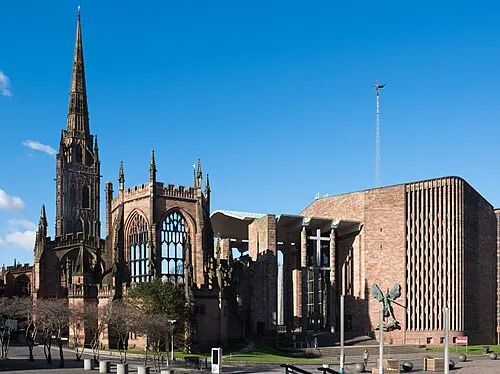 Coventry Cathedral Attraction, Coventry10 km S
-
Coventry City Football Club Landmark, Coventry6 km S
-
Hartshill Pyramid Mountain, Hartshill5.8 km NW
-
Hartshill Castle Historic site, Hartshill5.8 km NW
-
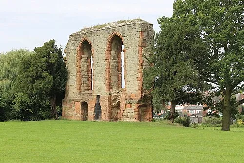 Caludon Castle Historic site, Coventry9.4 km S
-
 Coventry Transport Museum Museum, Coventry10 km S
-
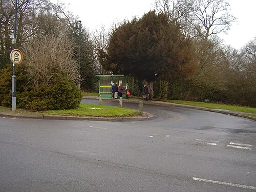 Allesley Ringwork Historic site, Coventry11 km SW
Other cities and towns in Warwickshire
-
North Warwickshire District Municipality, Warwickshire12 km NW
-
Rugby District Municipality, Warwickshire16 km SE
-
Warwick District Municipality, Warwickshire24 km S
-
Atherstone Town, Atherstone9.5 km NW
-
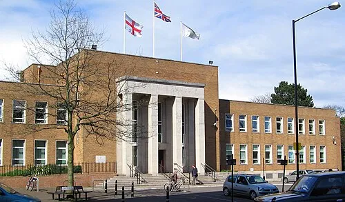 Rugby Town, Rugby District20 km SE
-
Stratford-on-Avon District Municipality, Warwickshire39 km S
Sources & licences
Data last updated: