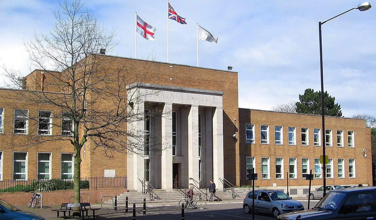
- Population
- 78,117
- 78.1K
- Elevation
- 120 m
- above sea level
- Local time
- UTC+00:00
- Europe/London · UTC+00:00
- Airports
- BHX Birmingham Airport34 km
- EMA East Midlands Airport51 km
About Rugby
Rugby is a town. Location: Rugby District, Warwickshire. Population: 78,117. Elevation: 120 m.
Rugby is a market town in eastern Warwickshire, England, close to the River Avon. At the 2021 census, its population was 78,117, making it the second-largest town in Warwickshire. It is the main settlement within the larger Borough of Rugby, which had a population of 114,400 in 2021. Rugby is situated on the eastern edge of Warwickshire, near to the borders with Leicestershire and Northamptonshire.
Source: Wikipedia · CC BY-SA 4.0
Photos of Rugby
-

Neil Theasby · CC BY-SA 2.0 -

Robert Eva · CC BY-SA 2.0 -

Robert Eva · CC BY-SA 2.0 -

Neil Theasby · CC BY-SA 2.0 -

Elliott Brown from Birmingham, United Kingdom · CC BY-SA 2.0


Travel notes for Rugby
From Wikivoyage
Rugby is a market town of 78,000 people (2021) in the Borough of Rugby in Warwickshire, in the West Midlands region of England, part of the United Kingdom. The town is credited with being the birthplace of rugby football, and is a must visit for the avid rugby fan. Rugby is also a birthplace of the jet engine.
Understand+
Rugby School is one of England's oldest and most prestigious public schools, and was the setting of Thomas Hughes's semi-autobiographical masterpiece Tom Brown's Schooldays. A substantial part of the 2004 dramatisation of the novel, starring Stephen Fry, was filmed on location at Rugby School.
In the 19th century, Rugby became famous for its once hugely important railway junction which was the setting for Charles Dickens's story Mugby Junction.
The town also inspired Thomas Hughes, (author of Tom Brown's Schooldays) to set up a colony in America, for the younger sons of the English gentry, who couldn't inherit under the laws of primogeniture. He named the town Rugby. The town of Rugby, Tennessee, still exists today.
Rugby has always been a centre for the surrounding farming communities, and a weekly cattle market continued to be held in the town until 2008, but it was the coming of the London & Birmingham Railway in 1838 which caused a significant expansion of the town.
In 1840 a junction with the Midland Counties Railway from Leicester was completed and in consequence major railway yards and other heavy engineering industries developed in the town.
The now demolished Rugby Radio Station would have been the radio station that would broadcast a firing message for Britain's nuclear submarine Polaris, should it have been necessary, according to declassified information. The radio station was key in linking London to New York.
The decline of heavy engineering and the downgrading of the railway facilities led to a decline in the town. However, efforts have been made to exploit the central location of the town to attract new businesses and distribution centres to the area.
Rugby Local Council website
Get in+
Rugby has major rail and road networks close by, a large reason for attracting industry, such as Rugby Cement to the region.
By train:
1 Rugby railway station. Rugby is often the reason accredited to why Rugby expanded to a size greater and engulfed the nearby village of Dunchurch. The railway station is mainly used for freight and commuters to and from nearby cities for work with an annual usage 1.6 million people; despite this Rugby enjoys one of the best and latest railway stations in the country, consisting of 6 platforms. (updated Oct 2022)
Rugby railway station is located less than a mile from the town centre (the Clock Tower), with the entrance to Rugby School about 400 yards further on.
Upon exiting the station, the town center can be accessed by walking up the hill the station is located on. On the large roundabout at the top, turn right on to Clifton Road (Lawrence Sheriff school will be on your right), the town center can be accessed by walking onwards.
Situated on the West Coast main line there are express services to and from London Euston approximately hourly operated by Avanti West Coast. The typical journey time is 51 minutes. There are direct services to Liverpool, Holyhead, Manchester and Glasgow, in the weekday peak hours. Advanced booking of tickets and travel outside of peak periods (6-10AM, 4-8PM) is strongly recommended to avoid the highest fares. Booking is strongly advised.
London Northwestern Railway operate train services also, note that these are slower than Avanti West Coast services and stop frequently. Although London Northwestern Railway trains are comfortable, Avanti West Coast are preferable and it is often cheaper to buy "Avanti West Coast Only tickets". Services by London Midland include services terminating at Birmingham New Street, Liverpool Lime Street, Crewe and London Euston. See [1] for live departure boards.
By road:
Rugby's central location in England has resulted in an excellent road network.
Source: Wikivoyage · CC BY-SA 4.0 · abridged
Climate of Rugby
Best months for sightseeingBest months for sightseeing: June–August.
This month · November
A cold month
Day 10° · Night 3° · Rain 60 mm
- Hottest month
- July (day 21°)
- Coldest month
- February (night 1°)
- Wettest month
- December (62 mm)
- Driest month
- February (44 mm)
Bars: average monthly low and high temperature. Below: precipitation. Monthly averages for 1970–2000 at about 18 km resolution, adjusted for elevation. Highlighted months are mild and relatively dry. Source: WorldClim 2.1 (CC BY 4.0).
Show values as a table
| Month | Jan | Feb | Mar | Apr | May | Jun | Jul | Aug | Sep | Oct | Nov | Dec |
|---|---|---|---|---|---|---|---|---|---|---|---|---|
| Average high (°C) | 7° | 7° | 10° | 12° | 16° | 19° | 21° | 21° | 18° | 14° | 10° | 7° |
| Average low (°C) | 1° | 1° | 2° | 3° | 6° | 9° | 11° | 11° | 9° | 6° | 3° | 2° |
| Precipitation (mm) | 59 | 44 | 50 | 47 | 50 | 56 | 49 | 59 | 58 | 57 | 60 | 62 |
How to get to Rugby
The nearest airport is Birmingham Airport (BHX), 34 km to the west as the crow flies. The nearest large city is Coventry, 17 km to the west.
Airports
- Birmingham Airport (BHX) Birmingham, West Midlands 34 kmwest
- East Midlands Airport (EMA) Nottingham, Leicestershire 51 kmnorth
- London Luton Airport (LTN) Luton, Luton 83 kmsoutheast
Nearby large cities
- Coventry Population: 345.3K 17 kmwest
- Northampton Population: 245.9K 29 kmsoutheast
- Leicester Population: 368.6K 31 kmnorth
- Solihull Population: 126.6K 36 kmwest
- Sutton Coldfield Population: 109.9K 43 kmnorthwest
Straight-line distances; road distances are longer. Airport data: OurAirports.
Day trips from Rugby
Within 100 km: 672 historic and cultural sites, 668 natural sites, 137 lakes, rivers and coasts.
0–25 km90 places
- Lake Lake 22 kmW
- Honey Hill Mountain 14 kmE
- Big Hill - Staverton Clump Mountain 15 kmS
- Beacon Hill Mountain 14 kmS
25–60 km387 places
- Horninglow island Island 54 kmNW
- Glover's Island Island 56 kmSW
- Heron Island Island 49 kmE
- Crescent Wood Island Island 32 kmW
60–100 km1,000 places
- Alney Island Island 88 kmSW
- Andersey Island Island 78 kmS
- Wargrave Island Island 99 kmS
- Newark Island Island 84 kmN
Straight-line distances.
Rugby and similar cities
Side by side with cities of similar size in the same country: population, elevation and climate.
| Measure | Rugby | Carlisle | Gateshead | Lisburn |
|---|---|---|---|---|
| Population | 78.1K | 78.5K | 77.6K | 77.5K |
| Elevation | 120 m | 29 m | 53 m | 53 m |
| Summer day (hottest month) | 21° | 19° | 20° | 19° |
| Winter night (coldest month) | 1° | 1° | 2° | 2° |
| Annual rainfall | 651 mm | 801 mm | 629 mm | 1,040 mm |
| Best months | Jun–Aug | Jun–Sep | Jun–Sep | Jun–Aug |
| Distance | — | 302 km | 289 km | 397 km |
Climate values are 1970–2000 monthly averages; straight-line distance.
Nearby attractions & nature
Everything nearby-
Rugby Castle Historic site, Rugby District0.4 km SE
-
Brownsover Historic site, Rugby District2.5 km N
-
VLF transmitter Rugby, Mast 12 Historic site, Clifton upon Dunsmore4.4 km E
-
VLF transmitter Rugby, Mast 11 Historic site, Clifton upon Dunsmore4.7 km E
-
VLF transmitter Rugby, Mast 10 Historic site, Clifton upon Dunsmore5 km E
-
VLF transmitter Rugby, Mast 4 Historic site, Clifton upon Dunsmore5 km E
-
VLF Transmitter Rugby, Mast 1 Historic site, Clifton upon Dunsmore5.2 km E
-
VLF transmitter Rugby, Mast 5 Historic site, Clifton upon Dunsmore5.3 km E
Sources & licences
Data last updated: · 2 independent sources