Lisburn
Local name: Lios na gCearrbhach
Located in Lisburn and Castlereagh, Northern Ireland Coordinates: 54°31′24″ N 6°02′07″ W
- Population
- 77,506
- 77.5K
- Elevation
- 53 m
- above sea level
- Local time
- UTC+00:00
- Europe/London · UTC+00:00
- Airports
- BHD George Best Belfast City Airport15 km
- BFS Belfast International Airport19 km
About Lisburn
Lisburn is a city. Location: Lisburn and Castlereagh, Northern Ireland. Population: 77,506. Elevation: 53 m.
Lisburn ( LIZ-burn, LISS-burn) is a cathedral city in Northern Ireland. It is 8 mi (13 km) southwest of Belfast city centre, on the River Lagan, which forms the boundary between County Antrim and County Down. First laid out in the 17th century by English and Welsh settlers, with the arrival of French Huguenots in the 18th century, the town developed as a global centre of the linen industry.
Source: Wikipedia · CC BY-SA 4.0
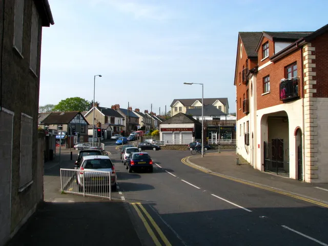
Photos of Lisburn
-

Gareth James · CC BY-SA 2.0 -

Belfast News Letter · Public domain -

Kenneth Allen · CC BY-SA 2.0 -
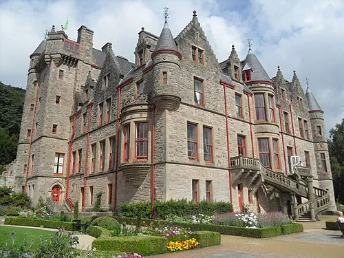
Belfast Castle Trevor Caruth · CC BY-SA 3.0 -
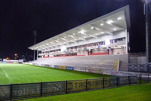
Kingspan Stadium Aaronsc at English Wikipedia · Public domain


Travel notes for Lisburn
From Wikivoyage
Lisburn is a market town traditionally in County Antrim north of the River Lagan; a small part lies south of the river in County Down. The counties of Northern Ireland are no longer units of governance so since 2015 it's been within the "super-district" of Lisburn and Castlereagh. It's best known as the seat of linen manufacture in Ireland, but it's also notorious as the site of the former Long Kesh or Maze prison. With a population of 51,400 in 2021, Lisburn was officially dubbed a "city" in 2002 but this is just ceremonial. Not only does it continue to feel like a town, but "city" hereabouts means the metropolis of Belfast 9 miles north; so a town is how it's described on this page.
Mystery cloaks Lisburn's Irish name of Lios na gCearrbhach, which means "ring-fort of the gamblers". Excavations have not revealed whether the gambling resembled Texas hold 'em, Craps, or a version of the Three Card Trick using megaliths.
The Visitor Information Centre is within the Linen Centre on The Square next to the bus station, same hours.
Understand+
Linen is a textile produced from flax. It was produced at least 30,000 years ago from wild flax, and since 9000 years ago from a domesticated species Linum usitatissimum, which became cultivated throughout the Old World. Linen is strong and absorbent, pleasantly cool to the touch, and can be given a lustrous shine. So it's made into garments and bedding, though it's tricky to work and production is laborious. By the Middle Ages flax was grown and processed in Ireland but the leading centres were along the lower Rhine, in what is now Germany, Netherlands and Belgium. In 1685 the Edict of Fontainebleau revoked religious tolerance of French Protestants, which they had enjoyed since the 1598 Edict of Nantes. This led to the flight of the Protestants (called Huguenots) to Britain and Ireland. They included many skilled weavers and brought with them improved methods of production. Notable among them was Louis Crommelin (1652-1727), who settled in Lisburn and built up the linen industry throughout Ireland; he's buried in the cathedral graveyard. Production scaled up from rural craft through cottage industry to large mills, and Victorian Lisburn was "Linenopolis" much as Manchester was "Cottonopolis" and Dundee was "Juteopolis." (See also Banbridge for early mill automation, which paved the way for computers and robots.) In the 20th century trade withered with cheap foreign imports and the development of artificial fibres. Linen lost its mass market but continued to be used for upmarket tailoring, and Irish linen nowadays uses imported flax.
Get in+
Lisburn is 9 miles southwest of Belfast, follow M1. There's a free Park & Ride at Sprucefield (M1 junction 8) mostly used by commuters into Belfast.
Trains run every 15 min from Belfast Grand Central to Lisburn (25 min), and continue to Lurgan and Portadown.
The Belfast-Dublin Enterprise trains don't stop here except once on Sunday, change at Portadown.
1 Lisburn railway station is north side of town centre. Both platforms are wheelchair accessible.
Hilden and Lambeg are two other halts at the north edge of town.
Ulsterbus 551 runs hourly from Belfast Grand Central to Lisburn (40 min), Moira, Lurgan and Craigavon.
Bus 538 also runs hourly from Belfast, and from Lisburn continues to Sprucefield, Hillsborough, Dromore, Banbridge, and occasionally to Newry.
Bus 23 runs from Belfast every two hours via Dunmurry.
Bus 109A runs hourly M-Sa from Antrim via Belfast International Airport (BFS IATA, aka Aldergrove) and Crumlin to Lisburn.
Bus 26B runs three times M-F from Newcastle via Dundrum, Ballynahinch and Hillsborough to Lisburn, taking 1 hr 15 min.
Goldliner X1 runs every couple of hours from Dublin Busáras and Airport (DUB IATA) via Newry and Banbridge, halting at Sprucefield retail park at the south edge of Lisburn on its way into Belfast. Don't take X2 or the Aircoach, which are non-stop to Belfast.
Hannon Coach runs daily from Glasgow to Belfast, Lisburn and Lurgan.
2 Lisburn bus centre is south side of town centre.
Source: Wikivoyage · CC BY-SA 4.0 · abridged
Climate of Lisburn
Best months for sightseeingBest months for sightseeing: June–August.
This month · November
A wet month
Day 9° · Night 4° · Rain 101 mm
- Hottest month
- July (day 19°)
- Coldest month
- January (night 2°)
- Wettest month
- January (108 mm)
- Driest month
- May (63 mm)
Bars: average monthly low and high temperature. Below: precipitation. Monthly averages for 1970–2000 at about 18 km resolution, adjusted for elevation. Highlighted months are mild and relatively dry. Source: WorldClim 2.1 (CC BY 4.0).
Show values as a table
| Month | Jan | Feb | Mar | Apr | May | Jun | Jul | Aug | Sep | Oct | Nov | Dec |
|---|---|---|---|---|---|---|---|---|---|---|---|---|
| Average high (°C) | 7° | 8° | 10° | 12° | 15° | 18° | 19° | 19° | 16° | 13° | 9° | 7° |
| Average low (°C) | 2° | 2° | 3° | 4° | 7° | 9° | 12° | 11° | 9° | 7° | 4° | 2° |
| Precipitation (mm) | 108 | 74 | 88 | 69 | 63 | 69 | 73 | 91 | 95 | 108 | 101 | 101 |
How to get to Lisburn
The nearest airport is George Best Belfast City Airport (BHD), 15 km to the northeast as the crow flies. For international flights: Belfast International Airport (BFS) (19 km). The nearest large city is Belfast, 11 km to the northeast.
Airports
- George Best Belfast City Airport (BHD) Belfast 15 kmnortheast
- Belfast International Airport (BFS) Belfast 19 kmnorthwest
- City of Derry Airport (LDY) Derry, Derry and Strabane 93 kmnorthwest
Nearby large cities
- Belfast Population: 348K 11 kmnortheast
- Dublin Population: 1M 133 kmsouth
- Glasgow Population: 626.4K 187 kmnortheast
- Blackpool Population: 145K 210 kmeast
- Preston Population: 313.3K 234 kmeast
Straight-line distances; road distances are longer. Airport data: OurAirports.
Day trips from Lisburn
Within 100 km: 85 historic and cultural sites, 508 natural sites, 353 lakes, rivers and coasts.
0–25 km51 places
- Rams Island Island 19 kmW
- Portmore Lough Lake 16 kmW
- Monlough Lake 12 kmE
- Lough Aghery Lake 14 kmS
25–60 km215 places
- West Maiden Island 49 kmNE
- Reedy Flat Island 29 kmW
- Reagh Island Island 25 kmE
- Lighthouse Island Island 38 kmNE
60–100 km680 places
- Portstewart Beach Beach 85 kmNW
- Benone Beach Beach 90 kmNW
- Portstewart Strand Beach 86 kmNW
- The Skerries Island 87 kmNW
Straight-line distances.
Lisburn and similar cities
Side by side with cities of similar size in the same country: population, elevation and climate.
| Measure | Lisburn | Gateshead | Paisley | Shrewsbury |
|---|---|---|---|---|
| Population | 77.5K | 77.6K | 77.3K | 76.8K |
| Elevation | 53 m | 53 m | 50 m | 75 m |
| Summer day (hottest month) | 19° | 20° | 18° | 21° |
| Winter night (coldest month) | 2° | 2° | 1° | 1° |
| Annual rainfall | 1,040 mm | 629 mm | 1,384 mm | 690 mm |
| Best months | Jun–Aug | Jun–Sep | Jun–Aug | Jun–Aug |
| Distance | — | 290 km | 178 km | 296 km |
Climate values are 1970–2000 monthly averages; straight-line distance.
Nearby attractions & nature
Everything nearby-
Ravernet River River, Northern Ireland2.8 km S
-
Lisnagarvey Blaw-Knox Radio Mast Landmark, Lisburn and Castlereagh4.1 km SW
-
Collin Mountain, Lisburn and Castlereagh5 km N
-
Giants Ring Historic site, Belfast5.8 km E
-
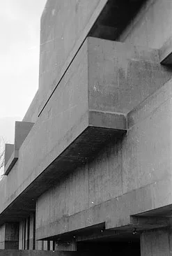 Ulster Museum Museum, Belfast9.2 km NE
-
Kingspan Stadium Landmark, Belfast10 km NE
-
Black Mountain Transmitting Station Landmark, Belfast7.1 km N
-
Belfast Castle Historic site, Belfast15 km NE
Other cities and towns in Lisburn and Castlereagh
Sources & licences
Data last updated: · 2 independent sources