Dundonald
Local name: Dún Dónaill
Located in Lisburn and Castlereagh, Northern Ireland Coordinates: 54°35′31″ N 5°47′53″ W
- Population
- 13,985
- 14K
- Elevation
- 43 m
- above sea level
- Local time
- UTC+00:00
- Europe/London · UTC+00:00
- Airports
- BHD George Best Belfast City Airport6 km
- BFS Belfast International Airport28 km
About Dundonald
Dundonald is a town. Location: Lisburn and Castlereagh, Northern Ireland. Population: 13,985. Elevation: 43 m.
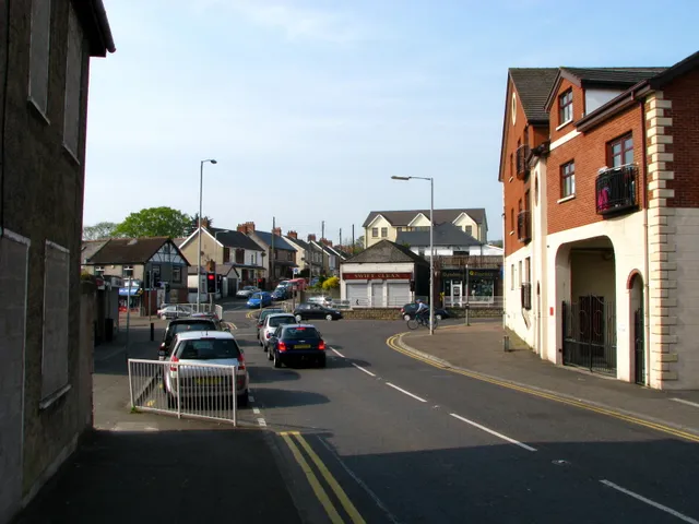
Dundonald (from Irish Dún Dónaill, meaning 'Donald's fort') is a large settlement and civil parish in County Down, Northern Ireland. It lies east of Belfast and is a suburb of the city. It is home to Moat Park, the Ulster Hospital, and Dundonald International Ice Bowl.
Source: Wikipedia · CC BY-SA 4.0
Photos of Dundonald
-

Dean Molyneaux · CC BY-SA 2.0 -

Dean Molyneaux · CC BY-SA 2.0 -
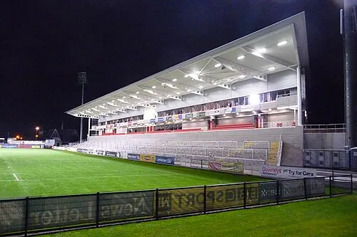
Kingspan Stadium Aaronsc at English Wikipedia · Public domain


Travel notes for Dundonald
From Wikivoyage
Dundonald is a town in the traditional County Down, east of Belfast, Northern Ireland. It lies east of Belfast and is a suburb of the city. It is home to Moat Park, the Ulster Hospital, and Dundonald International Ice Bowl.
Understand+
The counties have been abolished in Northern Ireland so since 2015 it's been in the "super district" of Lisburn and Castlereagh. Postal addresses show Belfast, County Antrim, suggesting it is in County Antrim, but this is only for postal purposes. It is 4 miles out from Belfast. The name "Dundonald" translates to "Donall's Stronghold" in Irish. The Twelfth of July parade was held in Dundonald in 2025 for the first time for nearly 60 years.
Get in+
The Comber Greenway is a direct traffic-free link from Belfast for cyclists and walkers that passes through Dundonald.
Source: Wikivoyage · CC BY-SA 4.0 · abridged
Climate of Dundonald
Best months for sightseeingBest months for sightseeing: June–August.
This month · November
A cold month
Day 9° · Night 3° · Rain 79 mm
- Hottest month
- July (day 20°)
- Coldest month
- January (night 1°)
- Wettest month
- October (86 mm)
- Driest month
- May (55 mm)
Bars: average monthly low and high temperature. Below: precipitation. Monthly averages for 1970–2000 at about 18 km resolution, adjusted for elevation. Highlighted months are mild and relatively dry. Source: WorldClim 2.1 (CC BY 4.0).
Show values as a table
| Month | Jan | Feb | Mar | Apr | May | Jun | Jul | Aug | Sep | Oct | Nov | Dec |
|---|---|---|---|---|---|---|---|---|---|---|---|---|
| Average high (°C) | 6° | 7° | 10° | 12° | 16° | 18° | 20° | 19° | 16° | 13° | 9° | 7° |
| Average low (°C) | 1° | 1° | 2° | 4° | 6° | 9° | 11° | 11° | 9° | 6° | 3° | 1° |
| Precipitation (mm) | 85 | 60 | 66 | 58 | 55 | 60 | 64 | 77 | 79 | 86 | 79 | 81 |
How to get to Dundonald
The nearest airport is George Best Belfast City Airport (BHD), 6 km to the northwest as the crow flies. For international flights: Belfast International Airport (BFS) (28 km). The nearest large city is Belfast, 8 km to the west.
Airports
- George Best Belfast City Airport (BHD) Belfast 6 kmnorthwest
- Belfast International Airport (BFS) Belfast 28 kmwest
- Campbeltown Airport (CAL) Campbeltown 94 kmnorth
Nearby large cities
- Belfast Population: 348K 8 kmwest
- Dublin Population: 1M 143 kmsouth
- Glasgow Population: 626.4K 172 kmnortheast
- Blackpool Population: 145K 199 kmsoutheast
- Preston Population: 313.3K 222 kmsoutheast
Straight-line distances; road distances are longer. Airport data: OurAirports.
Day trips from Dundonald
Within 100 km: 64 historic and cultural sites, 575 natural sites, 324 lakes, rivers and coasts.
0–25 km58 places
- Reagh Island Island 14 kmSE
- Lighthouse Island Island 21 kmNE
- Copeland Island Island 20 kmNE
- Strangford Lough Lake 16 kmSE
25–60 km242 places
- West Maiden Island 38 kmN
- Reedy Flat Island 45 kmW
- Rams Island Island 33 kmW
- Guns Island Island 37 kmSE
60–100 km663 places
- Portstewart Beach Beach 88 kmNW
- Benone Beach Beach 94 kmNW
- Portstewart Strand Beach 89 kmNW
- The Skerries Island 88 kmNW
Straight-line distances.
Nearby attractions & nature
Everything nearby-
Scrabo Hill Mountain, Ards and North Down5.5 km E
-
Stormont Castle Historic site, Ards and North Down3.6 km NW
-
St Columba's Church Attraction, Belfast4.1 km W
-
Ballykeel Mountain, Ards and North Down3.8 km N
-
Cairngaver Mountain, Ards and North Down4.1 km NE
-
Helens Tower Landmark, Ards and North Down5.9 km NE
-
Kingspan Stadium Landmark, Belfast7.1 km W
-
Titanic Studio Museum, Belfast7.2 km W
Other cities and towns in Lisburn and Castlereagh
Sources & licences
Data last updated: · 2 independent sources