Claverdon
Located in Stratford-on-Avon District, Warwickshire Coordinates: 52°16′53″ N 1°42′37″ W
- Elevation
- 127 m
- above sea level
- Local time
- UTC+00:00
- Europe/London · UTC+00:00
- Places inside
- 4
- listed under Claverdon
- Airports
- BHX Birmingham Airport19 km
- EMA East Midlands Airport66 km
About Claverdon
Claverdon is a village. Location: Stratford-on-Avon District, Warwickshire. Elevation: 127 m. The best months to visit are June–August. The nearest airport is Birmingham Airport (19 km). Nearby sights include Pinley Priory and Beaudesert Castle.
Photos of Claverdon
-
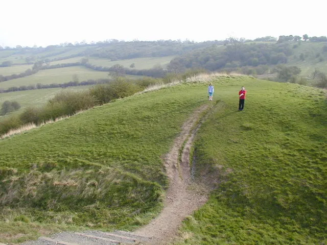
Beaudesert Castle Chris Gunns · CC BY-SA 2.0

Climate of Claverdon
Best months for sightseeingBest months for sightseeing: June–August.
This month · November
A cold month
Day 9° · Night 3° · Rain 61 mm
- Hottest month
- July (day 21°)
- Coldest month
- February (night 0°)
- Wettest month
- December (66 mm)
- Driest month
- February (46 mm)
Bars: average monthly low and high temperature. Below: precipitation. Monthly averages for 1970–2000 at about 18 km resolution, adjusted for elevation. Highlighted months are mild and relatively dry. Source: WorldClim 2.1 (CC BY 4.0).
Show values as a table
| Month | Jan | Feb | Mar | Apr | May | Jun | Jul | Aug | Sep | Oct | Nov | Dec |
|---|---|---|---|---|---|---|---|---|---|---|---|---|
| Average high (°C) | 6° | 7° | 9° | 12° | 16° | 18° | 21° | 21° | 18° | 14° | 9° | 7° |
| Average low (°C) | 0° | 0° | 2° | 3° | 6° | 8° | 11° | 10° | 8° | 6° | 3° | 1° |
| Precipitation (mm) | 65 | 46 | 52 | 46 | 51 | 60 | 47 | 62 | 60 | 58 | 61 | 66 |
How to get to Claverdon
The nearest airport is Birmingham Airport (BHX), 19 km to the north as the crow flies. The nearest large city is Solihull, 16 km to the north.
Airports
- Birmingham Airport (BHX) Birmingham, West Midlands 19 kmnorth
- East Midlands Airport (EMA) Nottingham, Leicestershire 66 kmnortheast
- London Luton Airport (LTN) Luton, Luton 103 kmsoutheast
Nearby large cities
- Solihull Population: 126.6K 16 kmnorth
- Coventry Population: 345.3K 19 kmnortheast
- Birmingham Population: 1.2M 26 kmnorthwest
- Sutton Coldfield Population: 109.9K 33 kmnorth
- West Bromwich Population: 103.1K 33 kmnorthwest
Straight-line distances; road distances are longer. Airport data: OurAirports.
Day trips from Claverdon
Within 100 km: 916 historic and cultural sites, 1,000 natural sites, 116 lakes, rivers and coasts.
0–25 km89 places
- Crescent Wood Island Island 19 kmN
- Lake Lake 11 kmNE
- Edge Hill Mountain 25 kmSE
- Ebrington Hill Mountain 22 kmS
25–60 km472 places
- Alney Island Island 60 kmSW
- Horninglow island Island 59 kmN
- Glover's Island Island 26 kmSW
- The Islands Island 54 kmNE
60–100 km1,471 places
- Andersey Island Island 75 kmSE
- Rose Isle Island 71 kmSE
- Temple Island Island 98 kmSE
- Lock Wood Island Island 75 kmSE
Straight-line distances.
Places in Claverdon
4 placesBar: population relative to the most populous place in this list.
Cities & villages3
- Barnmoor Green · Village
- Kington · Village
- Lye Green · Village
Nearby attractions & nature
Everything nearby-
Pinley Priory Historic site, Rowington1.8 km NE
-
Beaudesert Castle Historic site, Beaudesert4.5 km W
-
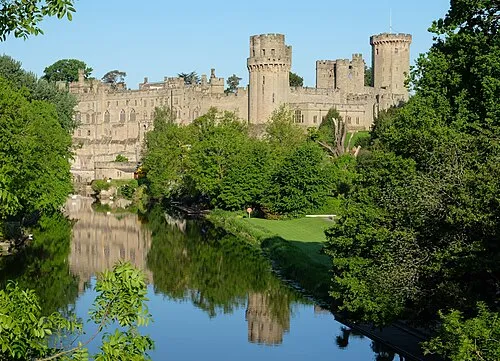 Warwick Castle Historic site, Warwick8.5 km E
-
Wootton Wawen Historic site, Wootton Wawen5.2 km W
-
Fulbrook Castle Historic site, Fulbrook6.7 km SE
-
Aston Cantlow Historic site, Aston Cantlow7.8 km SW
Sources & licences
Data last updated: