Portrush
Local name: Port Rois
Located in Causeway Coast and Glens, Northern Ireland Coordinates: 55°11′45″ N 6°38′57″ W
- Population
- 6,684
- 6.7K
- Elevation
- 11 m
- above sea level
- Local time
- UTC+00:00
- Europe/London · UTC+00:00
- Airports
- LDY City of Derry Airport37 km
- ILY Islay Airport60 km
About Portrush
Portrush is a town. Location: Causeway Coast and Glens, Northern Ireland. Population: 6,684. Elevation: 11 m.
Portrush (from Irish Port Rois, meaning 'port of the promontory') is a small seaside resort town on the north coast of County Antrim, Northern Ireland. It neighbours the resort of Portstewart in County Londonderry. The main part of the old town, including the railway station as well as most hotels, restaurants and bars, is built on a 1 mile (1.6 km)–long peninsula, Ramore Head. It had a population of 6,150 at the 2021 census.
Source: Wikipedia · CC BY-SA 4.0
Photos of Portrush
-

Greentreetown · CC BY-SA 4.0 -

Kenneth Allen · CC BY-SA 2.0 -

Kenneth Allen · CC BY-SA 2.0 -
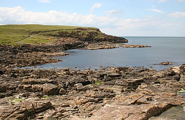
Ramore Head Anne Burgess · CC BY-SA 2.0


Travel notes for Portrush
From Wikivoyage
Portrush (Port Rois, "promontory port") is a resort town on the north coast of Northern Ireland, historically within County Antrim and nowadays part of Causeway Coast and Glens District. As that name implies, Portrush is a good base for visiting Giant's Causeway and other major attractions along the Antrim coast. It had a population of 6000 in 2021, greatly swollen in summer by visitors, when you need to book ahead with accommodation. It also houses many students and staff of the University of Ulster in Coleraine.
Portrush visitor information centre is in Town Hall by the railway station, open Apr-Sep M-Sa 9AM-5PM, Su 1-4PM.
Get in+
By road from Belfast or the south, the direct route is M2 / A26 north past Ballymena and Coleraine. If it's fine and you've got all day, meander along the scenic coastal route through Carrickfergus, the Antrim glens and Ballycastle.
Trains run hourly from Belfast Grand Central via Antrim (for International Airport), Ballymena and Coleraine. Change there for the Portrush train, total travel time two hours, while the train from Belfast continues to Derry.
1 Portrush railway station is central, near West Strand Beach.
2 Dhu Varren is a halt half a mile south, in the main area for B&Bs.
Ulsterbus 140b runs a triangle from Coleraine to Portrush (20 min), Portstewart and back to Coleraine; 140a is the reverse triangle. It's every 20 min M-Sa.
Bus 402 runs every 30 min from Coleraine to Portrush, Dunluce (for castle), Portballintrae, Bushmills (for distillery), Giant's Causeway, Ballintoy (for Carrick-a-Rede bridge) and Ballycastle. Don't take the 172, which from Coleraine heads straight to Bushmills and bypasses Portrush.
Goldliner Bus 278 runs in university term-time, with one bus F & Su from Monaghan via Armagh, Moy, Dungannon, Cookstown, Magherafelt, Garvagh, Coleraine, Ulster University and Portstewart to Portrush.
Portrush bus terminal is shown on timetables as "Dunluce Ave". It's 100 yards east of the railway station
Source: Wikivoyage · CC BY-SA 4.0 · abridged
Climate of Portrush
Best months for sightseeingBest months for sightseeing: June–August.
This month · November
A wet month
Day 10° · Night 5° · Rain 132 mm
- Hottest month
- August (day 18°)
- Coldest month
- February (night 3°)
- Wettest month
- January (137 mm)
- Driest month
- May (64 mm)
Bars: average monthly low and high temperature. Below: precipitation. Monthly averages for 1970–2000 at about 18 km resolution, adjusted for elevation. Highlighted months are mild and relatively dry. Source: WorldClim 2.1 (CC BY 4.0).
Show values as a table
| Month | Jan | Feb | Mar | Apr | May | Jun | Jul | Aug | Sep | Oct | Nov | Dec |
|---|---|---|---|---|---|---|---|---|---|---|---|---|
| Average high (°C) | 8° | 8° | 9° | 11° | 14° | 16° | 18° | 18° | 16° | 13° | 10° | 9° |
| Average low (°C) | 3° | 3° | 4° | 5° | 7° | 10° | 12° | 12° | 10° | 8° | 5° | 4° |
| Precipitation (mm) | 137 | 102 | 105 | 73 | 64 | 70 | 79 | 97 | 108 | 132 | 132 | 130 |
How to get to Portrush
The nearest airport is City of Derry Airport (LDY), 37 km to the southwest as the crow flies. For international flights: Belfast International Airport (BFS) (66 km). The nearest large city is Belfast, 81 km to the southeast.
Airports
- City of Derry Airport (LDY) Derry, Derry and Strabane 37 kmsouthwest
- Islay Airport (ILY) Isle of Islay, Argyll and Bute 60 kmnortheast
- Belfast International Airport (BFS) Belfast 66 kmsoutheast
Nearby large cities
- Belfast Population: 348K 81 kmsoutheast
- Glasgow Population: 626.4K 168 kmnortheast
- Dublin Population: 1M 209 kmsouth
- Edinburgh Population: 515K 233 kmnortheast
- Dundee Population: 148.2K 270 kmnortheast
Straight-line distances; road distances are longer. Airport data: OurAirports.
Day trips from Portrush
Within 100 km: 82 historic and cultural sites, 823 natural sites, 476 lakes, rivers and coasts.
0–25 km48 places
- Portstewart Beach Beach 6 kmSW
- Benone Beach Beach 15 kmW
- Portstewart Strand Beach 8 kmW
- The Skerries Island 3 kmNE
25–60 km349 places
- Lisfannon Beach Beach 55 kmW
- Texa Island Island 57 kmNE
- Rathlin Island Island 30 kmNE
- Oversay Island Island 54 kmN
60–100 km984 places
- Isle of Arran Island 99 kmNE
- Island Roy Island 73 kmW
- Oronsay Island 95 kmN
- West Maiden Island 65 kmSE
Straight-line distances.
Nearby attractions & nature
Everything nearby-
Ramore Head Natural site, Causeway Coast and Glens2 km NW
-
Portrush Historic site, Causeway Coast and Glens0.9 km N
-
Corbally Reservoir Lake, Causeway Coast and Glens2.1 km SE
-
Dunluce Castle Historic site, Causeway Coast and Glens4.2 km E
-
The Skerries Island, Northern Ireland3.3 km NE
-
Dunluce Castle Historic site, Causeway Coast and Glens4.7 km E
-
Portstewart Beach Beach, Causeway Coast and Glens5.8 km SW
-
The Diamond, Coleraine Historic site, Causeway Coast and Glens7.3 km S
Other cities and towns in Causeway Coast and Glens
-
 Limavady Town, Causeway Coast and Glens25 km SW
-
Ballymoney Town, Causeway Coast and Glens17 km SE
-
Ballycastle Town, Causeway Coast and Glens26 km E
Sources & licences
Data last updated: · 2 independent sources