Limavady
Local name: Léim an Mhadaidh
Located in Causeway Coast and Glens, Northern Ireland Coordinates: 55°03′02″ N 6°57′03″ W
- Population
- 11,279
- 11.3K
- Elevation
- 20 m
- above sea level
- Local time
- UTC+00:00
- Europe/London · UTC+00:00
- Airports
- LDY City of Derry Airport13 km
- BFS Belfast International Airport64 km
About Limavady
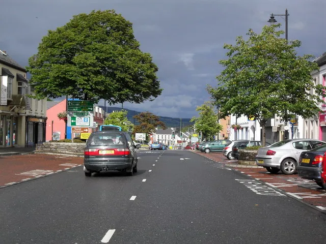
Limavady is a town. Location: Causeway Coast and Glens, Northern Ireland. Population: 11,279. Elevation: 20 m.
Limavady (; from Irish Léim an Mhadaidh 'leap of the dog') is a market town in County Londonderry, Northern Ireland, with Binevenagh as a backdrop. Lying 17 miles (27 km) east of Derry and 14 miles (23 km) southwest of Coleraine, Limavady had a population of 11,279 people at the 2021 Census. In the 40 years between 1971 and 2011, Limavady's population nearly doubled. Limavady is within Causeway Coast and Glens Borough.
Source: Wikipedia · CC BY-SA 4.0
Photos of Limavady
-

john.purvis · CC BY 2.0 -

john.purvis · CC BY 2.0 -

Alistair Cunningham · CC BY 3.0 -

Alistair Cunningham · CC BY 3.0 -
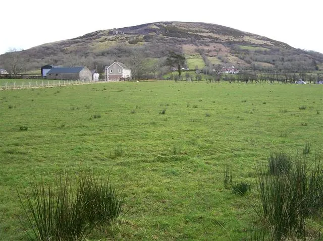
Keady Mountain Kenneth Allen · CC BY-SA 2.0


Travel notes for Limavady
From Wikivoyage
Limavady is a market town in County Londonderry in Northern Ireland, in the scenic Roe Valley. Limavady is nowadays part of Causeway Coast and Glens District, and in 2021 had a population of 11,000. "Limavady" is from Léim a' Mhadaidh – "leap of the dog". In legend the dog leapt from a bluff across the Roe Valley to warn of attack, or summon help, or simply to leg it.
Understand+
- "very Irish, for though it has been planted for more than two centuries by English and Scottish settlers, the old Irish race still forms the great majority of its peasant inhabitants; and there are few, if any counties in which, with less foreign admixture, the ancient melodies of the country have been so extensively preserved." — Publisher's introduction of 1855
Jane Ross (1810-1879) lived with her sisters at 51 Main St Limavady, and early one morning in 1853 she heard an unusual violin tune played outside her window. She was a keen collector of Irish folk music; she never got the name of the player or of the tune, but it joined a batch published by George Petrie. Known as the "Londonderry Air", it was originally without words. It was unlike other Irish folk tunes, and other collectors were unaware of it. It's nowadays believed to stem from the 18th-century Aisling an Óigfhir or "The Young Man's Dream", but played so slowly and mournfully as to cause Ross to mistake the time signature.
The first set of words to the tune appeared in the 1870s, and around 50 versions have been published, mostly so sad and mawkish that you would either fall about laughing or throw up. There really ought to be a mash-up version (yes, that scans for its first line), to set His love among the sons of men, and lie and faint within your silken bosom, the pilgrim told not how or when. But in 1913 Frederic Edward Weatherly set the words that have become the unofficial national anthem of Northern Ireland and its diaspora. They're every bit as mawkish, and you can laugh or upchuck if you will — lots of late-night carousers do so. But if there is a single molecule of Ulster in your being, then you will nevertheless sing like you mean it, with tears in your eyes. It's called "Danny Boy".
Get in+
1 City of Derry Airport (LDY IATA) is at Eglinton 10 miles west on A2, with flights from the UK and in summer from the Med. You've more choice flying into one of the Belfast airports.
By road from Belfast follow M2 / A6 to Dungiven then B68 north.
Goldliner 234 runs every couple of hours from Londonderry via City of Derry Airport to Limavady (40 min) and Coleraine. In term-time it continues to Ulster University.
Ulsterbus 143 / 144 / 152 is a slower service, taking an hour from Londonderry hourly M-F.
Bus 134 runs from Coleraine along the coast road A2 to Castlerock, Magilligan crossroads, Bellarena, Aghanloo Cross and Limavady, taking an hour. There are 8 M-F and 6 Sa.
2 Buscentre in Limavady is east end of Main St.
The railway runs right next to Limavady and the airport and serves neither. It's probably simplest to take the hourly train from Belfast to Londonderry then the bus out.
3 Bellarena is a halt on the railway five miles north of Limavady. It's served by the infrequent Bus 134 (above) or you could have a taxi arranged.
4 Magilligan Point is the landing for the Lough Foyle Ferry from Greencastle in County Donegal. It sails Jun-Aug, shuttling continuously from 9AM to 8PM, a 10-min crossing. It carries light vehicles; there are buses to Greencastle but no onward public transport from Magilligan Point. Make sure your personal and car documents are valid for the Republic of Ireland.
Source: Wikivoyage · CC BY-SA 4.0 · abridged
Climate of Limavady
Best months for sightseeingBest months for sightseeing: June–August.
This month · November
A wet month
Day 10° · Night 5° · Rain 148 mm
- Hottest month
- July (day 18°)
- Coldest month
- February (night 3°)
- Wettest month
- November (148 mm)
- Driest month
- May (77 mm)
Bars: average monthly low and high temperature. Below: precipitation. Monthly averages for 1970–2000 at about 18 km resolution, adjusted for elevation. Highlighted months are mild and relatively dry. Source: WorldClim 2.1 (CC BY 4.0).
Show values as a table
| Month | Jan | Feb | Mar | Apr | May | Jun | Jul | Aug | Sep | Oct | Nov | Dec |
|---|---|---|---|---|---|---|---|---|---|---|---|---|
| Average high (°C) | 8° | 8° | 9° | 11° | 14° | 16° | 18° | 18° | 16° | 13° | 10° | 8° |
| Average low (°C) | 3° | 3° | 4° | 5° | 7° | 10° | 12° | 12° | 10° | 8° | 5° | 4° |
| Precipitation (mm) | 146 | 113 | 115 | 83 | 77 | 83 | 89 | 111 | 121 | 145 | 148 | 147 |
How to get to Limavady
The nearest airport is City of Derry Airport (LDY), 13 km to the west as the crow flies. For international flights: Belfast International Airport (BFS) (64 km). The nearest large city is Belfast, 83 km to the southeast.
Airports
- City of Derry Airport (LDY) Derry, Derry and Strabane 13 kmwest
- Belfast International Airport (BFS) Belfast 64 kmsoutheast
- Islay Airport (ILY) Isle of Islay, Argyll and Bute 83 kmnortheast
Nearby large cities
- Belfast Population: 348K 83 kmsoutheast
- Glasgow Population: 626.4K 193 kmnortheast
- Dublin Population: 1M 197 kmsouth
- Edinburgh Population: 515K 258 kmnortheast
- Limerick Population: 102.3K 287 kmsouthwest
Straight-line distances; road distances are longer. Airport data: OurAirports.
Day trips from Limavady
Within 100 km: 87 historic and cultural sites, 763 natural sites, 618 lakes, rivers and coasts.
0–25 km90 places
- Portstewart Beach Beach 20 kmNE
- Benone Beach Beach 14 kmN
- Portstewart Strand Beach 18 kmNE
- Lough Inn Lake 21 kmNW
25–60 km387 places
- Island Roy Island 56 kmW
- Lisfannon Beach Beach 34 kmW
- The Skerries Island 28 kmNE
- Sheep Island Island 44 kmNE
60–100 km991 places
- West Maiden Island 79 kmE
- Texa Island Island 81 kmNE
- Sheep Island Island 92 kmE
- Sanda Island Island 91 kmE
Straight-line distances.
Nearby attractions & nature
Everything nearby-
Curly River River, Northern Ireland1.8 km N
-
Castle River River, Northern Ireland1.8 km N
-
Roe Valley Country Park Natural site, Northern Ireland2.9 km S
-
Keady Mountain Mountain, Causeway Coast and Glens5.9 km E
-
Boyds Mountain Mountain, Causeway Coast and Glens8.6 km E
-
Binevenagh Mountain, Causeway Coast and Glens7.3 km N
-
Cnoc na hEarcola Mountain, Causeway Coast and Glens9.2 km SE
-
 Benbradagh Mountain, Causeway Coast and Glens13 km S
Other cities and towns in Causeway Coast and Glens
-
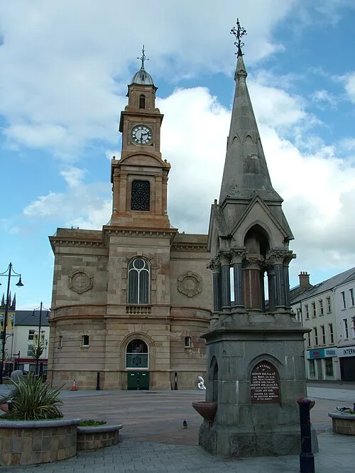 Coleraine City, Causeway Coast and Glens20 km NE
-
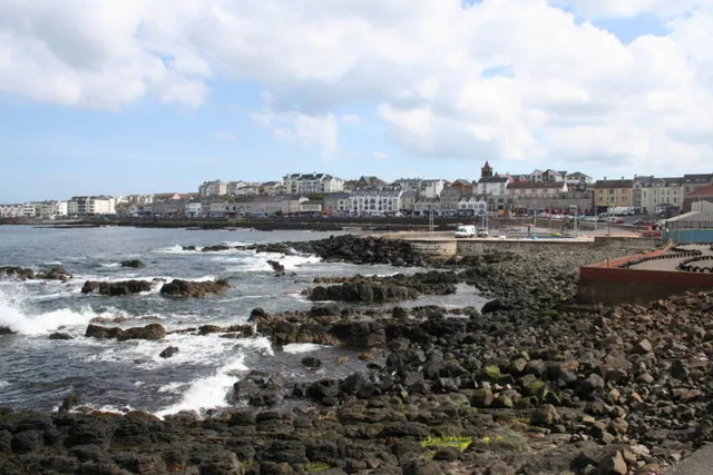 Portstewart Town, Causeway Coast and Glens21 km NE
-
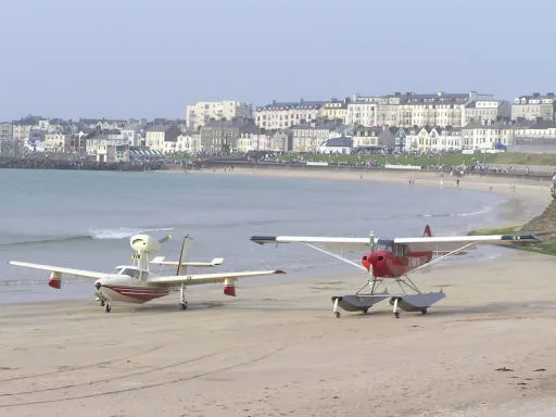 Portrush Town, Causeway Coast and Glens25 km NE
-
Ballymoney Town, Causeway Coast and Glens28 km E
-
Ballycastle Town, Causeway Coast and Glens48 km E
Sources & licences
Data last updated: · 2 independent sources