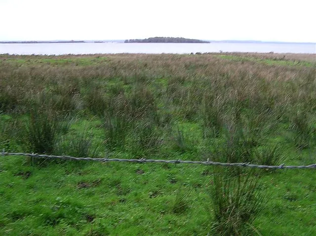
- Elevation
- 17 m
- above sea level
- Local time
- UTC+00:00
- Europe/London · UTC+00:00
- Airports
- BFS Belfast International Airport27 km
- BHD George Best Belfast City Airport45 km
About Coney Island
Coney Island is an island. Location: Northern Ireland, United Kingdom.
Coney Island is an island in Lough Neagh, Northern Ireland. It is about 1 km offshore from Maghery in County Armagh, is thickly wooded and of nearly 9 acres (36,000 m2) in area. It lies between the mouths of the River Blackwater and the River Bann in the south-west corner of Lough Neagh. Boat trips to the island are available at weekends from Maghery Country Park or Kinnego Marina. The island is owned by the National Trust and managed on their behalf by Armagh City, Banbridge and Craigavon Borough Council.
Source: Wikipedia · CC BY-SA 4.0
Climate of Coney Island
Best months for sightseeingBest months for sightseeing: June–September.
This month · November
A cold month
Day 10° · Night 4° · Rain 94 mm
- Hottest month
- July (day 19°)
- Coldest month
- January (night 2°)
- Wettest month
- January (99 mm)
- Driest month
- May (59 mm)
Bars: average monthly low and high temperature. Below: precipitation. Monthly averages for 1970–2000 at about 18 km resolution, adjusted for elevation. Highlighted months are mild and relatively dry. Source: WorldClim 2.1 (CC BY 4.0).
Show values as a table
| Month | Jan | Feb | Mar | Apr | May | Jun | Jul | Aug | Sep | Oct | Nov | Dec |
|---|---|---|---|---|---|---|---|---|---|---|---|---|
| Average high (°C) | 7° | 8° | 9° | 12° | 15° | 17° | 19° | 19° | 16° | 13° | 10° | 8° |
| Average low (°C) | 2° | 2° | 3° | 5° | 7° | 10° | 12° | 12° | 10° | 7° | 4° | 3° |
| Precipitation (mm) | 99 | 73 | 80 | 62 | 59 | 63 | 64 | 82 | 82 | 99 | 94 | 97 |
Other places to visit in this season: June July August September
How to get to Coney Island
The nearest airport is Belfast International Airport (BFS), 27 km to the northeast as the crow flies. The nearest large city is Belfast, 41 km to the east.
Airports
- Belfast International Airport (BFS) Belfast 27 kmnortheast
- George Best Belfast City Airport (BHD) Belfast 45 kmeast
- City of Derry Airport (LDY) Derry, Derry and Strabane 71 kmnorthwest
Nearby large cities
- Belfast Population: 348K 41 kmeast
- Dublin Population: 1M 133 kmsouth
- Glasgow Population: 626.4K 209 kmnortheast
- Blackpool Population: 145K 241 kmeast
- Limerick Population: 102.3K 248 kmsouthwest
Straight-line distances; road distances are longer. Airport data: OurAirports.
Day trips from Coney Island
Within 100 km: 127 historic and cultural sites, 541 natural sites, 597 lakes, rivers and coasts.
0–25 km23 places
- Reedy Flat Island 4 kmE
- Rams Island Island 18 kmNE
- Portmore Lough Lake 18 kmE
- Lough Neagh Lake 14 kmNE
25–60 km387 places
- Reagh Island Island 59 kmE
- Castle Island Island 59 kmE
- Gores Island Island 60 kmE
- White Island Island 46 kmS
60–100 km855 places
- Pollboy Bridge Landmark 96 kmS
- Portstewart Beach Beach 74 kmN
- Benone Beach Beach 75 kmN
- Portstewart Strand Beach 74 kmN
Straight-line distances.
Nearest towns and villages
-
Milltown Village, Armagh City Banbridge and Craigavon2.1 km SW
-
Maghery Village, Mid Ulster2.2 km W
-
Charlestown Village, Armagh City Banbridge and Craigavon2.8 km SE
-
The Birches Village, Armagh City Banbridge and Craigavon3.7 km S
-
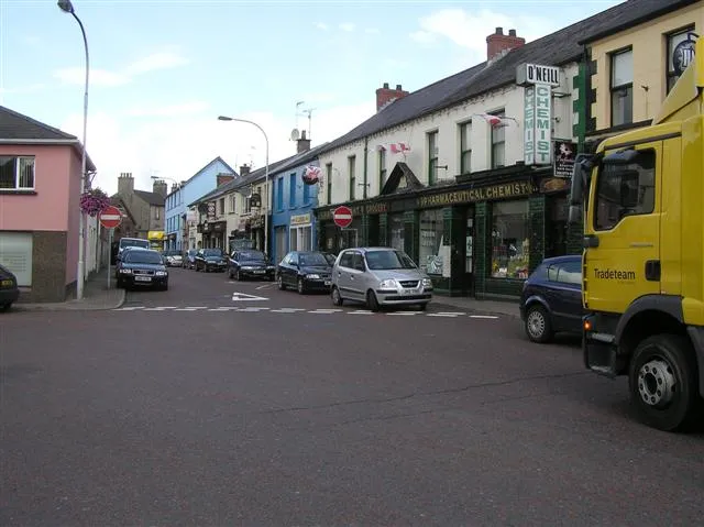 Coalisland Town, Mid Ulster10 km W
-
Aughamullan Village, Mid Ulster4.7 km NW
Nearby attractions & nature
Everything nearby-
Washing Bay Natural site, Northern Ireland2.8 km NW
-
River Blackwater River, Northern Ireland2.2 km W
-
Reedy Flat Island, Northern Ireland4.3 km E
-
River Bann River, Northern Ireland2.8 km SE
-
Torrent River River, Northern Ireland3.7 km NW
-
Lough Gullion Lake, Northern Ireland7.5 km SE
-
Oxford Island Natural site, Armagh City Banbridge and Craigavon11 km E
-
Lough Neagh Lake, Northern Ireland14 km NE
Sources & licences
Data last updated: · 2 independent sources