- Elevation
- 23 m
- above sea level
- Local time
- UTC+00:00
- Europe/London · UTC+00:00
- Airports
- ABZ Aberdeen International Airport22 km
- DND Dundee Airport120 km
About Burn of Forvie
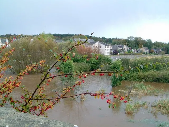
Burn of Forvie is a river. Location: Aberdeenshire, Scotland. The best months to visit are June–September. The nearest airport is Aberdeen International Airport (22 km). Nearby sights include Inch Geck and Sands of Forvie Nature Reserve.
Climate of Burn of Forvie
Best months for sightseeingBest months for sightseeing: June–September.
This month · November
A cold month
Day 8° · Night 2° · Rain 79 mm
- Hottest month
- July (day 18°)
- Coldest month
- January (night -1°)
- Wettest month
- November (79 mm)
- Driest month
- February (51 mm)
Bars: average monthly low and high temperature. Below: precipitation. Monthly averages for 1970–2000 at about 18 km resolution, adjusted for elevation. Highlighted months are mild and relatively dry. Source: WorldClim 2.1 (CC BY 4.0).
Show values as a table
| Month | Jan | Feb | Mar | Apr | May | Jun | Jul | Aug | Sep | Oct | Nov | Dec |
|---|---|---|---|---|---|---|---|---|---|---|---|---|
| Average high (°C) | 4° | 6° | 9° | 11° | 14° | 16° | 18° | 18° | 16° | 12° | 8° | 5° |
| Average low (°C) | -1° | 0° | 2° | 3° | 5° | 8° | 10° | 10° | 8° | 5° | 2° | 0° |
| Precipitation (mm) | 71 | 51 | 55 | 54 | 52 | 56 | 60 | 64 | 71 | 77 | 79 | 70 |
Other places to visit in this season: June July August September
How to get to Burn of Forvie
The nearest airport is Aberdeen International Airport (ABZ), 22 km to the southwest as the crow flies. The nearest large city is Aberdeen, 26 km to the south.
Airports
- Aberdeen International Airport (ABZ) Aberdeen 22 kmsouthwest
- Dundee Airport (DND) Dundee 120 kmsouthwest
- Inverness Airport (INV) Inverness, Highland 125 kmwest
Nearby large cities
- Aberdeen Population: 198.6K 26 kmsouth
- Dundee Population: 148.2K 117 kmsouthwest
- Edinburgh Population: 515K 174 kmsouthwest
- Glasgow Population: 626.4K 218 kmsouthwest
- Newcastle upon Tyne Population: 300.1K 267 kmsouth
Straight-line distances; road distances are longer. Airport data: OurAirports.
Day trips from Burn of Forvie
Within 100 km: 53 historic and cultural sites, 1,079 natural sites, 184 lakes, rivers and coasts.
0–25 km82 places
- Newburgh Seals Beach Beach 6 kmS
- Aberdeen Beach Beach 24 kmS
- Keith Inch Island 20 kmNE
- The Donnons Island 10 kmNE
25–60 km411 places
- Balbithan Island Island 25 kmSW
- Sunnyside Beach Beach 60 kmNW
- Logg Island Island 41 kmNW
- Scury Islands Island 46 kmNW
60–100 km823 places
- Findlays Seat Mountain 76 kmW
- Lossiemouth East Beach Beach 87 kmNW
- Island of Dundurcas Island 74 kmW
- Heathery Isle Island 74 kmW
Straight-line distances.
Nearest towns and villages
-
 Ellon Town, Aberdeenshire5.4 km W
-
Auchmacoy Village, Aberdeenshire1.9 km W
-
Newburgh Village, Aberdeenshire5.7 km S
-
Pitlurg Village, Aberdeenshire2.7 km NE
-
Kirkton of Logie Buchan Village, Aberdeenshire2.7 km SW
-
Collieston Village, Aberdeenshire3.5 km SE
Nearby attractions & nature
Everything nearby-
Inch Geck Island, Aberdeenshire3 km SW
-
Sands of Forvie Nature Reserve Natural site, Aberdeenshire3.8 km S
-
Doocot Rock Island, Aberdeenshire3.6 km W
-
Hackley Head Natural site, Aberdeenshire4.2 km SE
-
High Law Mountain, Aberdeenshire6.1 km NE
-
Hill of Dudwick Mountain, Aberdeenshire7.8 km NW
-
Newburgh Seals Beach Beach, Aberdeenshire6.3 km S
-
Elphin Hill Mountain, Aberdeenshire7.3 km NW
Sources & licences
Data last updated: