- Elevation
- 81 m
- above sea level
- Local time
- UTC+00:00
- Europe/London · UTC+00:00
- Airports
- ABZ Aberdeen International Airport28 km
- DND Dundee Airport74 km
About Carron Water
Carron Water is a river. Location: Aberdeenshire, Scotland. The best months to visit are June–August. The nearest airport is Aberdeen International Airport (28 km). Nearby sights include Strathlethan Bay and Old Hall Bay.
Climate of Carron Water
Best months for sightseeingBest months for sightseeing: June–August.
This month · November
A cold month
Day 7° · Night 1° · Rain 81 mm
- Hottest month
- July (day 19°)
- Coldest month
- January (night -2°)
- Wettest month
- January (88 mm)
- Driest month
- April (49 mm)
Bars: average monthly low and high temperature. Below: precipitation. Monthly averages for 1970–2000 at about 18 km resolution, adjusted for elevation. Highlighted months are mild and relatively dry. Source: WorldClim 2.1 (CC BY 4.0).
Show values as a table
| Month | Jan | Feb | Mar | Apr | May | Jun | Jul | Aug | Sep | Oct | Nov | Dec |
|---|---|---|---|---|---|---|---|---|---|---|---|---|
| Average high (°C) | 4° | 5° | 9° | 11° | 15° | 17° | 19° | 19° | 16° | 12° | 7° | 5° |
| Average low (°C) | -2° | -2° | 1° | 2° | 5° | 8° | 10° | 9° | 7° | 4° | 1° | -1° |
| Precipitation (mm) | 88 | 59 | 62 | 49 | 56 | 55 | 60 | 68 | 73 | 86 | 81 | 77 |
How to get to Carron Water
The nearest airport is Aberdeen International Airport (ABZ), 28 km to the north as the crow flies. The nearest large city is Aberdeen, 23 km to the north.
Airports
- Aberdeen International Airport (ABZ) Aberdeen 28 kmnorth
- Dundee Airport (DND) Dundee 74 kmsouthwest
- Inverness Airport (INV) Inverness, Highland 129 kmnorthwest
Nearby large cities
- Aberdeen Population: 198.6K 23 kmnorth
- Dundee Population: 148.2K 71 kmsouthwest
- Edinburgh Population: 515K 126 kmsouthwest
- Glasgow Population: 626.4K 175 kmsouthwest
- Newcastle upon Tyne Population: 300.1K 223 kmsouth
Straight-line distances; road distances are longer. Airport data: OurAirports.
Day trips from Carron Water
Within 100 km: 74 historic and cultural sites, 1,619 natural sites, 272 lakes, rivers and coasts.
0–25 km139 places
- Aberdeen Beach Beach 24 kmN
- Loch of Skene Lake 24 kmN
- Black Loch Lake 24 kmW
- Cairn o’ Mount Mountain 23 kmW
25–60 km551 places
- Balbithan Island Island 33 kmN
- Newburgh Seals Beach Beach 42 kmN
- The Donnons Island 56 kmNE
- Inch Geck Island 45 kmN
60–100 km1,275 places
- Findlays Seat Mountain 91 kmNW
- Sunnyside Beach Beach 89 kmN
- Mugdrum Island Island 92 kmSW
- Isle of May Island 88 kmS
Straight-line distances.
Nearest towns and villages
-
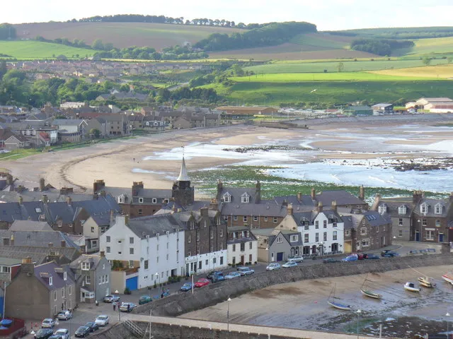 Stonehaven Town, Aberdeenshire1.5 km N
-
Fetteresso Village, Aberdeenshire1 km W
-
Dunnottar Village, Aberdeenshire1 km SE
-
Cowie Neighbourhood, Aberdeenshire2.6 km N
-
Redcloak Village, Aberdeenshire3.4 km NW
-
Crawton Village, Aberdeenshire4.6 km S
Nearby attractions & nature
Everything nearby-
Strathlethan Bay Natural site, Aberdeenshire1 km E
-
Old Hall Bay Natural site, Aberdeenshire1 km E
-
Castle Haven Natural site, Aberdeenshire1 km E
-
Cowie Harbour Natural site, Aberdeenshire1.4 km NE
-
Tremuda Bay Natural site, Aberdeenshire2.1 km SE
-
Cowie Water River, Aberdeenshire2 km N
-
Bowdun Head Natural site, Aberdeenshire2 km E
-
Stonehaven Bay Natural site, Aberdeenshire2.1 km NE
Sources & licences
Data last updated: