- Elevation
- 31 m
- above sea level
- Airports
- ILY Islay Airport64 km
- GLA Glasgow Airport73 km
About Eilean Glas
Eilean Glas is an island. Location: Argyll and Bute, Scotland. The best months to visit are June–August. The nearest airport is Islay Airport (64 km). Nearby sights include Sgeireag Gaibhre and Crinan Ferry Hill.
Climate of Eilean Glas
Best months for sightseeingBest months for sightseeing: June–August.
This month · November
A wet month
Day 10° · Night 6° · Rain 184 mm
- Hottest month
- August (day 18°)
- Coldest month
- February (night 4°)
- Wettest month
- January (201 mm)
- Driest month
- May (77 mm)
Bars: average monthly low and high temperature. Below: precipitation. Monthly averages for 1970–2000 at about 18 km resolution, adjusted for elevation. Highlighted months are mild and relatively dry. Source: WorldClim 2.1 (CC BY 4.0).
Show values as a table
| Month | Jan | Feb | Mar | Apr | May | Jun | Jul | Aug | Sep | Oct | Nov | Dec |
|---|---|---|---|---|---|---|---|---|---|---|---|---|
| Average high (°C) | 8° | 8° | 9° | 11° | 15° | 16° | 18° | 18° | 16° | 13° | 10° | 8° |
| Average low (°C) | 4° | 4° | 4° | 5° | 8° | 10° | 12° | 12° | 10° | 8° | 6° | 4° |
| Precipitation (mm) | 201 | 122 | 151 | 92 | 77 | 85 | 105 | 125 | 164 | 180 | 184 | 186 |
How to get to Eilean Glas
The nearest airport is Islay Airport (ILY), 64 km to the southwest as the crow flies. For international flights: Glasgow Airport (GLA) (73 km). The nearest large city is Glasgow, 84 km to the east.
Airports
- Islay Airport (ILY) Isle of Islay, Argyll and Bute 64 kmsouthwest
- Glasgow Airport (GLA) Glasgow 73 kmeast
- Campbeltown Airport (CAL) Campbeltown 74 kmsouth
Nearby large cities
- Glasgow Population: 626.4K 84 kmeast
- Edinburgh Population: 515K 147 kmeast
- Dundee Population: 148.2K 164 kmeast
- Belfast Population: 348K 168 kmsouth
- Aberdeen Population: 198.6K 242 kmnortheast
Straight-line distances; road distances are longer. Airport data: OurAirports.
Nearest towns and villages
-
Crinan Village, Argyll and Bute1.5 km SW
-
Bellanoch Village, Argyll and Bute2.3 km S
-
Poltalloch Village, Argyll and Bute2.5 km NE
-
Slockavullin Village, Argyll and Bute3.9 km NE
-
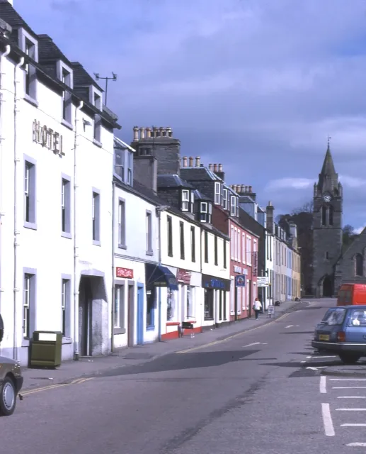 Lochgilphead City, Argyll and Bute9.2 km SE
-
Cairnbaan Village, Argyll and Bute5.2 km SE
Nearby attractions & nature
Everything nearby-
Sgeireag Gaibhre Island, Argyll and Bute0.3 km N
-
Crinan Ferry Hill Mountain, Argyll and Bute0.7 km S
-
Crinan Wood Mountain, Argyll and Bute1.1 km SW
-
Creag na h-Ath Mountain, Argyll and Bute1.7 km N
-
Eilean dà Mhèinn Island, Argyll and Bute1.6 km W
-
Loch Crinan Natural site, Argyll and Bute1.7 km NW
-
An-tinalin Island, Argyll and Bute1.7 km NW
-
Barr Ban Mountain, Argyll and Bute2.3 km SW
More lakes, rivers and coasts in United Kingdom
-
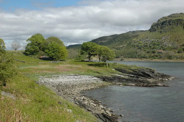 Island Macaskin Island, Argyll and Bute4.9 km N
-
Eilean nan Coinean Island, Argyll and Bute2.9 km NW
-
Liath-sgeir Mhòr Island, Argyll and Bute3.8 km NW
-
Liath-sgeir Bheag Island, Argyll and Bute4.1 km NW
-
Eilean na Cille Island, Argyll and Bute5.2 km NW
-
Garbh Rèisa Island, Argyll and Bute5.3 km NW
Sources & licences
Data last updated: