Craigbouie Fell
Located in Dumfries and Galloway, Scotland Coordinates: 54°51′36″ N 5°07′03″ W
- Elevation
- 128 m
- above sea level
- Local time
- UTC+00:00
- Europe/London · UTC+00:00
- Airports
- BHD George Best Belfast City Airport56 km
- CAL Campbeltown Airport74 km
About Craigbouie Fell
Craigbouie Fell is a mountain. Location: Dumfries and Galloway, Scotland. Elevation: 128 m. The best months to visit are June–August. The nearest airport is George Best Belfast City Airport (56 km). Nearby sights include Killantringan Fell and Black Head.
Photos of Craigbouie Fell
-
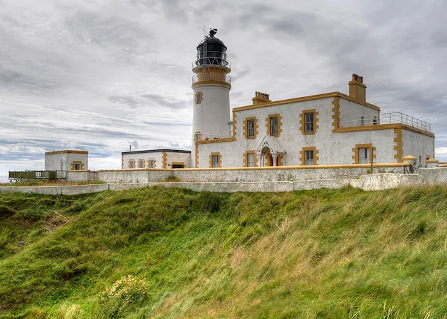
Killantringan Lighthouse David Dixon · CC BY-SA 2.0

Climate of Craigbouie Fell
Best months for sightseeingBest months for sightseeing: June–August.
This month · November
A wet month
Day 9° · Night 3° · Rain 124 mm
- Hottest month
- July (day 18°)
- Coldest month
- February (night 1°)
- Wettest month
- October (127 mm)
- Driest month
- May (58 mm)
Bars: average monthly low and high temperature. Below: precipitation. Monthly averages for 1970–2000 at about 18 km resolution, adjusted for elevation. Highlighted months are mild and relatively dry. Source: WorldClim 2.1 (CC BY 4.0).
Show values as a table
| Month | Jan | Feb | Mar | Apr | May | Jun | Jul | Aug | Sep | Oct | Nov | Dec |
|---|---|---|---|---|---|---|---|---|---|---|---|---|
| Average high (°C) | 6° | 6° | 8° | 10° | 14° | 16° | 18° | 17° | 15° | 12° | 9° | 7° |
| Average low (°C) | 1° | 1° | 2° | 3° | 6° | 8° | 10° | 10° | 8° | 6° | 3° | 2° |
| Precipitation (mm) | 124 | 86 | 95 | 67 | 58 | 72 | 77 | 97 | 104 | 127 | 124 | 120 |
How to get to Craigbouie Fell
The nearest airport is George Best Belfast City Airport (BHD), 56 km to the southwest as the crow flies. For international flights: Belfast International Airport (BFS) (74 km). The nearest large city is Belfast, 60 km to the southwest.
Airports
- George Best Belfast City Airport (BHD) Belfast 56 kmsouthwest
- Campbeltown Airport (CAL) Campbeltown 74 kmnorthwest
- Belfast International Airport (BFS) Belfast 74 kmwest
Nearby large cities
- Belfast Population: 348K 60 kmsouthwest
- Glasgow Population: 626.4K 124 kmnortheast
- Edinburgh Population: 515K 172 kmnortheast
- Blackpool Population: 145K 178 kmsoutheast
- Dublin Population: 1M 185 kmsouthwest
Straight-line distances; road distances are longer. Airport data: OurAirports.
Day trips from Craigbouie Fell
Within 100 km: 75 historic and cultural sites, 1,188 natural sites, 414 lakes, rivers and coasts.
0–25 km132 places
- Isle of Lochnaw Island 7 kmN
- Heron Isle Island 12 kmNE
- Well Island Island 7 kmN
- Duck Island Island 7 kmN
25–60 km439 places
- West Maiden Island 41 kmW
- Sheep Island Island 56 kmNW
- Sanda Island Island 55 kmNW
- Reagh Island Island 52 kmSW
60–100 km1,106 places
- Isle of Arran Island 83 kmN
- Powillimount Beach Beach 99 kmE
- Ayr Beach Beach 73 kmNE
- Troon Beach Beach 81 kmN
Straight-line distances.
Nearest towns and villages
-
Portpatrick Village, Dumfries and Galloway2.1 km S
-
Enoch Village, Dumfries and Galloway1.1 km S
-
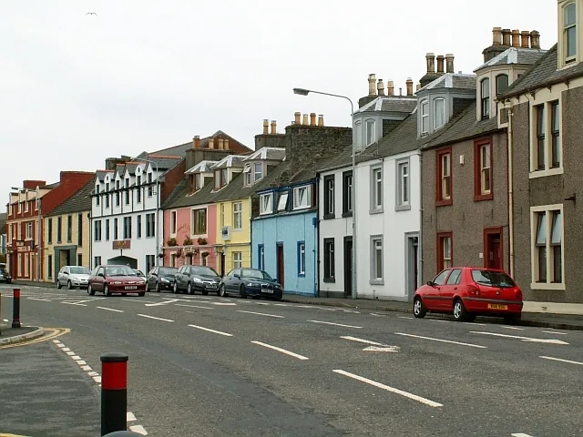 Stranraer Town, Dumfries and Galloway7.5 km NE
-
Glenstockdale Village, Dumfries and Galloway5.2 km N
-
Colfin Village, Dumfries and Galloway5.7 km E
-
Challoch Village, Dumfries and Galloway6.7 km N
Nearby attractions & nature
Everything nearby-
Killantringan Fell Mountain, Dumfries and Galloway0.8 km NW
-
Black Head Natural site, Dumfries and Galloway2 km W
-
Maidenhead Bay Natural site, Scotland1.6 km SW
-
Killantringan Lighthouse Landmark, Dumfries and Galloway1.9 km W
-
Craigenlee Fell Mountain, Dumfries and Galloway2.4 km NE
-
Knock Bay Natural site, Scotland2.2 km W
-
Castle Bay Natural site, Scotland2.9 km S
-
Killantringan Bay Natural site, Scotland3.2 km W
Sources & licences
Data last updated: