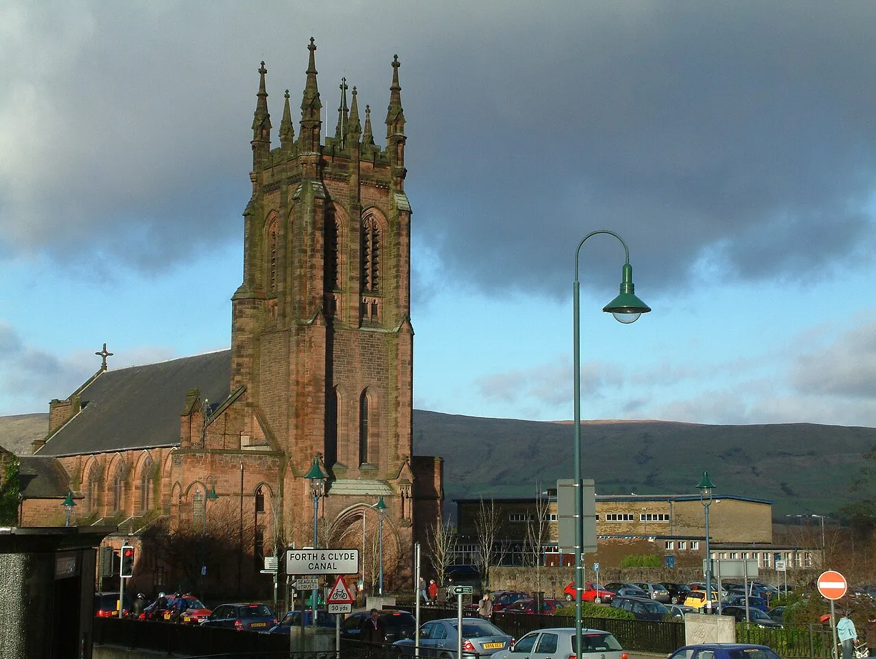
- Population
- 19,630
- 19.6K
- Elevation
- 51 m
- above sea level
- Local time
- UTC+00:00
- Europe/London · UTC+00:00
- Airports
- GLA Glasgow Airport19 km
- EDI Edinburgh Airport49 km
About Kirkintilloch
Kirkintilloch is a city. Location: East Dunbartonshire, Scotland. Population: 19,630. Elevation: 51 m.
Kirkintilloch (; Scots: Kirkintulloch; Scottish Gaelic: Cair Cheann Tulaich) is a town and a Burgh of Barony (The Baron of Kirkintilloch) in East Dunbartonshire, Scotland. It lies on the Forth and Clyde Canal and on the south side of Strathkelvin, about 8 miles (13 km) northeast of central Glasgow. Historically part of Dunbartonshire, the town is the administrative home of East Dunbartonshire council area, its population in 2009 was estimated at 19,700 and its population in 2011 was 19,689.
Source: Wikipedia · CC BY-SA 4.0
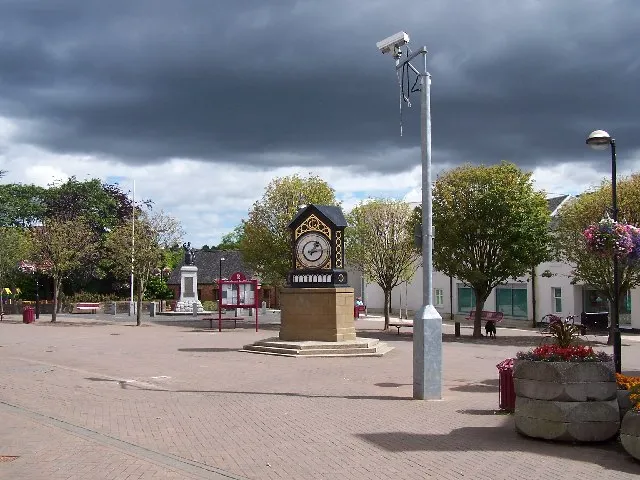
Photos of Kirkintilloch
-

Jim Smillie · CC BY-SA 2.0 -

Richard Sutcliffe · CC BY-SA 2.0 -

Richard Sutcliffe · CC BY-SA 2.0 -
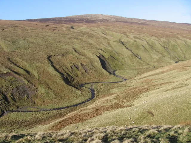
Earl's Seat Chris Wimbush · CC BY-SA 2.0 -
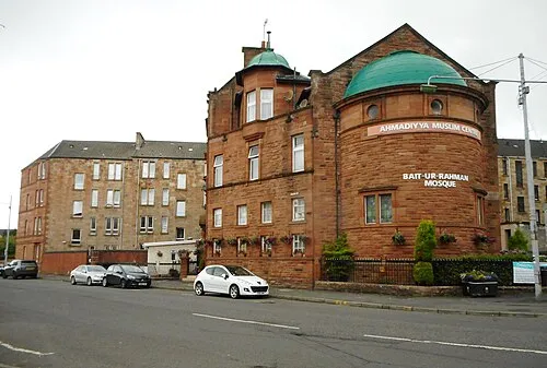
Bait-ur-Rahman Richard Sutcliffe · CC BY-SA 2.0


Travel notes for Kirkintilloch
From Wikivoyage
Kirkintilloch is an industrial town in the Clydeside area of central Scotland, with a population in 2022 of 20,000. It's about 8 miles northeast of central Glasgow, on the Forth and Clyde Canal. The main reason to visit is to see the Antonine Wall east of the town. It's also a base for exploring the canal and the Campsie Fells to the north.
Understand+
Clyde Puffers were stubby little cargo ships that plied the seas around the Firth of Clyde and the Hebrides, and came to hold a romanticised place in Scottish lore. Kirkintilloch, miles inland, was their unlikely birthplace.
The first puffers in 1856 were simply iron canal barges with a rudimentary steam engine. Since the barge continually drew fresh water from the canal, the engine didn’t have a condenser, so the piston strokes created a great snorting puff-puff-puff of steam. Later designs had condensers and could go to sea but the name stuck. The ships had blunt bows, shallow draft with flat bottoms, a single mast, and (later) a derrick and a wheelhouse just behind the funnel. They were built along the Forth and Clyde Canal, with yards concentrated at Glasgow Maryhill and at Kirkintilloch. New ships were launched sideways into the canal with an almighty splash, and the local children’s sport was to try to sprint along the towpath beneath the wave without getting drenched.
Forth and Clyde Canal traffic withered as the railways were built, but the Crinan Canal remained an important shortcut between Glasgow and the Hebrides, which lacked roads and harbour facilities. The puffer could simply be beached as the tide fell, a horse and cart plodded alongside for the coal sacks and other supplies to be offloaded, then the puffer departed on the next flood of tide. This era passed into legend with the Para Handy tales of Neil Munro, published from 1905, describing the adventures of the four-man Vital Spark.
Get in+
Kirkintilloch is 8 miles northeast of Glasgow, by car leave M80 at junction 3 and follow A806 north for 3 miles. By bike follow the canal towpath or A803 north through Bishopbriggs. Parking in the town is generally easy and free.
First Greater Glasgow Buses X85 and X87 run from Glasgow Buchanan station via M80 and Lenzie to Kirkintilloch twice an hour, taking 30 min. The X85 continues to Lennoxtown and Clachan in the Campsie Fells. Bus 89 runs every 30 min via Bishopbriggs and Cadder, taking 35 min and continuing to Kilsyth. Bus 88 lurches slowly via Bishopbriggs to Kirkintilloch every 20 min, taking an hour.
1 Lenzie is the nearest railway station, one mile south. Trains from Glasgow Queen Street run every 30 min, taking 12 min and continuing north via Stirling to Alloa or Dunblane. From Edinburgh you need to change, either at Larbert off the train for Stirling and Dunblane, or at Croy off the train to Glasgow. Lenzie station has a ticket office and machines, toilets and waiting room. There's a footbridge between platforms and a long work-around by road.
Source: Wikivoyage · CC BY-SA 4.0 · abridged
Climate of Kirkintilloch
Best months for sightseeingBest months for sightseeing: June–August.
This month · November
A wet month
Day 9° · Night 3° · Rain 144 mm
- Hottest month
- July (day 19°)
- Coldest month
- January (night 1°)
- Wettest month
- January (156 mm)
- Driest month
- April (66 mm)
Bars: average monthly low and high temperature. Below: precipitation. Monthly averages for 1970–2000 at about 18 km resolution, adjusted for elevation. Highlighted months are mild and relatively dry. Source: WorldClim 2.1 (CC BY 4.0).
Show values as a table
| Month | Jan | Feb | Mar | Apr | May | Jun | Jul | Aug | Sep | Oct | Nov | Dec |
|---|---|---|---|---|---|---|---|---|---|---|---|---|
| Average high (°C) | 6° | 7° | 8° | 11° | 15° | 17° | 19° | 18° | 15° | 12° | 9° | 7° |
| Average low (°C) | 1° | 1° | 2° | 4° | 6° | 9° | 11° | 11° | 9° | 6° | 3° | 2° |
| Precipitation (mm) | 156 | 107 | 116 | 66 | 71 | 68 | 75 | 91 | 125 | 147 | 144 | 144 |
How to get to Kirkintilloch
The nearest airport is Glasgow Airport (GLA), 19 km to the southwest as the crow flies. The nearest large city is Glasgow, 11 km to the southwest.
Airports
- Glasgow Airport (GLA) Glasgow 19 kmsouthwest
- Edinburgh Airport (EDI) Ingliston, Edinburgh 49 kmeast
- Glasgow Prestwick Airport (PIK) Prestwick, South Ayrshire 56 kmsouthwest
Nearby large cities
- Glasgow Population: 626.4K 11 kmsouthwest
- Edinburgh Population: 515K 60 kmeast
- Dundee Population: 148.2K 94 kmnortheast
- Aberdeen Population: 198.6K 184 kmnortheast
- Belfast Population: 348K 187 kmsouthwest
Straight-line distances; road distances are longer. Airport data: OurAirports.
Day trips from Kirkintilloch
Within 100 km: 181 historic and cultural sites, 3,802 natural sites, 1,054 lakes, rivers and coasts.
0–25 km174 places
- Newshot Island Island 17 kmW
- Spiers Island Island 19 kmE
- Speirs Island Island 9 kmNE
- Loch Coulter Reservoir Lake 15 kmNE
25–60 km1,454 places
- Great Cumbrae Island Island 52 kmW
- Troon Beach Beach 55 kmSW
- Hunterston Sands Beach 52 kmSW
- Burntisland Beach Beach 60 kmE
60–100 km3,409 places
- Isle of Arran Island 79 kmSW
- Ayr Beach Beach 61 kmSW
- Portobello Beach Beach 65 kmE
- Gullane Beach Beach 83 kmE
Straight-line distances.
Nearby attractions & nature
Everything nearby-
Luggie Water River, Scotland0.7 km S
-
Gartshore Bing Mountain, East Dunbartonshire3.1 km E
-
Heronryhill Mountain, East Dunbartonshire3.9 km E
-
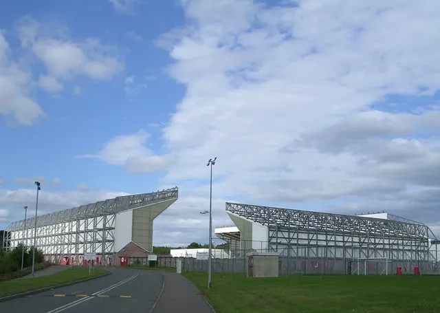 Broadwood Stadium Landmark, North Lanarkshire7.2 km E
-
Bar Hill Mountain, East Dunbartonshire5.9 km E
-
Mounthuillie Mountain, East Dunbartonshire6.1 km NW
-
Antonine Wall Historic site, East Dunbartonshire6.2 km NE
-
Campsie Glen Natural site, East Dunbartonshire7.9 km NW
Other cities and towns in East Dunbartonshire
-
 Milngavie Town, East Dunbartonshire11 km W
-
Bishopbriggs Town, East Dunbartonshire5.5 km SW
-
Bearsden Town, East Dunbartonshire12 km W
Sources & licences
Data last updated: · 2 independent sources