South Lanarkshire
Local name: Siorrachd Lannraig a Deas
Located in Scotland, United Kingdom Coordinates: 55°35′00″ N 3°50′00″ W

- Population
- 334,030
- 334K
- Elevation
- 225 m
- above sea level
- Local time
- UTC+00:00
- Europe/London · UTC+00:00
- Places inside
- 395
- listed under South Lanarkshire
- Airports
- PIK Glasgow Prestwick Airport48 km
- GLA Glasgow Airport50 km
About South Lanarkshire
South Lanarkshire is a district. Location: Scotland, United Kingdom. Population: 334,030.
South Lanarkshire (Scots: Sooth Lanrikshire; Scottish Gaelic: Siorrachd Lannraig a Deas) is one of 32 unitary authorities of Scotland. It borders the south-east of the Glasgow City council area and contains some of Greater Glasgow's suburban towns, as well as many rural towns and villages. It also shares borders with Dumfries and Galloway, East Ayrshire, East Renfrewshire, North Lanarkshire, the Scottish Borders and West Lothian. It includes most of the historic county of Lanarkshire.
Source: Wikipedia · CC BY-SA 4.0
At a glance
- Built
- 1996
- Area
- 1,772 km²
Source: Wikidata
Photos of South Lanarkshire
-
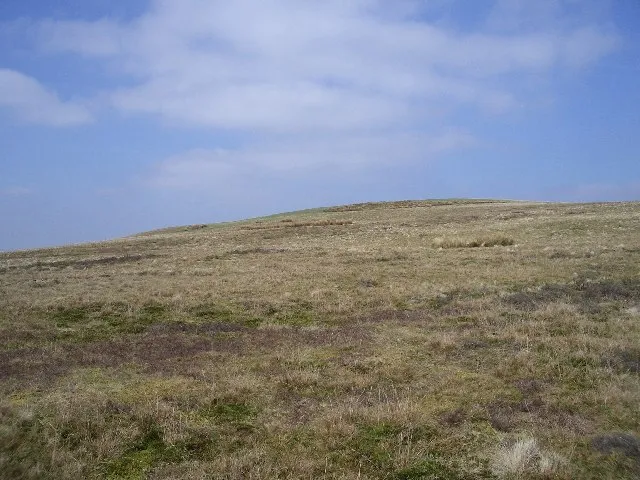
Henshaw Hill Callum Black · CC BY-SA 2.0 -
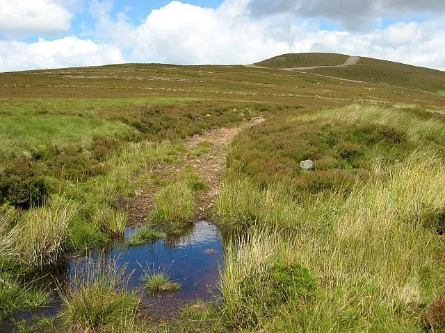
Bleak Law Eileen Henderson · CC BY-SA 2.0 -
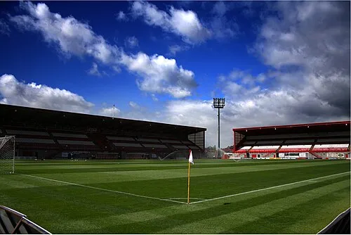
New Douglas Park Alasdair Middleton from Rothesay, Scotland · CC BY 2.0


Places bordering South Lanarkshire
- East Ayrshire
- East Renfrewshire
- North Lanarkshire
Population of South Lanarkshire over time
| 2008 | 311,310 | |
|---|---|---|
| 2009 | 312,180 | |
| 2010 | 313,180 | |
| 2011 | 313,900 | |
| 2012 | 314,330 | |
| 2013 | 314,810 | |
| 2014 | 315,300 | |
| 2015 | 316,230 | |
| 2016 | 317,100 | |
| 2017 | 318,170 | |
| 2018 | 319,020 | |
| 2019 | 320,530 |
Censuses and official estimates; source: Wikidata.
Climate of South Lanarkshire
Best months for sightseeingBest months for sightseeing: June–August.
This month · November
A wet month
Day 8° · Night 3° · Rain 159 mm
- Hottest month
- July (day 18°)
- Coldest month
- January (night 1°)
- Wettest month
- January (167 mm)
- Driest month
- April (75 mm)
Bars: average monthly low and high temperature. Below: precipitation. Monthly averages for 1970–2000 at about 18 km resolution, adjusted for elevation. Highlighted months are mild and relatively dry. Source: WorldClim 2.1 (CC BY 4.0).
Show values as a table
| Month | Jan | Feb | Mar | Apr | May | Jun | Jul | Aug | Sep | Oct | Nov | Dec |
|---|---|---|---|---|---|---|---|---|---|---|---|---|
| Average high (°C) | 6° | 6° | 7° | 10° | 14° | 16° | 18° | 17° | 15° | 11° | 8° | 6° |
| Average low (°C) | 1° | 1° | 1° | 3° | 5° | 8° | 10° | 10° | 8° | 5° | 3° | 1° |
| Precipitation (mm) | 167 | 117 | 127 | 75 | 78 | 77 | 83 | 104 | 138 | 160 | 159 | 164 |
How to get to South Lanarkshire
The nearest airport is Glasgow Prestwick Airport (PIK), 48 km to the west as the crow flies. The nearest large city is Glasgow, 41 km to the northwest.
Airports
- Glasgow Prestwick Airport (PIK) Prestwick, South Ayrshire 48 kmwest
- Glasgow Airport (GLA) Glasgow 50 kmnorthwest
- Edinburgh Airport (EDI) Ingliston, Edinburgh 50 kmnortheast
Nearby large cities
- Glasgow Population: 626.4K 41 kmnorthwest
- Edinburgh Population: 515K 57 kmnortheast
- Dundee Population: 148.2K 112 kmnortheast
- Newcastle upon Tyne Population: 300.1K 157 kmsoutheast
- Belfast Population: 348K 173 kmsouthwest
Straight-line distances; road distances are longer. Airport data: OurAirports.
Day trips from South Lanarkshire
Within 100 km: 291 historic and cultural sites, 3,107 natural sites, 850 lakes, rivers and coasts.
0–25 km295 places
- New Island Island 10 kmSW
- Nether Tarrioch Holm Island 22 kmW
- Culter Fell Mountain 21 kmE
- Cairn Table Mountain 15 kmSW
25–60 km1,452 places
- Ayr Beach Beach 53 kmW
- Troon Beach Beach 52 kmW
- Cramond beach Beach 56 kmNE
- Inchcolm Island 60 kmNE
60–100 km2,501 places
- Isle of Arran Island 89 kmW
- Great Cumbrae Island Island 71 kmW
- Powillimount Beach Beach 79 kmS
- Hunterston Sands Beach 69 kmW
Straight-line distances.
Places in South Lanarkshire
395 placesCities & villages24
- Crawford · Village
- Crawforddyke · Neighbourhood
- Crawfordjohn · Village
- Crutherland · Village
- Culter · Village
- Dalton · Village
- Devonburn · Village
- Dillarburn · Village
- Dolphinton · Village
- Douglas West · Village
- Drumclog · Village
- Dunsyre · Village
- Earnock · Neighbourhood
- East Mains · Neighbourhood
- Eddlewood · Neighbourhood
- Elsrickle · Village
- Elvanfoot · Village
- Fairhill · Neighbourhood
- Farm Cross · Neighbourhood
- Fernhill · Village
- Ferniegair · Village
- Flemington · Neighbourhood
- Flemington · Neighbourhood
- Gallowflat · Neighbourhood
Mountains & nature33
- Craighead Hill · Mountain
- Craig Hill · Mountain
- Crooked Bank · Mountain
- Cross Ridge · Mountain
- Culter Fell · Mountain
- Darlees Rig · Mountain
- Devonshaw Hill · Mountain
- Dillar Hill · Mountain
- Doddin · Mountain
- Douglas Rig · Mountain
- Drake Law · Mountain
- Duncangill Head · Mountain
- Dungavel Hill · Mountain
- Dungavel Hill · Mountain
- Dungrain Law · Mountain
- Dun Law · Mountain
- Dunside Rig · Mountain
- Dunsyre Hill · Mountain
- Earlside · Mountain
- Easteryardhouse Hill · Mountain
- Easthills · Mountain
- Ellershie Hill · Mountain
- Errickstane Hill · Mountain
- Ewe Hill · Mountain
- Fagyad Hill · Mountain
- Faugh · Mountain
- Forside Hill · Mountain
- Gallow Hill · Mountain
- Gana Hill · Mountain
- Gart Law · Mountain
- Gathersnow Hill · Mountain
- Glaikhead Bing · Mountain
- Glendowran Hill · Mountain
Heritage & sights3
- Dechmont Hill Mediumwave Transmitter, Mast 1 · Landmark
- Dechmont Hill Mediumwave Transmitter, Mast 2 · Landmark
- Dechmont Hill Mediumwave Transmitter, Mast 3 · Landmark
Nearby attractions & nature
Everything nearby-
Windrow Burn River, Scotland3.9 km S
-
Ponfeigh Burn River, Scotland4.5 km NE
-
Logan Water River, Scotland5.6 km W
-
Glespin Burn River, Scotland6 km S
-
Kennox Water River, Scotland7 km SW
-
Douglas Water River, Scotland7.7 km NE
Other regions in Scotland
-
East Ayrshire District, Scotland28 km W
-
North Lanarkshire District, Scotland32 km N
-
 East Renfrewshire District, Scotland37 km NW
-
 East Dunbartonshire District, Scotland45 km NW
-
 Renfrewshire District, Scotland50 km NW
-
South Ayrshire District, Scotland65 km SW
Sources & licences
Data last updated: · 2 independent sources