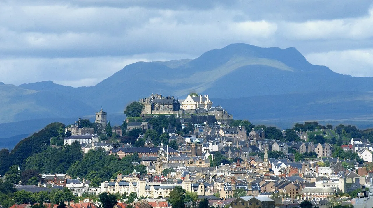
- Population
- 94,210
- 94.2K
- Elevation
- 121 m
- above sea level
- Local time
- UTC+00:00
- Europe/London · UTC+00:00
- Places inside
- 511
- listed under Stirling
- Airports
- GLA Glasgow Airport30 km
- EDI Edinburgh Airport57 km
About Stirling
Stirling is a district. Location: Scotland, United Kingdom. Population: 94,210. The best months to visit are June–August. The nearest airport is Glasgow Airport (30 km). Nearby sights include Kilsyth Hills and Broadwood Stadium.
Climate of Stirling
Best months for sightseeingBest months for sightseeing: June–August.
This month · November
A wet month
Day 8° · Night 3° · Rain 169 mm
- Hottest month
- July (day 17°)
- Coldest month
- January (night 1°)
- Wettest month
- January (192 mm)
- Driest month
- April (78 mm)
Bars: average monthly low and high temperature. Below: precipitation. Monthly averages for 1970–2000 at about 18 km resolution, adjusted for elevation. Highlighted months are mild and relatively dry. Source: WorldClim 2.1 (CC BY 4.0).
Show values as a table
| Month | Jan | Feb | Mar | Apr | May | Jun | Jul | Aug | Sep | Oct | Nov | Dec |
|---|---|---|---|---|---|---|---|---|---|---|---|---|
| Average high (°C) | 6° | 6° | 8° | 10° | 14° | 16° | 17° | 17° | 15° | 11° | 8° | 6° |
| Average low (°C) | 1° | 1° | 2° | 3° | 5° | 8° | 10° | 10° | 8° | 6° | 3° | 1° |
| Precipitation (mm) | 192 | 128 | 137 | 78 | 85 | 79 | 89 | 107 | 145 | 173 | 169 | 171 |
How to get to Stirling
The nearest airport is Glasgow Airport (GLA), 30 km to the southwest as the crow flies. The nearest large city is Glasgow, 28 km to the south.
Airports
- Glasgow Airport (GLA) Glasgow 30 kmsouthwest
- Edinburgh Airport (EDI) Ingliston, Edinburgh 57 kmeast
- Glasgow Prestwick Airport (PIK) Prestwick, South Ayrshire 72 kmsouth
Nearby large cities
- Glasgow Population: 626.4K 28 kmsouth
- Edinburgh Population: 515K 67 kmeast
- Dundee Population: 148.2K 87 kmnortheast
- Aberdeen Population: 198.6K 174 kmnortheast
- Belfast Population: 348K 200 kmsouthwest
Straight-line distances; road distances are longer. Airport data: OurAirports.
Day trips from Stirling
Within 100 km: 188 historic and cultural sites, 4,008 natural sites, 1,095 lakes, rivers and coasts.
0–25 km291 places
- Inchlonaig Island 24 kmW
- Inchcailloch Island 20 kmW
- Ellens Isle Island 18 kmNW
- Aber Isle Island 20 kmW
25–60 km1,353 places
- Great Cumbrae Island Island 58 kmSW
- Hunterston Sands Beach 60 kmSW
- Inishail Island 60 kmNW
- Inchcolm Island 59 kmE
60–100 km3,647 places
- Isle of Arran Island 86 kmSW
- Ayr Beach Beach 77 kmS
- Troon Beach Beach 69 kmSW
- Burntisland Beach Beach 63 kmE
Straight-line distances.
Places in Stirling
511 placesCities & villages5
- Milton · Neighbourhood
- Milton of Buchanan · Village
- Mugdock · Village
- Port of Menteith · Village
- Raploch · Neighbourhood
Mountains & nature50
- Meall an Fhiodhain · Mountain
- Meall an Lochain · Mountain
- Meall an t-Seallaidh · Mountain
- Meall Biorach · Mountain
- Meall Buidhe · Mountain
- Meall Buidhe · Mountain
- Meall Cala · Mountain
- Meall Clachach · Mountain
- Meall Clachach · Mountain
- Meall Daimh · Mountain
- Meall Dhamh · Mountain
- Meall Dhuin Croisg · Mountain
- Meall Ear · Mountain
- Meall Eoghainn · Mountain
- Meall Gainmheich · Mountain
- Meall Gaothach · Mountain
- Meall Garbh · Mountain
- Meall Ghaordaidh · Mountain
- Meall Glas · Mountain
- Meall Gobhlach · Mountain
- Meall Leathan Dhail · Mountain
- Meall Monachyle · Mountain
- Meall Mor · Mountain
- Meall Mor · Mountain
- Meall Mor Far West Top · Mountain
- Meall Mor nan Eag · Mountain
- Meall na Caora · Mountain
- Meall na Cloiche · Mountain
- Meall na Dige · Mountain
- Meall nan Oighreag · Mountain
- Meall nan Samhna West Top · Mountain
- Meall nan Tarmachan · Mountain
- Meall nan Tighearn · Mountain
- Meall na Samhna · Mountain
- Meall Odhar · Mountain
- Meall Odhar · Mountain
- Meall Reamhar · Mountain
- Meall Reamhar · Mountain
- Meall Reamhar West Top · Mountain
- Meall Sgallachd · Mountain
- Meall Taurnaigh · Mountain
- Meall Ton Eich · Mountain
- Meikle Bin · Mountain
- Meikle Caldon · Mountain
- Middlethird Hill · Mountain
- Mullach an t-Samhraidh · Mountain
- Parlan Hill · Mountain
- Ptarmigan · Mountain
- Queen Elizabeth Forest Park · Natural site
- Quinloch Muir Hill · Mountain
Lakes, rivers & coasts4
- Otter Island · Island
- Portnellan Island · Island
- River Balvag · River
- River Dochart · River
Heritage & sights1
- Mugdock Castle · Historic site
Nearby attractions & nature
Everything nearby-
Kilsyth Hills Mountain, Scotland16 km SE
-
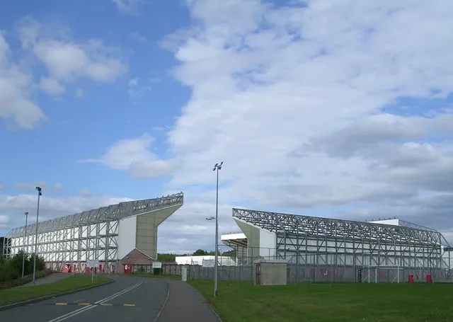 Broadwood Stadium Landmark, North Lanarkshire23 km SE
-
Campsie Glen Natural site, East Dunbartonshire13 km S
-
Owsen Hill Mountain, East Dunbartonshire12 km S
-
Dumbreck Mountain, East Dunbartonshire13 km S
-
Lecket Hill Mountain, East Dunbartonshire13 km S
Sources & licences
Data last updated: