West Dunbartonshire
Local name: Siorrachd Dhùn Bhreatainn an Iar
Located in Scotland, United Kingdom Coordinates: 55°58′00″ N 4°32′00″ W
- Population
- 89,120
- 89.1K
- Elevation
- 162 m
- above sea level
- Local time
- UTC+00:00
- Europe/London · UTC+00:00
- Places inside
- 69
- listed under West Dunbartonshire
- Airports
- GLA Glasgow Airport12 km
- PIK Glasgow Prestwick Airport52 km
About West Dunbartonshire
West Dunbartonshire is a district. Location: Scotland, United Kingdom. Population: 89,120.
West Dunbartonshire (Scots: Wast Dunbairtonshire; Scottish Gaelic: Siorrachd Dhùn Breatann an Iar, pronounced [ˈʃirˠəxk ɣum ˈpɾʲɛht̪ən̪ˠ əɲ ˈiəɾ]) is one of the 32 local government council areas of Scotland. The area lies to the north-west of the Glasgow City council area and contains many of Glasgow's commuter towns and villages. West Dunbartonshire also borders Argyll and Bute, East Dunbartonshire, Renfrewshire and Stirling.
Source: Wikipedia · CC BY-SA 4.0
Photos of West Dunbartonshire
-
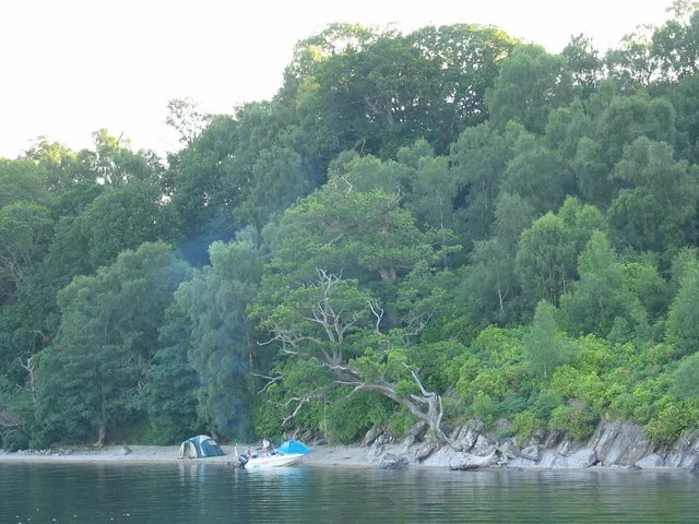
Inchmurrin Johnny Durnan · CC BY-SA 2.0 -
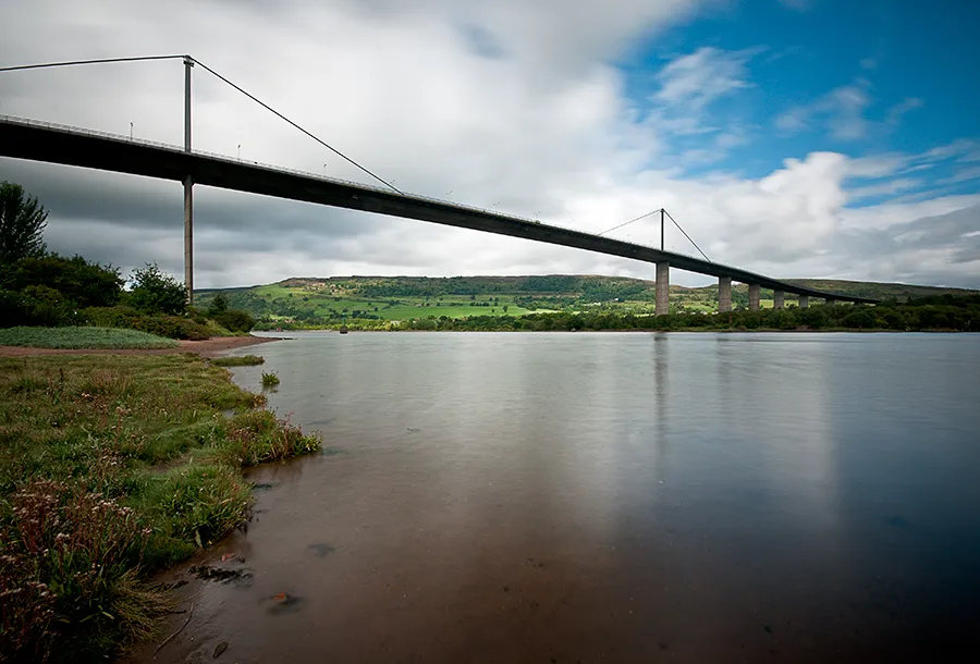
Erskine Bridge Baaker2009 from Dumbarton · CC BY 2.0


Population of West Dunbartonshire over time
| 2008 | 91,190 | |
|---|---|---|
| 2009 | 91,080 | |
| 2010 | 90,800 | |
| 2011 | 90,610 | |
| 2012 | 90,340 | |
| 2013 | 89,800 | |
| 2014 | 89,710 | |
| 2015 | 89,590 | |
| 2016 | 89,860 | |
| 2017 | 89,610 | |
| 2018 | 89,130 | |
| 2019 | 88,930 |
Censuses and official estimates; source: Wikidata.
Climate of West Dunbartonshire
Best months for sightseeingBest months for sightseeing: June–August.
This month · November
A wet month
Day 8° · Night 3° · Rain 148 mm
- Hottest month
- July (day 17°)
- Coldest month
- January (night 1°)
- Wettest month
- January (161 mm)
- Driest month
- April (71 mm)
Bars: average monthly low and high temperature. Below: precipitation. Monthly averages for 1970–2000 at about 18 km resolution, adjusted for elevation. Highlighted months are mild and relatively dry. Source: WorldClim 2.1 (CC BY 4.0).
Show values as a table
| Month | Jan | Feb | Mar | Apr | May | Jun | Jul | Aug | Sep | Oct | Nov | Dec |
|---|---|---|---|---|---|---|---|---|---|---|---|---|
| Average high (°C) | 6° | 6° | 8° | 10° | 14° | 16° | 17° | 17° | 15° | 12° | 8° | 6° |
| Average low (°C) | 1° | 1° | 2° | 3° | 5° | 8° | 10° | 10° | 8° | 6° | 3° | 1° |
| Precipitation (mm) | 161 | 109 | 119 | 71 | 72 | 71 | 82 | 98 | 131 | 152 | 148 | 148 |
How to get to West Dunbartonshire
The nearest airport is Glasgow Airport (GLA), 12 km to the southeast as the crow flies. The nearest large city is Glasgow, 21 km to the southeast.
Airports
- Glasgow Airport (GLA) Glasgow 12 kmsoutheast
- Glasgow Prestwick Airport (PIK) Prestwick, South Ayrshire 52 kmsouth
- Edinburgh Airport (EDI) Ingliston, Edinburgh 73 kmeast
Nearby large cities
- Glasgow Population: 626.4K 21 kmsoutheast
- Edinburgh Population: 515K 84 kmeast
- Dundee Population: 148.2K 112 kmnortheast
- Belfast Population: 348K 176 kmsouthwest
- Aberdeen Population: 198.6K 199 kmnortheast
Straight-line distances; road distances are longer. Airport data: OurAirports.
Day trips from West Dunbartonshire
Within 100 km: 169 historic and cultural sites, 3,699 natural sites, 1,180 lakes, rivers and coasts.
0–25 km302 places
- Inchlonaig Island 16 kmN
- Inchcailloch Island 13 kmN
- Aber Isle Island 11 kmN
- Bucinch Island 14 kmN
25–60 km1,311 places
- Great Cumbrae Island Island 33 kmSW
- Ayr Beach Beach 57 kmS
- Troon Beach Beach 48 kmS
- Hunterston Sands Beach 35 kmSW
60–100 km3,435 places
- Isle of Arran Island 61 kmSW
- Burntisland Beach Beach 82 kmE
- Cramond beach Beach 77 kmE
- Portobello Beach Beach 89 kmE
Straight-line distances.
Places in West Dunbartonshire
69 placesCities & villages4
- Silverton · Neighbourhood
- Townend · Neighbourhood
- Tullichewan · Neighbourhood
- Whitecrook · Neighbourhood
Mountains & nature2
- The Slacks · Mountain
- Whinney Hill · Mountain
Lakes, rivers & coasts2
- River Leven · River
- Torrinch · Island
Heritage & sights1
- Strathclyde Homes Stadium · Landmark
Nearby attractions & nature
Everything nearby-
Loch Humphrey Lake, Scotland4.6 km SE
-
Dumbuck Lighthouse Landmark, Renfrewshire4.1 km S
-
Garrison Lighthouse (historical) Landmark, Renfrewshire4.5 km SW
-
Kilmannan Reservoir Lake, Scotland7.3 km E
-
Burncrooks Reservoir Lake, Scotland7.5 km E
-
Cochno Loch Lake, Scotland7.5 km E
Other regions in Scotland
-
 Renfrewshire District, Scotland15 km S
-
 East Dunbartonshire District, Scotland21 km E
-
Inverclyde District, Scotland15 km SW
-
 East Renfrewshire District, Scotland27 km SE
-
Glasgow City District, Scotland21 km SE
-
 North Ayrshire District, Scotland33 km SW
Sources & licences
Data last updated: · 2 independent sources