- Elevation
- 169 m
- above sea level
- Local time
- UTC+00:00
- Europe/London · UTC+00:00
- Airports
- IOM Isle of Man Airport85 km
- LPL Liverpool John Lennon Airport97 km
About Pen y Castell
Pen y Castell is a mountain. Location: Llanddyfnan, Anglesey. Elevation: 169 m. The best months to visit are June–September. The nearest airport is Isle of Man Airport (85 km). Nearby sights include Barclodiau and Mynydd Bodafon [Yr Arwydd].
Photos of Pen y Castell
-
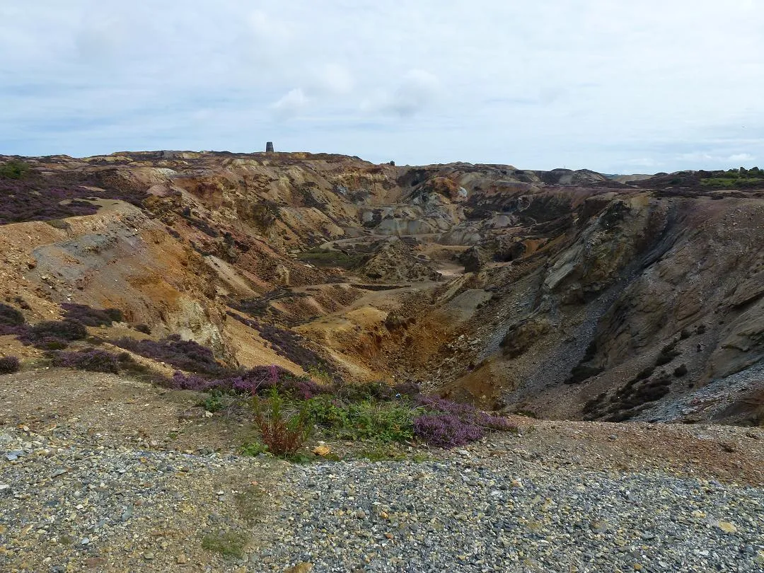
Parys Mountain Mark.murphy · CC BY-SA 3.0

Climate of Pen y Castell
Best months for sightseeingBest months for sightseeing: June–September.
This month · November
A wet month
Day 10° · Night 5° · Rain 116 mm
- Hottest month
- July (day 18°)
- Coldest month
- February (night 2°)
- Wettest month
- November (116 mm)
- Driest month
- May (51 mm)
Bars: average monthly low and high temperature. Below: precipitation. Monthly averages for 1970–2000 at about 18 km resolution, adjusted for elevation. Highlighted months are mild and relatively dry. Source: WorldClim 2.1 (CC BY 4.0).
Show values as a table
| Month | Jan | Feb | Mar | Apr | May | Jun | Jul | Aug | Sep | Oct | Nov | Dec |
|---|---|---|---|---|---|---|---|---|---|---|---|---|
| Average high (°C) | 7° | 7° | 9° | 11° | 14° | 16° | 18° | 18° | 16° | 13° | 10° | 8° |
| Average low (°C) | 2° | 2° | 3° | 4° | 7° | 9° | 11° | 11° | 10° | 8° | 5° | 3° |
| Precipitation (mm) | 93 | 70 | 79 | 56 | 51 | 56 | 60 | 75 | 84 | 103 | 116 | 104 |
Other places to visit in this season: June July August September
How to get to Pen y Castell
The nearest airport is Isle of Man Airport (IOM), 85 km to the north as the crow flies. The nearest large city is Birkenhead, 86 km to the east.
Airports
- Isle of Man Airport (IOM) Castletown, Rushen 85 kmnorth
- Liverpool John Lennon Airport (LPL) Liverpool 97 kmeast
- Dublin Airport (DUB) Dublin 131 kmwest
Nearby large cities
- Birkenhead Population: 325.3K 86 kmeast
- Liverpool Population: 496.8K 88 kmeast
- Blackpool Population: 145K 98 kmnortheast
- St Helens Population: 183.2K 105 kmeast
- Wigan Population: 175.4K 113 kmeast
Straight-line distances; road distances are longer. Airport data: OurAirports.
Day trips from Pen y Castell
Within 100 km: 209 historic and cultural sites, 1,147 natural sites, 140 lakes, rivers and coasts.
0–25 km109 places
- Anglesey Island 7 kmS
- Traeth Lligwy Beach 4 kmNE
- West Mouse Island 18 kmNW
- Puffin Island Island 19 kmE
25–60 km494 places
- Traeth Penllech Beach 57 kmSW
- Porth Towyn Beach Beach 53 kmSW
- Ynys Tywyn Island 48 kmS
- Ynys Gifftan Island 50 kmS
60–100 km893 places
- British Isles Island 76 kmN
- Whistling Sands Beach 63 kmSW
- Thurstaston Beach Beach 77 kmE
- Formby Beach Beach 84 kmE
Straight-line distances.
Nearest towns and villages
-
Maenaddwyn Village, Llanddyfnan1.6 km SW
-
Yr Arwydd Village, Moelfre1.4 km NE
-
Brynrefail Village, Moelfre1.9 km NE
-
 Benllech Village, Llanfair-Mathafarn-Eithaf5.6 km SE
-
Moelfre Village, Moelfre4.5 km E
-
Moelfre Municipality, Anglesey2.3 km NE
Nearby attractions & nature
Everything nearby-
Barclodiau Mountain, Llanddyfnan0.5 km S
-
Mynydd Bodafon [Yr Arwydd] Island, Moelfre0.4 km E
-
Sotherby Top Mountain, Llaneugrad2.7 km SE
-
Parys Mountain Mountain, Amlwch5.8 km NW
-
Bae Lligwy Natural site, Wales4 km NE
-
Pen y Foel Mountain, Llannerch-y-Medd4.3 km W
-
Traeth Lligwy Beach, Moelfre3.5 km NE
-
Mynydd Eilian Mountain, Llaneilian6.4 km N
Sources & licences
Data last updated: