- Elevation
- 365 m
- above sea level
- Local time
- UTC+00:00
- Europe/London · UTC+00:00
- Places inside
- 13
- listed under Llanllechid
- Airports
- LPL Liverpool John Lennon Airport81 km
- IOM Isle of Man Airport107 km
About Llanllechid
Llanllechid is a municipality. Location: Gwynedd, Wales. Elevation: 365 m. The best months to visit are June–August. The nearest airport is Liverpool John Lennon Airport (81 km). Nearby sights include Tyn Twr and Bera Bach.
Climate of Llanllechid
Best months for sightseeingBest months for sightseeing: June–August.
This month · November
A wet month
Day 9° · Night 3° · Rain 136 mm
- Hottest month
- July (day 18°)
- Coldest month
- February (night 0°)
- Wettest month
- November (136 mm)
- Driest month
- May (63 mm)
Bars: average monthly low and high temperature. Below: precipitation. Monthly averages for 1970–2000 at about 18 km resolution, adjusted for elevation. Highlighted months are mild and relatively dry. Source: WorldClim 2.1 (CC BY 4.0).
Show values as a table
| Month | Jan | Feb | Mar | Apr | May | Jun | Jul | Aug | Sep | Oct | Nov | Dec |
|---|---|---|---|---|---|---|---|---|---|---|---|---|
| Average high (°C) | 6° | 6° | 7° | 10° | 13° | 16° | 18° | 17° | 15° | 12° | 9° | 7° |
| Average low (°C) | 1° | 0° | 2° | 3° | 5° | 8° | 10° | 10° | 8° | 6° | 3° | 2° |
| Precipitation (mm) | 113 | 83 | 99 | 67 | 63 | 69 | 74 | 89 | 101 | 122 | 136 | 126 |
How to get to Llanllechid
The nearest airport is Liverpool John Lennon Airport (LPL), 81 km to the east as the crow flies. The nearest large city is Birkenhead, 72 km to the east.
Airports
- Liverpool John Lennon Airport (LPL) Liverpool 81 kmeast
- Isle of Man Airport (IOM) Castletown, Rushen 107 kmnorth
- Manchester Airport (MAN) Manchester, Greater Manchester 118 kmeast
Nearby large cities
- Birkenhead Population: 325.3K 72 kmeast
- Liverpool Population: 496.8K 75 kmeast
- St Helens Population: 183.2K 91 kmeast
- Blackpool Population: 145K 96 kmnortheast
- Warrington Population: 172.3K 99 kmeast
Straight-line distances; road distances are longer. Airport data: OurAirports.
Places in Llanllechid
13 placesCities & villages3
- Crymlyn · Village
- Llanllechid · Village
- Tal-y-bont · Village
Mountains & nature10
- Carneddau · Mountain
- Carnedd Gwenllian · Mountain
- Carnedd Llewelyn · Mountain
- Drosgl · Mountain
- Foel Meirch · Mountain
- Gyrn · Mountain
- Gyrn Wigau · Mountain
- Moel Faban · Mountain
- Moel Wnion · Mountain
- Yr Elen · Mountain
Nearby attractions & nature
Everything nearby-
Tyn Twr Historic site, Bethesda2.3 km SW
-
Bera Bach Mountain, Aber2.9 km E
-
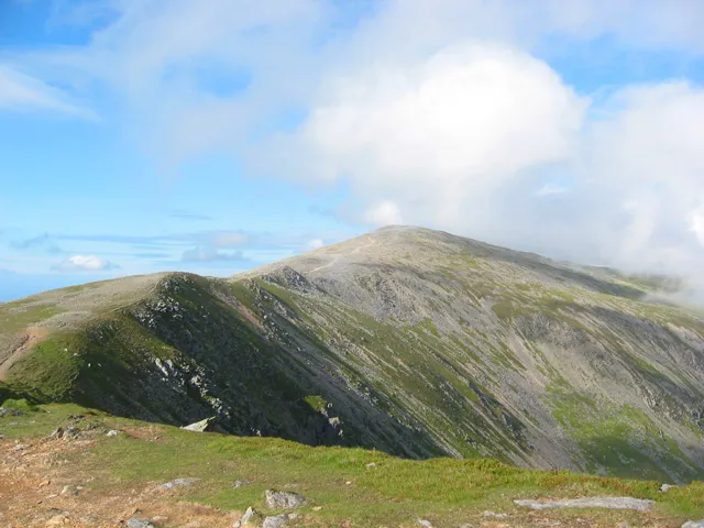 Carnedd Dafydd Mountain, Capel Curig4.9 km SE
-
Bera Mawr Mountain, Aber3.2 km E
-
Nant Ffrancon Natural site, Gwynedd4.5 km S
-
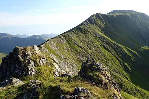 Elidir Fawr Mountain, Llanddeiniolen7 km SW
-
Foel Grach Mountain, Caerhun4.8 km E
-
Llwytmor Mountain, Aber4.9 km E
Sources & licences
Data last updated: