- Population
- 135,059
- 135.1K
- Elevation
- 405 m
- above sea level
- Local time
- UTC+00:00
- Europe/London · UTC+00:00
- Places inside
- 111
- listed under Powys
- Airports
- CWL Cardiff International Airport104 km
- BHX Birmingham Airport114 km
About Powys
Powys is a district. Location: Wales, United Kingdom. Population: 135,059.
In comparison
- 66 sights and natural places within 10 km Wennallt, Sugar Loaf
- Listed here: Municipality: 110, Village: 1
Climate of Powys
Best months for sightseeingBest months for sightseeing: June–August.
Bars: average monthly low and high temperature. Below: precipitation. Monthly averages for 1970–2000 at about 18 km resolution, adjusted for elevation. Highlighted months are mild and relatively dry. Source: WorldClim 2.1 (CC BY 4.0).
Show values as a table
| Month | Jan | Feb | Mar | Apr | May | Jun | Jul | Aug | Sep | Oct | Nov | Dec |
|---|---|---|---|---|---|---|---|---|---|---|---|---|
| Average high (°C) | 5° | 5° | 7° | 10° | 14° | 16° | 18° | 18° | 15° | 12° | 8° | 6° |
| Average low (°C) | 0° | -1° | 1° | 2° | 5° | 8° | 10° | 9° | 7° | 5° | 2° | 1° |
| Precipitation (mm) | 164 | 112 | 120 | 84 | 73 | 81 | 71 | 96 | 109 | 134 | 151 | 166 |
Airports nearest to Powys
- Cardiff International Airport (CWL) Cardiff 104 km
- Birmingham Airport (BHX) Birmingham, West Midlands 114 km
- Bristol Airport (BRS) Bristol 116 km
Straight-line distance; airports with scheduled flights only. Source: OurAirports (public domain).
Places in Powys
111 places-
Llanfyllin Municipality
-
Llangamarch Municipality
-
Llangattock Municipality
-
Llangedwyn Municipality
-
Llangors Municipality
-
Llangunllo Municipality
-
Llangurig Municipality
-
Llangynidr Municipality
-
Llangyniew Municipality
-
Llangynog Municipality
-
Llanidloes Municipality
-
Llanidloes Without Municipality
-
Llanigon Municipality
-
Llanrhaeadr-ym-Mochnant Municipality
-
Llansantffraid Municipality
-
Llansilin Municipality
-
Llanwddyn Municipality
-
Llanwrthwl Municipality
-
Llanwrtyd Wells Municipality
-
Llanyre Municipality
-
Llywel Municipality
-
Machynlleth Municipality
-
Maescar Municipality
-
Manafon Municipality
-
Meifod Municipality
-
Merthyr Cynog Municipality
-
Mochdre Municipality
-
Montgomery Municipality
-
New Radnor Municipality
-
Newtown and Llanllwchaiarn Municipality
-
Old Radnor Municipality
-
Painscastle Municipality
-
Penybont Municipality
-
Pen-y-bont-Fawr Municipality
-
Presteigne Municipality
-
Rhayader Municipality
-
St. Harmon Municipality
-
Talgarth Municipality
-
Talybont-on-Usk Municipality
-
Tawe-Uchaf Municipality
-
The Vale of Grwyney Municipality
-
Trallong Municipality
-
Trefeglwys Municipality
-
Treflys Municipality
-
Tregynon Municipality
-
Trewern Municipality
-
Welshpool Municipality
-
Whitton Municipality
-
Yscir Municipality
-
Ystradfellte Municipality
-
Ystradgynlais Municipality
Nature and heritage in Powys
-
Mynydd Tarw Mountain, Llanrhaeadr-ym-Mochnant
-
Long Mountain Mountain, Trewern
-
Mynydd Llangynidr Mountain, Llangynidr
-
Breidden Hill Mountain, Bausley with Criggion
-
Crug Gynon Mountain, Llanwrtyd Wells
-
The Tumpa Mountain, Llanigon
Nearby attractions & nature
Everything nearby-
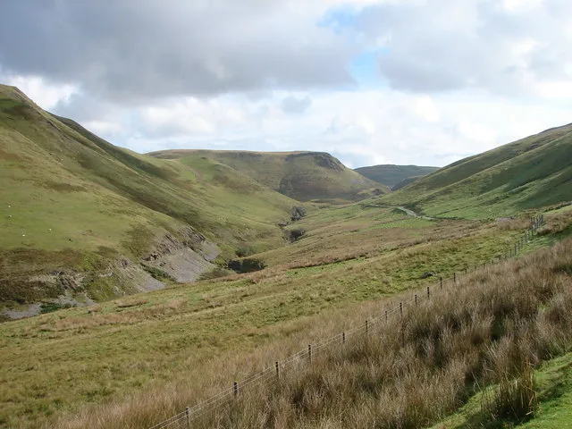 Cambrian Mountains Mountain, Wales11 km NW
-
Afon Elan River, Wales8.8 km SW
-
River Ithon River, Wales13 km S
-
Pen-y-gareg Reservoir Lake, Wales14 km W
-
Gareg-ddu Reservoir Lake, Wales15 km SW
-
Caban-côch Reservoir Lake, Wales15 km SW
Sources & licences
Data last updated: