Hermagor-Pressegger See
Located in Politischer Bezirk Hermagor, Carinthia Coordinates: 46°36′32″ N 13°20′41″ E
- Population
- 6,792
- 6.8K
- Elevation
- 586 m
- above sea level
- Local time
- UTC+01:00
- Europe/Vienna · UTC+01:00
- Places inside
- 70
- listed under Hermagor-Pressegger See
- Airports
- KLU Klagenfurt Airport76 km
- TRS Trieste Airport87 km
About Hermagor-Pressegger See
Hermagor-Pressegger See is a municipality. Location: Politischer Bezirk Hermagor, Carinthia. Population: 6,792. Elevation: 586 m. The best months to visit are June–September. The nearest airport is Klagenfurt Airport (76 km). Nearby sights include Gösseringbach and Garnitzenbach.
Photos of Hermagor-Pressegger See
-
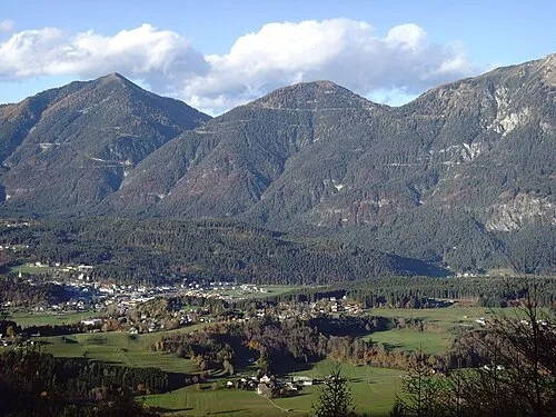
Möschacher Wipfel Markus Wurzer · CC BY-SA 3.0 -
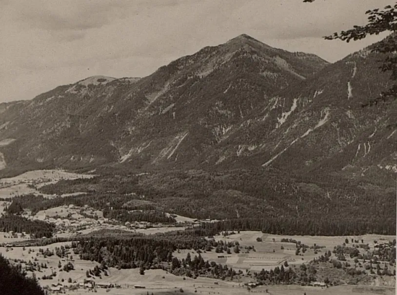
Golz K.u.k. Kriegspressequartier, Lichtbildstelle - Wien · Public domain -
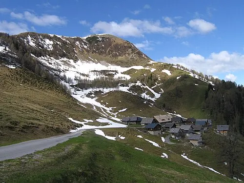
Poludnig JakobZ · CC BY-SA 3.0


Climate of Hermagor-Pressegger See
Best months for sightseeingBest months for sightseeing: June–September.
This month · November
A wet month
Day 9° · Night 1° · Rain 150 mm
- Hottest month
- July (day 24°)
- Coldest month
- January (night -4°)
- Wettest month
- June (169 mm)
- Driest month
- February (69 mm)
Bars: average monthly low and high temperature. Below: precipitation. Monthly averages for 1970–2000 at about 18 km resolution, adjusted for elevation. Highlighted months are mild and relatively dry. Source: WorldClim 2.1 (CC BY 4.0).
Show values as a table
| Month | Jan | Feb | Mar | Apr | May | Jun | Jul | Aug | Sep | Oct | Nov | Dec |
|---|---|---|---|---|---|---|---|---|---|---|---|---|
| Average high (°C) | 4° | 6° | 10° | 13° | 18° | 22° | 24° | 24° | 20° | 15° | 9° | 5° |
| Average low (°C) | -4° | -3° | 0° | 3° | 8° | 11° | 14° | 13° | 10° | 6° | 1° | -3° |
| Precipitation (mm) | 84 | 69 | 99 | 131 | 147 | 169 | 165 | 147 | 157 | 163 | 150 | 106 |
Other places to visit in this season: June July August September
How to get to Hermagor-Pressegger See
The nearest airport is Klagenfurt Airport (KLU), 76 km to the east as the crow flies. The nearest large city is Klagenfurt, 74 km to the east.
Airports
- Klagenfurt Airport (KLU) Klagenfurt am Wörthersee 76 kmeast
- Trieste Airport (TRS) Ronchi dei Legionari/Trieste 87 kmsouth
- Ljubljana Jože Pučnik Airport (LJU) Zgornji Brnik 96 kmsoutheast
Nearby large cities
- Klagenfurt Population: 100.3K 74 kmeast
- Ljubljana Population: 272.2K 109 kmsoutheast
- Salzburg Population: 157.2K 134 kmnorth
- Innsbruck Population: 132.5K 165 kmnorthwest
- Rijeka Population: 108K 166 kmsoutheast
Straight-line distances; road distances are longer. Airport data: OurAirports.
Day trips from Hermagor-Pressegger See
Within 100 km: 181 historic and cultural sites, 2,736 natural sites, 695 lakes, rivers and coasts.
0–25 km167 places
- Weissensee Lake 11 kmN
- Lake Pressegg Lake 8 kmE
- Farchtensee Lake 12 kmNE
- Egger Alpen See Lake 5 kmSE
25–60 km859 places
- Lake Bohinj Lake 54 kmSE
- Triglav Mountain 46 kmSE
- Rjavina Mountain 48 kmSE
- Prestreljenik Mountain 29 kmS
60–100 km2,586 places
- Hoher Dachstein Mountain 98 kmN
- Raša River 98 kmSE
- Lake Bled Lake 64 kmSE
- Porezen Mountain 68 kmSE
Straight-line distances.
Places in Hermagor-Pressegger See
70 places- 1 Hermagor 1.5K
- 2 Tröpolach 426
- 3 Rattendorf 296
- 4 Neudorf 292
- 5 Untervellach 252
- 6 Presseggen 224
- 7 Khünburg 209
- 8 Radnig 208
- 9 Obervellach 202
- 10 Kühwegboden 199
- 11 Kühweg 177
- 12 Möderndorf 173
- 13 Jenig 165
- 14 Förolach 163
- 15 Görtschach 163
- 16 Micheldorf 163
- 17 Egg 142
- 18 Postran 121
- 19 Watschig 120
- 20 Presseggersee 118
- 21 Dellach 89
- 22 Latschach 81
- 23 Mitschig 80
- 24 Grünburg 76
- 25 Kreuth ob Rattendorf 68
- 26 Kameritsch 62
- 27 Kreuth ob Mellweg 61
- 28 Fritzendorf 60
- 29 Kraschach 55
- 30 Mellweg 52
- 31 Untermöschach 49
- 32 Wittenig 46
- 33 Sonnenalpe Nassfeld 43
- 34 Schlanitzen 41
- 35 Potschach 38
- 36 Mellach 34
- 37 Podlanig 34
- 38 Sonnleitn 32
- 39 Kleinbergl 31
- 40 Neuprießenegg 31
- 41 Obermöschach 28
- 42 Guggenberg 26
- 43 Nampolach 24
- 44 Danz 22
- 45 Kraß 22
- 46 Brugg 21
- 47 Bergl 20
- 48 Götzing 17
- 49 Süßenberg 16
- 50 Kreuth ob Möschach 13
- 51 Eggforst 11
- 52 Radnigforst 9
- 53 Braunitzen 7
- 54 Achleiten 4
- 55 Aigen 4
- 56 Siebenbrünn 4
- 57 Schmidt 1
Bar: population relative to the most populous place in this list.
Mountains & nature2
- Creta di Aip · Mountain
- Gartnerkofel · Mountain
Heritage & sights1
- Burgruine Malenthein · Historic site
Nearby attractions & nature
Everything nearby-
Gösseringbach River, Carinthia2.2 km E
-
Garnitzenbach River, Carinthia3.1 km E
-
Rudnigbach River, Carinthia4.1 km NW
-
Unterdorfer Berg Mountain, Carinthia5.6 km E
-
Monte Acuto Mountain, Malborghetto Valbruna6 km SE
-
Dosso Gais Mountain, Styria6.3 km SE
-
Punta Lonas Mountain, Malborghetto Valbruna6.5 km S
-
Bodensee Lake, Carinthia4.9 km SW
Sources & licences
Data last updated: