Spittal an der Drau
Located in Spittal an der Drau District, Carinthia Coordinates: 46°46′36″ N 13°32′38″ E
- Population
- 15,462
- 15.5K
- Elevation
- 528 m
- above sea level
- Local time
- UTC+01:00
- Europe/Vienna · UTC+01:00
- Places inside
- 27
- listed under Spittal an der Drau
- Airports
- KLU Klagenfurt Airport63 km
- LJU Ljubljana Jože Pučnik Airport93 km
About Spittal an der Drau
Spittal an der Drau is a municipality. Location: Spittal an der Drau District, Carinthia. Population: 15,462. Elevation: 528 m. The best months to visit are May–September. The nearest airport is Klagenfurt Airport (63 km). Nearby sights include Hochgosch and Martennock.
Climate of Spittal an der Drau
Best months for sightseeingBest months for sightseeing: May–September.
This month · November
A wet month
Day 8° · Night 0° · Rain 123 mm
- Hottest month
- July (day 25°)
- Coldest month
- January (night -5°)
- Wettest month
- July (159 mm)
- Driest month
- February (59 mm)
Bars: average monthly low and high temperature. Below: precipitation. Monthly averages for 1970–2000 at about 18 km resolution, adjusted for elevation. Highlighted months are mild and relatively dry. Source: WorldClim 2.1 (CC BY 4.0).
Show values as a table
| Month | Jan | Feb | Mar | Apr | May | Jun | Jul | Aug | Sep | Oct | Nov | Dec |
|---|---|---|---|---|---|---|---|---|---|---|---|---|
| Average high (°C) | 4° | 6° | 10° | 14° | 19° | 23° | 25° | 25° | 21° | 15° | 8° | 4° |
| Average low (°C) | -5° | -4° | 0° | 3° | 8° | 11° | 13° | 13° | 9° | 5° | 0° | -4° |
| Precipitation (mm) | 68 | 59 | 84 | 107 | 125 | 152 | 159 | 139 | 136 | 135 | 123 | 88 |
Other places to visit in this season: May June July August September
How to get to Spittal an der Drau
The nearest airport is Klagenfurt Airport (KLU), 63 km to the east as the crow flies. The nearest large city is Klagenfurt, 61 km to the east.
Airports
- Klagenfurt Airport (KLU) Klagenfurt am Wörthersee 63 kmeast
- Ljubljana Jože Pučnik Airport (LJU) Zgornji Brnik 93 kmsoutheast
- Trieste Airport (TRS) Ronchi dei Legionari/Trieste 106 kmsouth
Nearby large cities
- Klagenfurt Population: 100.3K 61 kmeast
- Salzburg Population: 157.2K 120 kmnorth
- Graz Population: 303.3K 148 kmeast
- Innsbruck Population: 132.5K 172 kmwest
- Rijeka Population: 108K 176 kmsoutheast
Straight-line distances; road distances are longer. Airport data: OurAirports.
Day trips from Spittal an der Drau
Within 100 km: 235 historic and cultural sites, 3,080 natural sites, 847 lakes, rivers and coasts.
0–25 km221 places
- Weissensee Lake 16 kmSW
- Lake Pressegg Lake 18 kmSW
- Millstätter See Lake 4 kmNE
- Farchtensee Lake 12 kmSW
25–60 km1,088 places
- Wildsee Lake 53 kmN
- Klammsee Lake 59 kmN
- Brettersee Lake 59 kmN
- Kranzlsee Lake 58 kmN
60–100 km2,853 places
- Hoher Dachstein Mountain 78 kmN
- Sille River 85 kmW
- Fürlegsee Lake 81 kmNW
- Vorderer Langtalsee Lake 63 kmNW
Straight-line distances.
Places in Spittal an der Drau
27 places- 1 Spittal an der Drau 12.9K
- 2 Rothenthurn 380
- 3 Unteramlach 258
- 4 Olsach 224
- 5 Molzbichl 209
- 6 Oberamlach 179
- 7 Sankt Peter 178
- 8 Neuolsach 171
- 9 Aichforst 154
- 10 Baldersdorf 93
- 11 Schwarzenbach 91
- 12 Zgurn 77
- 13 Edling 76
- 14 Aich 69
- 15 Nußdorf 57
- 16 Winkl 54
- 17 Brodbrenten 34
- 18 Kleinegg 27
- 19 Sankt Sigmund 26
- 20 Kleinsaß 12
- 21 Burgbichl 8
- 22 Unterzmöln 5
Bar: population relative to the most populous place in this list.
Cities & villages4
- Grossegg · Village
- Insberg · Village
- Millstättersee · Village
- Ziebl · Village
Heritage & sights1
- Schloss Schüttbach · Historic site
Nearby attractions & nature
Everything nearby-
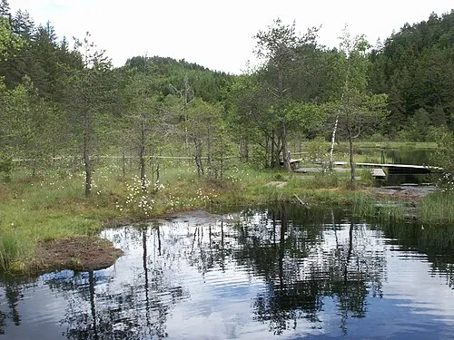 Hochgosch Mountain, Millstatt3.1 km NE
-
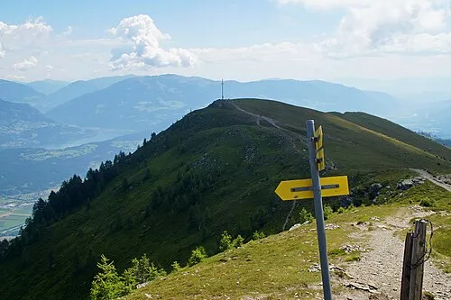 Martennock Mountain, Baldramsdorf4.8 km W
-
Unter Drautal Natural site, Carinthia4.5 km SE
-
Millstätter See Lake, Carinthia4.1 km NE
-
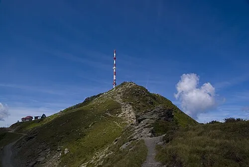 Goldeck Mountain, Baldramsdorf6.6 km W
-
Treffling Bach River, Carinthia4.9 km NW
-
Golsernock Mountain, Stockenboi7.3 km S
-
Oberer Fratres Berg Mountain, Seeboden6.4 km NW
Sources & licences
Data last updated: