Gornji Kosinj
Located in Municipality of Perušić, Lika-Senj County Coordinates: 44°43′00″ N 15°16′29″ E

- Population
- 92
- 92
- Elevation
- 496 m
- above sea level
- Local time
- UTC+01:00
- Europe/Zagreb · UTC+01:00
- Airports
- ZAD Zadar Airport69 km
- RJK Rijeka Airport79 km
About Gornji Kosinj
Gornji Kosinj is a village. Location: Municipality of Perušić, Lika-Senj County. Population: 92. Elevation: 496 m.
Gornji Kosinj is a village in Perušić municipality, Lika-Senj County, Croatia. It is located in Kosinj Valley, near the Lika river. In 2021, its population was 92. The Church of Saint Anthony of Padua stands in the village.
Source: Wikipedia · CC BY-SA 4.0
At a glance
- Area
- 14 km²
Source: Wikidata
Photos of Gornji Kosinj
-
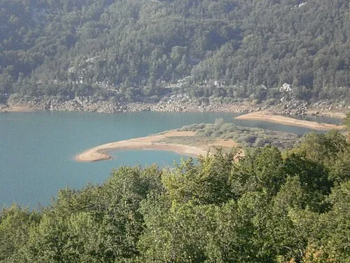
Kruščičko Jezero Dragan Zeba · CC BY 3.0

Climate of Gornji Kosinj
Best months for sightseeingBest months for sightseeing: June–September.
This month · November
A wet month
Day 9° · Night 2° · Rain 169 mm
- Hottest month
- July (day 25°)
- Coldest month
- January (night -3°)
- Wettest month
- November (169 mm)
- Driest month
- July (64 mm)
Bars: average monthly low and high temperature. Below: precipitation. Monthly averages for 1970–2000 at about 18 km resolution, adjusted for elevation. Highlighted months are mild and relatively dry. Source: WorldClim 2.1 (CC BY 4.0).
Show values as a table
| Month | Jan | Feb | Mar | Apr | May | Jun | Jul | Aug | Sep | Oct | Nov | Dec |
|---|---|---|---|---|---|---|---|---|---|---|---|---|
| Average high (°C) | 4° | 6° | 9° | 13° | 19° | 22° | 25° | 25° | 20° | 15° | 9° | 5° |
| Average low (°C) | -3° | -3° | 0° | 4° | 8° | 11° | 13° | 13° | 9° | 6° | 2° | -2° |
| Precipitation (mm) | 97 | 96 | 98 | 109 | 97 | 99 | 64 | 84 | 131 | 151 | 169 | 134 |
Other places to visit in this season: June July August September
How to get to Gornji Kosinj
The nearest airport is Zadar Airport (ZAD), 69 km to the south as the crow flies. The nearest large city is Rijeka, 94 km to the northwest.
Airports
- Zadar Airport (ZAD) Zadar 69 kmsouth
- Rijeka Airport (RJK) Rijeka(Omišalj) 79 kmnorthwest
- Pula Airport (PUY) Pula 109 kmwest
Nearby large cities
- Rijeka Population: 108K 94 kmnorthwest
- Zagreb Population: 663.6K 134 kmnortheast
- Banja Luka Population: 221.1K 153 kmeast
- Ljubljana Population: 272.2K 160 kmnorth
- Split Population: 149.8K 163 kmsoutheast
Straight-line distances; road distances are longer. Airport data: OurAirports.
Day trips from Gornji Kosinj
Within 100 km: 6 historic and cultural sites, 46 natural sites, 68 lakes, rivers and coasts.
0–25 km7 places
- Progon Mountain 12 kmS
- Kotlina Natural site 12 kmN
- Kruščičko Jezero Lake 4 kmS
- Veliki Kozjak Mountain 19 kmW
25–60 km30 places
- Silba Island 59 kmSW
- Birovača Mountain 56 kmE
- Klenovac Natural site 44 kmE
- Liskovac Natural site 46 kmE
60–100 km83 places
- Krk Island 65 kmNW
- Lošinj Island 71 kmW
- Uvala Stipanja Natural site 68 kmNW
- Otok Ilovik Island 65 kmSW
Straight-line distances.
Nearby attractions & nature
Everything nearby-
Kruščičko Jezero Lake, Lika-Senj County3.8 km S
-
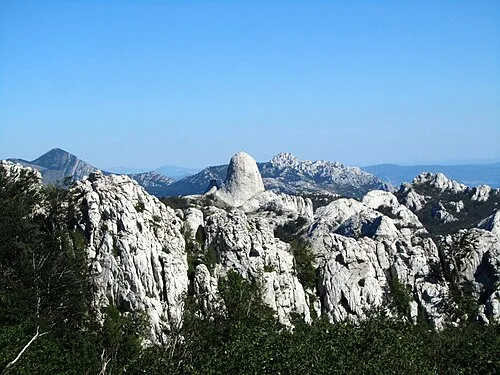 Velebit Mountain, Croatia21 km S
-
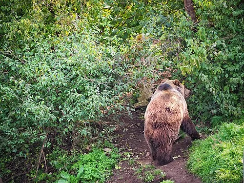 Štirovača Natural site, Lika-Senj County18 km W
-
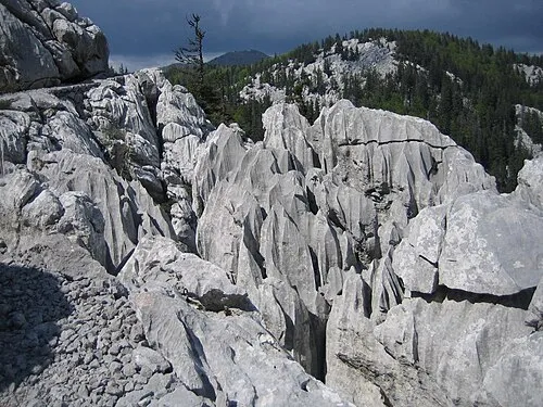 Northern Velebit National Park Natural site, Lika-Senj County22 km W
-
Progon Mountain, Lika-Senj County12 km S
-
Veliki Kozjak Mountain, Lika-Senj County19 km W
Sources & licences
Data last updated: · 2 independent sources