- Population
- 1,222
- 1.2K
- Elevation
- 195 m
- above sea level
- Local time
- UTC+01:00
- Europe/Zagreb · UTC+01:00
- Airports
- MBX Maribor Edvard Rusjan Airport58 km
- SOB Hévíz–Balaton Airport63 km
About Mačkovec
Mačkovec is a village. Location: City of Čakovec, Međimurje County. Population: 1,222. Elevation: 195 m.
Mačkovec (Hungarian: Nyírvölgy) is a village in Međimurje County, Croatia. It had a population of 1,326 in the 2011 census. The village is located approximately 3 kilometres from the centre of Čakovec, the county seat and largest city of Međimurje County, and administratively belongs to the city's wider area. Its southern end is connected with the north-eastern part of Šenkovec. The D209 road goes through the north-western part of the village, connecting Čakovec with Mursko Središće and Lendava.
Source: Wikipedia · CC BY-SA 4.0
At a glance
- Area
- 4.3 km²
Source: Wikidata
Climate of Mačkovec
Best months for sightseeingBest months for sightseeing: May–September.
This month · November
A cold month
Day 9° · Night 1° · Rain 75 mm
- Hottest month
- July (day 26°)
- Coldest month
- January (night -4°)
- Wettest month
- June (93 mm)
- Driest month
- January (39 mm)
Bars: average monthly low and high temperature. Below: precipitation. Monthly averages for 1970–2000 at about 18 km resolution, adjusted for elevation. Highlighted months are mild and relatively dry. Source: WorldClim 2.1 (CC BY 4.0).
Show values as a table
| Month | Jan | Feb | Mar | Apr | May | Jun | Jul | Aug | Sep | Oct | Nov | Dec |
|---|---|---|---|---|---|---|---|---|---|---|---|---|
| Average high (°C) | 3° | 6° | 11° | 16° | 22° | 24° | 26° | 26° | 21° | 15° | 9° | 4° |
| Average low (°C) | -4° | -3° | 1° | 5° | 9° | 13° | 14° | 14° | 10° | 5° | 1° | -3° |
| Precipitation (mm) | 39 | 42 | 54 | 64 | 73 | 93 | 90 | 87 | 80 | 74 | 75 | 55 |
Other places to visit in this season: May June July August September
How to get to Mačkovec
The nearest airport is Maribor Edvard Rusjan Airport (MBX), 58 km to the west as the crow flies. For international flights: Zagreb Franjo Tuđman International Airport (ZAG) (80 km). The nearest large city is Zagreb, 76 km to the southwest.
Airports
- Maribor Edvard Rusjan Airport (MBX) Maribor 58 kmwest
- Hévíz–Balaton Airport (SOB) Sármellék 63 kmnortheast
- Zagreb Franjo Tuđman International Airport (ZAG) Velika Gorica 80 kmsouth
Nearby large cities
- Zagreb Population: 663.6K 76 kmsouthwest
- Graz Population: 303.3K 104 kmnorthwest
- Pécs Population: 145.3K 144 kmeast
- Ljubljana Population: 272.2K 154 kmwest
- Klagenfurt Population: 100.3K 165 kmwest
Straight-line distances; road distances are longer. Airport data: OurAirports.
Day trips from Mačkovec
Within 100 km: 68 historic and cultural sites, 174 natural sites, 183 lakes, rivers and coasts.
0–25 km7 places
- Ledava River 15 kmNE
- Ščavnica River 15 kmNW
- Lake Dubrava Lake 20 kmSE
- Lake Varaždin Lake 12 kmS
25–60 km69 places
- Lake Ptuj Lake 41 kmW
- Jezero Pernica Lake 57 kmW
- Polskava River 42 kmW
- Ložnica River 58 kmW
60–100 km349 places
- Kašina River 66 kmS
- Ribnica Lake Lake 90 kmW
- Pohorje Mountain 75 kmW
- Krka River 87 kmSW
Straight-line distances.
Nearby attractions & nature
Everything nearby-
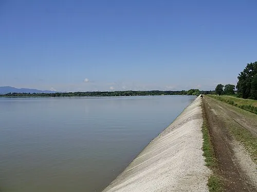 Lake Varaždin Lake, Croatia12 km S
-
 Kerka River, Hungary14 km NE
-
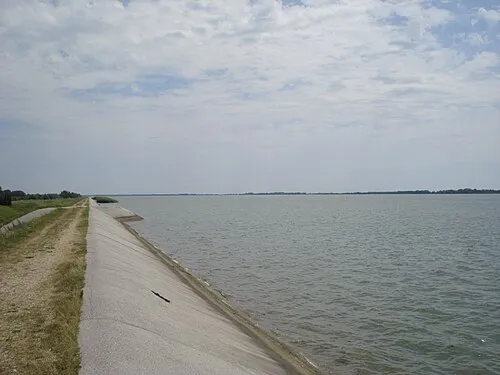 Lake Dubrava Lake, Croatia20 km SE
-
 Trnava Murska River, Croatia22 km E
-
Csiboda Mountain, Zala County19 km NE
-
 Ledava River, Slovenia15 km NE
Other cities and towns in City of Čakovec
-
 Savska Ves Village, City of Čakovec5.5 km S
-
 Ivanovec Village, City of Čakovec6.8 km SE
-
Štefanec Village, City of Čakovec7.6 km SE
-
Kuršanec Village, City of Čakovec10 km S
-
Totovec Village, City of Čakovec9 km S
-
Novo Selo na Dravi Village, City of Čakovec10 km S
Sources & licences
Data last updated: · 2 independent sources