Town of Pleternica
Located in Požega-Slavonia County, Croatia Coordinates: 45°17′09″ N 17°48′08″ E
- Population
- 9,138
- 9.1K
- Elevation
- 121 m
- above sea level
- Local time
- UTC+01:00
- Europe/Zagreb · UTC+01:00
- Places inside
- 20
- listed under Town of Pleternica
- Airports
- BNX Banja Luka International Airport55 km
- OSI Osijek Airport81 km
About Town of Pleternica
Town of Pleternica is a district. Location: Požega-Slavonia County, Croatia. Population: 9,138. The best months to visit are May–June, September. The nearest airport is Banja Luka International Airport (55 km). Nearby sights include Londža and Sokolovac.
Climate of Town of Pleternica
Best months for sightseeingBest months for sightseeing: May–June, September.
This month · November
A cold month
Day 10° · Night 2° · Rain 82 mm
- Hottest month
- July (day 27°)
- Coldest month
- January (night -3°)
- Wettest month
- June (100 mm)
- Driest month
- February (51 mm)
Bars: average monthly low and high temperature. Below: precipitation. Monthly averages for 1970–2000 at about 18 km resolution, adjusted for elevation. Highlighted months are mild and relatively dry. Source: WorldClim 2.1 (CC BY 4.0).
Show values as a table
| Month | Jan | Feb | Mar | Apr | May | Jun | Jul | Aug | Sep | Oct | Nov | Dec |
|---|---|---|---|---|---|---|---|---|---|---|---|---|
| Average high (°C) | 4° | 7° | 12° | 17° | 22° | 25° | 27° | 27° | 23° | 17° | 10° | 5° |
| Average low (°C) | -3° | -2° | 2° | 5° | 10° | 13° | 15° | 14° | 11° | 6° | 2° | -2° |
| Precipitation (mm) | 52 | 51 | 52 | 64 | 75 | 100 | 74 | 71 | 61 | 74 | 82 | 67 |
How to get to Town of Pleternica
The nearest airport is Banja Luka International Airport (BNX), 55 km to the southwest as the crow flies. The nearest large city is Banja Luka, 73 km to the southwest.
Airports
- Banja Luka International Airport (BNX) Mahovljani 55 kmsouthwest
- Osijek Airport (OSI) Osijek(Klisa) 81 kmeast
- Pécs-Pogány International Airport (PEV) Pécs 85 kmnortheast
Nearby large cities
- Banja Luka Population: 221.1K 73 kmsouthwest
- Pécs Population: 145.3K 94 kmnorth
- Tuzla Population: 142.5K 108 kmsoutheast
- Zenica Population: 164.4K 121 kmsouth
- Zagreb Population: 663.6K 154 kmnorthwest
Straight-line distances; road distances are longer. Airport data: OurAirports.
Day trips from Town of Pleternica
Within 100 km: 5 historic and cultural sites, 55 natural sites, 68 lakes, rivers and coasts.
0–25 km13 places
- Krndija Mountain 20 kmNE
- Dolovi Natural site 21 kmSW
- Ukrina River 24 kmSE
- Crna River 24 kmS
25–60 km28 places
- Rt Mountain 58 kmSW
- Soline Mountain 41 kmS
- Jabukovac Mountain 38 kmS
- Vučjak Mountain 40 kmSE
60–100 km87 places
- Island of Vukovar Island 97 kmE
- Živica River 100 kmE
- Busača Lake 64 kmSE
- Klepalo Mountain 87 kmSW
Straight-line distances.
Places in Town of Pleternica
20 places
Pleternica
Population: 2.9K
Gradac
Population: 789

Drenovac
Population: 532

Sulkovci
Population: 419
Kuzmica
Population: 369

Frkljevci
Population: 287
- 7 Srednje Selo 253
- 8 Kadanovci 197
- 9 Bresnica Požeška 175
- 10 Ratkovica 156
- 11 Bilice 150
- 12 Svilna 109
- 13 Sesvete 107
- 14 Bzenica 79
- 15 Ašikovci 67
- 16 Kalinić 62
- 17 Knežci 50
- 18 Ćošinci 39
- 19 Brđani 32
Bar: population relative to the most populous place in this list.
Cities & villages1
- Mihaljevići · Village
Nearby attractions & nature
Everything nearby-
Londža River, Croatia2 km S
-
Sokolovac Mountain, Požega-Slavonia County12 km W
-
Cerovac Mountain, Brod-Posavina County11 km W
-
 Požeška Gora Mountain, Croatia17 km W
-
 Petnja River, Croatia14 km SE
-
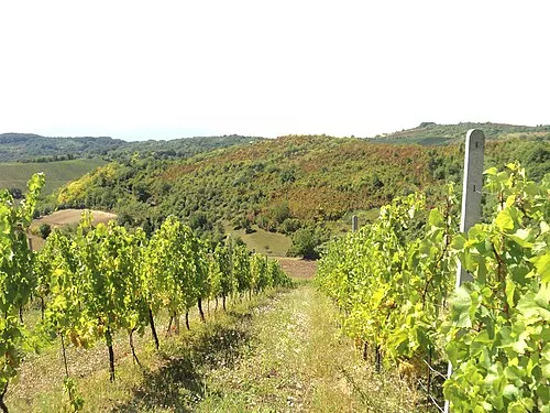 Dilj Planina Mountain, Croatia23 km E
Sources & licences
Data last updated: