Punat
Located in Municipality of Punat, Primorje-Gorski Kotar County Coordinates: 45°00′53″ N 14°37′44″ E

- Population
- 1,784
- 1.8K
- Elevation
- 7 m
- above sea level
- Local time
- UTC+01:00
- Europe/Zagreb · UTC+01:00
- Airports
- RJK Rijeka Airport23 km
- PUY Pula Airport57 km
About Punat
Punat is a city. Location: Municipality of Punat, Primorje-Gorski Kotar County. Population: 1,784. Elevation: 7 m.
Punat is a municipality in the Primorje-Gorski Kotar County in western Croatia on the island of Krk. The municipality has a population of 1,900, with 90% Croats (2021). With Stara Baška being the only other settlement in the municipality, the village of Punat itself has a population of 1,784. The town first appears in writings from 1377 AD, but the exact date of its foundation is not known. It is situated on a bay known for the island of Košljun and the Church of St. Dunat.
Source: Wikipedia · CC BY-SA 4.0
Photos of Punat
-

pollobarca2 · CC BY-SA 2.0 -

Fulvio Bacchia · CC BY-SA 3.0 -

Luca.favorido · CC0 -

Stefan.lefnaer · CC BY-SA 4.0 -

Hansueli Krapf This file was uploaded with Commonist · CC BY-SA 3.0


Travel notes for Punat
From Wikivoyage
Punat lies on the eastern coast of the bay of Punat on the island of Krk in Croatia. It is well protected against storm, as well as the whole bay of Punat. In the bay of Punat there is a well known marina. In the middle of the bay of Punat there is a little island called Košljun, famous for a Franciscan monastery and ethnographic and sacral museum collections.
Source: Wikivoyage · CC BY-SA 4.0 · abridged
Places bordering Punat
- Krk
- Baška
Climate of Punat
Best months for sightseeingBest months for sightseeing: May–June, September.
This month · November
A wet month
Day 14° · Night 7° · Rain 156 mm
- Hottest month
- July (day 29°)
- Coldest month
- January (night 3°)
- Wettest month
- October (159 mm)
- Driest month
- July (51 mm)
Bars: average monthly low and high temperature. Below: precipitation. Monthly averages for 1970–2000 at about 18 km resolution, adjusted for elevation. Highlighted months are mild and relatively dry. Source: WorldClim 2.1 (CC BY 4.0).
Show values as a table
| Month | Jan | Feb | Mar | Apr | May | Jun | Jul | Aug | Sep | Oct | Nov | Dec |
|---|---|---|---|---|---|---|---|---|---|---|---|---|
| Average high (°C) | 9° | 10° | 13° | 17° | 22° | 26° | 29° | 29° | 24° | 19° | 14° | 10° |
| Average low (°C) | 3° | 3° | 6° | 9° | 13° | 17° | 19° | 19° | 15° | 11° | 7° | 4° |
| Precipitation (mm) | 100 | 81 | 82 | 85 | 81 | 90 | 51 | 74 | 136 | 159 | 156 | 124 |
How to get to Punat
The nearest airport is Rijeka Airport (RJK), 23 km to the north as the crow flies. The nearest large city is Rijeka, 38 km to the northwest.
Airports
- Rijeka Airport (RJK) Rijeka(Omišalj) 23 kmnorth
- Pula Airport (PUY) Pula 57 kmwest
- Zadar Airport (ZAD) Zadar 117 kmsoutheast
Nearby large cities
- Rijeka Population: 108K 38 kmnorthwest
- Ljubljana Population: 272.2K 116 kmnorth
- Zagreb Population: 663.6K 138 kmnortheast
- Klagenfurt Population: 100.3K 181 kmnorth
- Banja Luka Population: 221.1K 205 kmeast
Straight-line distances; road distances are longer. Airport data: OurAirports.
Day trips from Punat
Within 100 km: 9 historic and cultural sites, 68 natural sites, 61 lakes, rivers and coasts.
0–25 km8 places
- Krk Island 7 kmN
- Uvala Stipanja Natural site 15 kmN
- Otočić Košljun Island 1 kmNW
- Otok Sveti Grgur Island 20 kmSE
25–60 km29 places
- Lošinj Island 51 kmS
- Otočić Srakane Vele Island 54 kmSW
- Rab Island 30 kmSE
- Cres Island 30 kmSW
60–100 km101 places
- Silba Island 71 kmS
- Otok Ilovik Island 63 kmS
- Otok Premuda Island 76 kmS
- Otok Sestrunj Island 98 kmS
Straight-line distances.
Nearby attractions & nature
Everything nearby-
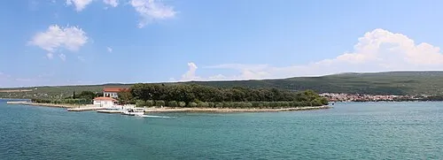 Otočić Košljun Island, Primorje-Gorski Kotar County1.4 km NW
-
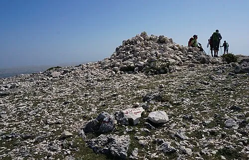 Obzova Mountain, Croatia5.1 km SE
-
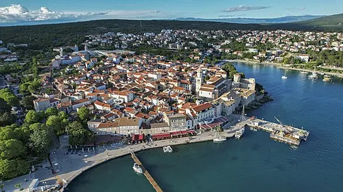 Krk Island, Primorje-Gorski Kotar County6.8 km N
-
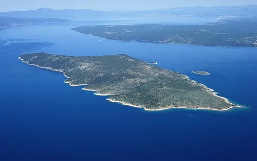 Otok Plavnik Island, Primorje-Gorski Kotar County9.4 km SW
-
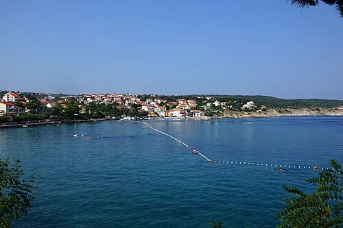 Uvala Stipanja Natural site, Primorje-Gorski Kotar County15 km N
-
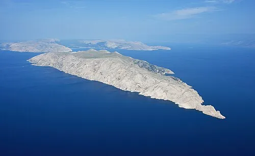 Otok Prvić Island, Primorje-Gorski Kotar County18 km SE
-
 Otok Sveti Grgur Island, Primorje-Gorski Kotar County20 km SE
-
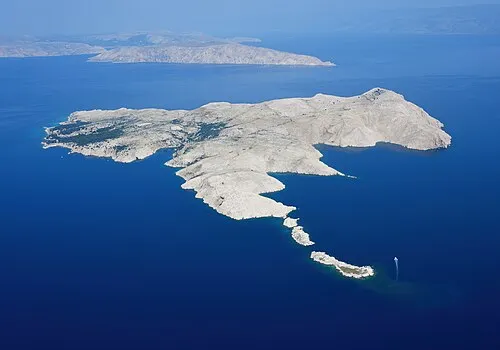 Goli otok Island, Primorje-Gorski Kotar County24 km SE
Sources & licences
Data last updated: · 2 independent sources