
- Population
- 82
- 82
- Elevation
- 298 m
- above sea level
- Local time
- UTC+01:00
- Europe/Zagreb · UTC+01:00
- Airports
- ZAD Zadar Airport39 km
- SPU Split Saint Jerome Airport67 km
About Bjelina
Bjelina is a village. Location: Town of Benkovac, Zadar County. Population: 82. Elevation: 298 m.
Bjelina (Serbian Cyrillic: Бјелина) is a village westwards from the town of Knin in the Benkovac municipality of southern Croatia.
Source: Wikipedia · CC BY-SA 4.0
At a glance
- Area
- 25.3 km²
Source: Wikidata
Climate of Bjelina
Best months for sightseeingBest months for sightseeing: May–September.
This month · November
A wet month
Day 12° · Night 4° · Rain 111 mm
- Hottest month
- July (day 29°)
- Coldest month
- January (night 0°)
- Wettest month
- November (111 mm)
- Driest month
- July (43 mm)
Bars: average monthly low and high temperature. Below: precipitation. Monthly averages for 1970–2000 at about 18 km resolution, adjusted for elevation. Highlighted months are mild and relatively dry. Source: WorldClim 2.1 (CC BY 4.0).
Show values as a table
| Month | Jan | Feb | Mar | Apr | May | Jun | Jul | Aug | Sep | Oct | Nov | Dec |
|---|---|---|---|---|---|---|---|---|---|---|---|---|
| Average high (°C) | 7° | 9° | 12° | 16° | 21° | 25° | 29° | 28° | 24° | 18° | 12° | 9° |
| Average low (°C) | 0° | 0° | 3° | 6° | 11° | 14° | 16° | 16° | 12° | 9° | 4° | 1° |
| Precipitation (mm) | 75 | 69 | 74 | 81 | 69 | 66 | 43 | 56 | 90 | 98 | 111 | 92 |
Other places to visit in this season: May June July August September
How to get to Bjelina
The nearest airport is Zadar Airport (ZAD), 39 km to the west as the crow flies. The nearest large city is Split, 77 km to the southeast.
Airports
- Zadar Airport (ZAD) Zadar 39 kmwest
- Split Saint Jerome Airport (SPU) Split 67 kmsoutheast
- Brač Airport (BWK) Gornji Humac 108 kmsoutheast
Nearby large cities
- Split Population: 149.8K 77 kmsoutheast
- Rijeka Population: 108K 180 kmnorthwest
- Zagreb Population: 663.6K 197 kmnorth
- Ljubljana Population: 272.2K 246 kmnorthwest
- Pécs Population: 145.3K 294 kmnortheast
Straight-line distances; road distances are longer. Airport data: OurAirports.
Day trips from Bjelina
Within 100 km: 10 historic and cultural sites, 22 natural sites, 60 lakes, rivers and coasts.
0–25 km3 places
- Krka National Park Natural site 23 kmSE
- Asseria Historic site 16 kmW
- Burnum Historic site 13 kmSE
25–60 km47 places
- Otok Prvić Island 35 kmS
- Otok Zlarin Island 39 kmS
- Otok Kaprije Island 40 kmS
- Krapanj Island 42 kmS
60–100 km42 places
- Šolta Island 82 kmSE
- Silba Island 99 kmNW
- Otok Mali Drvenik Island 69 kmS
- Birovača Mountain 61 kmN
Straight-line distances.
Nearby attractions & nature
Everything nearby-
 Burnum Historic site, Šibenik-Knin County13 km SE
-
Asseria Historic site, Zadar County16 km W
-
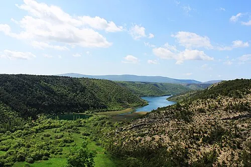 Krka National Park Natural site, Šibenik-Knin County23 km SE
Other cities and towns in Town of Benkovac
-
Kula Atlagić Village, Town of Benkovac20 km W
-
 Šopot Village, Town of Benkovac20 km W
-
Donje Ceranje Village, Town of Benkovac21 km SW
-
Miranje Village, Town of Benkovac21 km W
-
Nadin Village, Town of Benkovac27 km W
-
 Smilčić Village, Town of Benkovac28 km W
Sources & licences
Data last updated: · 2 independent sources