- Population
- 131
- 131
- Elevation
- 208 m
- above sea level
- Local time
- UTC+01:00
- Europe/Zagreb · UTC+01:00
- Airports
- ZAD Zadar Airport19 km
- SPU Split Saint Jerome Airport81 km
About Kula Atlagić
Kula Atlagić is a village. Location: Town of Benkovac, Zadar County. Population: 131. Elevation: 208 m.
Kula Atlagić (Serbian Cyrillic: Кула Атлагић), also known as Kula Atlagića, is a settlement in the Benkovac municipality, in the Zadar County in Croatia. It is located in the Ravni Kotari region of Dalmatia.
Source: Wikipedia · CC BY-SA 4.0
At a glance
- Area
- 13.6 km²
Source: Wikidata
Climate of Kula Atlagić
Best months for sightseeingBest months for sightseeing: May–June, September.
This month · November
A wet month
Day 13° · Night 4° · Rain 107 mm
- Hottest month
- July (day 30°)
- Coldest month
- January (night 1°)
- Wettest month
- November (107 mm)
- Driest month
- July (36 mm)
Bars: average monthly low and high temperature. Below: precipitation. Monthly averages for 1970–2000 at about 18 km resolution, adjusted for elevation. Highlighted months are mild and relatively dry. Source: WorldClim 2.1 (CC BY 4.0).
Show values as a table
| Month | Jan | Feb | Mar | Apr | May | Jun | Jul | Aug | Sep | Oct | Nov | Dec |
|---|---|---|---|---|---|---|---|---|---|---|---|---|
| Average high (°C) | 9° | 10° | 13° | 16° | 22° | 26° | 30° | 29° | 24° | 19° | 13° | 10° |
| Average low (°C) | 1° | 1° | 3° | 7° | 11° | 14° | 17° | 16° | 13° | 9° | 4° | 2° |
| Precipitation (mm) | 74 | 66 | 70 | 76 | 67 | 60 | 36 | 52 | 93 | 102 | 107 | 92 |
How to get to Kula Atlagić
The nearest airport is Zadar Airport (ZAD), 19 km to the west as the crow flies. The nearest large city is Split, 92 km to the southeast.
Airports
- Zadar Airport (ZAD) Zadar 19 kmwest
- Split Saint Jerome Airport (SPU) Split 81 kmsoutheast
- Brač Airport (BWK) Gornji Humac 123 kmsoutheast
Nearby large cities
- Split Population: 149.8K 92 kmsoutheast
- Rijeka Population: 108K 168 kmnorthwest
- Zagreb Population: 663.6K 198 kmnorth
- Ljubljana Population: 272.2K 237 kmnorth
- Klagenfurt Population: 100.3K 302 kmnorth
Straight-line distances; road distances are longer. Airport data: OurAirports.
Day trips from Kula Atlagić
Within 100 km: 10 historic and cultural sites, 22 natural sites, 62 lakes, rivers and coasts.
0–25 km7 places
- Otočić Galešnjak Island 18 kmSW
- Otok Vrgada Island 24 kmS
- Arta Vela Island 23 kmS
- Lake Vrana Lake 18 kmS
25–60 km48 places
- Otok Prvić Island 40 kmSE
- Otok Zlarin Island 46 kmSE
- Otok Kaprije Island 41 kmS
- Krapanj Island 50 kmSE
60–100 km39 places
- Šolta Island 94 kmSE
- Silba Island 80 kmNW
- Otok Mali Drvenik Island 78 kmSE
- Otok Ilovik Island 94 kmNW
Straight-line distances.
Nearby attractions & nature
Everything nearby-
Asseria Historic site, Zadar County4.5 km SE
-
 Zrmanja River, Croatia17 km N
-
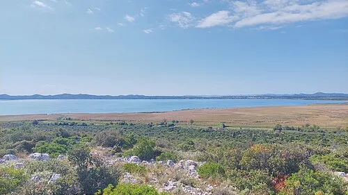 Lake Vrana Lake, Zadar County18 km S
-
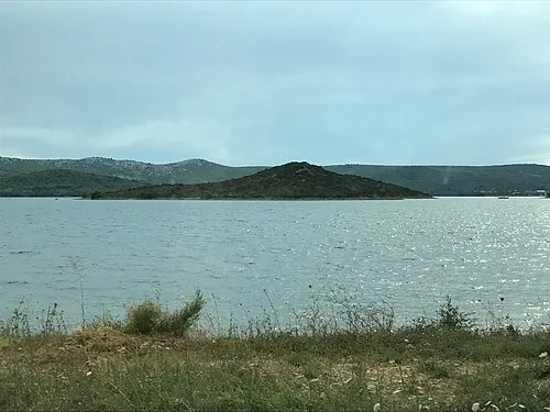 Otočić Galešnjak Island, Zadar County18 km SW
-
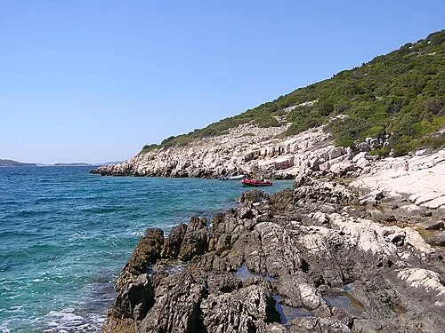 Arta Vela Island, Šibenik-Knin County23 km S
-
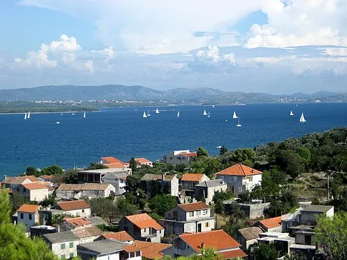 Pasman Island, Zadar County23 km SW
Other cities and towns in Town of Benkovac
-
Donje Ceranje Village, Town of Benkovac11 km S
-
Bruška Village, Town of Benkovac13 km E
-
 Islam Grčki Village, Town of Benkovac17 km NW
-
 Bjelina Village, Town of Benkovac20 km E
Sources & licences
Data last updated: · 2 independent sources