- Elevation
- 1,204 m
- above sea level
- Local time
- UTC+02:00
- Asia/Nicosia · UTC+02:00
- Airports
- PFO Paphos International Airport40 km
- ECN Ercan International Airport67 km
About Moutti tou Drakonta
Moutti tou Drakonta is a mountain. Location: Pedoulás, Nicosia. Elevation: 1,204 m. The best months to visit are May–October. The nearest airport is Paphos International Airport (40 km). Nearby sights include Mount Olympus and Koukos.
Photos of Moutti tou Drakonta
-
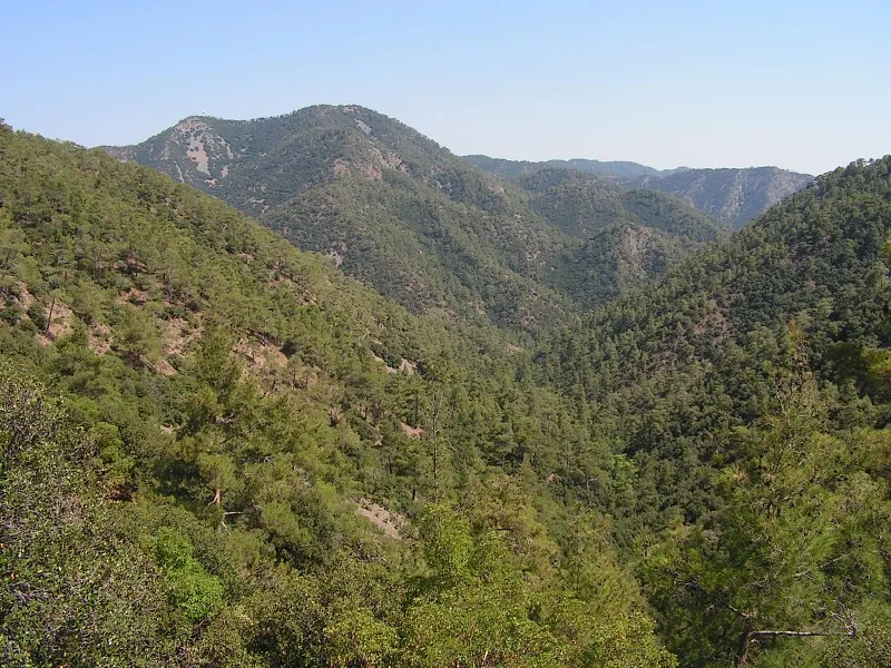
Mount Olympus Paul167 · CC BY-SA 2.5 -
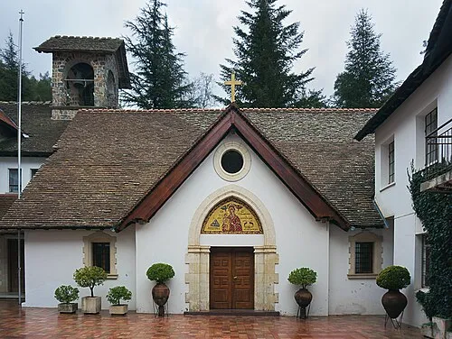
Trooditissa Monastery Anna Anichkova · CC BY-SA 3.0

Climate of Moutti tou Drakonta
Best months for sightseeingBest months for sightseeing: May–October.
This month · November
Outside the best season
Day 14° · Night 4° · Rain 70 mm
Better nearby cities in November
- Limassol · 38 km southeast23°
- Nicosia · 55 km northeast22°
- Hottest month
- August (day 27°)
- Coldest month
- January (night -1°)
- Wettest month
- January (138 mm)
- Driest month
- August (5 mm)
Bars: average monthly low and high temperature. Below: precipitation. Monthly averages for 1970–2000 at about 18 km resolution, adjusted for elevation. Highlighted months are mild and relatively dry. Source: WorldClim 2.1 (CC BY 4.0).
Show values as a table
| Month | Jan | Feb | Mar | Apr | May | Jun | Jul | Aug | Sep | Oct | Nov | Dec |
|---|---|---|---|---|---|---|---|---|---|---|---|---|
| Average high (°C) | 8° | 8° | 11° | 15° | 20° | 24° | 27° | 27° | 25° | 20° | 14° | 10° |
| Average low (°C) | -1° | -1° | 1° | 5° | 8° | 12° | 15° | 15° | 12° | 9° | 4° | 1° |
| Precipitation (mm) | 138 | 100 | 84 | 40 | 27 | 12 | 6 | 5 | 8 | 40 | 70 | 138 |
Other places to visit in this season: May June July August September October
How to get to Moutti tou Drakonta
The nearest airport is Paphos International Airport (PFO), 40 km to the southwest as the crow flies. The nearest large city is Limassol, 38 km to the southeast.
Airports
- Paphos International Airport (PFO) Paphos 40 kmsouthwest
- Ercan International Airport (ECN) Tymbou (Kirklar) 67 kmeast
- Larnaca International Airport (LCA) Larnaca 76 kmeast
Nearby large cities
- Limassol Population: 154K 38 kmsoutheast
- Nicosia Population: 200.5K 55 kmnortheast
- Silifke Population: 132.7K 187 kmnortheast
- Alanya Population: 364.2K 190 kmnorth
- Karaman Population: 175.4K 249 kmnorth
Straight-line distances; road distances are longer. Airport data: OurAirports.
Day trips from Moutti tou Drakonta
Within 100 km: 1,229 historic and cultural sites, 444 natural sites, 93 lakes, rivers and coasts.
0–25 km374 places
- Mount Olympus Mountain 6 kmSE
- Cyprus Island 17 kmE
- Pétra tou Limníti Island 25 kmN
- Prodromas Lake 4 kmSE
25–60 km1,024 places
- Stavrovoúni Attraction 58 kmE
- Tsada Community Park Natural site 33 kmSW
- Asprovounaro Mountain 33 kmW
- Tala (Kamares Tennis Courts) Landmark 36 kmW
60–100 km368 places
- Kastela Beach 77 kmE
- Nisída Chotí Island 80 kmNE
- Nisída Glykiótissa Island 61 kmNE
- Dolunay Göleti Lake 70 kmNE
Straight-line distances.
Nearest towns and villages
-
Pedoulás Village, Pedoulás2.3 km E
-
Lemíthou Village, Lemíthou2 km S
-
 Pródromos Village, Pródromos3.1 km SE
-
Moutoullás Village, Moutoutllás2.8 km NE
-
Kalopanagiótis Village, Kalopanagiótis3.4 km NE
-
Gerakiés Village, Gerakiés3.8 km N
Nearby attractions & nature
Everything nearby-
Mount Olympus Mountain, Páno Plátres6.3 km SE
-
Koukos Mountain, Pródromos3.1 km SE
-
Ágios Ilías Mountain, Treis Eliés2.8 km SW
-
Mavrogenis Mountain, Mylikoúri4 km W
-
Agia Triada Mountain, Gerakiés3.5 km N
-
Apostolos Andreas Attraction, Moutoutllás1.5 km NE
-
North Shoulder Mountain, Kakopetriá4.9 km E
-
Archángelos Michaíl Historic site, Pedoulás2.4 km E
Sources & licences
Data last updated: · 2 independent sources