- Elevation
- 299 m
- above sea level
- Local time
- UTC+01:00
- Europe/Paris · UTC+01:00
- Airports
- CMF Chambéry Aix les Bains airport20 km
- NCY Annecy Meythet airport32 km
About Lac de Barterand
Lac de Barterand is a lake. Location: Ain, Auvergne-Rhône-Alpes. Elevation: 299 m. The best months to visit are May–September. The nearest airport is Chambéry Aix les Bains airport (20 km). Nearby sights include Mont Landard and Séran.
Climate of Lac de Barterand
Best months for sightseeingBest months for sightseeing: May–September.
This month · November
A cold month
Day 10° · Night 3° · Rain 99 mm
- Hottest month
- July (day 27°)
- Coldest month
- January (night -1°)
- Wettest month
- October (108 mm)
- Driest month
- August (72 mm)
Bars: average monthly low and high temperature. Below: precipitation. Monthly averages for 1970–2000 at about 18 km resolution, adjusted for elevation. Highlighted months are mild and relatively dry. Source: WorldClim 2.1 (CC BY 4.0).
Show values as a table
| Month | Jan | Feb | Mar | Apr | May | Jun | Jul | Aug | Sep | Oct | Nov | Dec |
|---|---|---|---|---|---|---|---|---|---|---|---|---|
| Average high (°C) | 5° | 8° | 12° | 15° | 20° | 24° | 27° | 26° | 22° | 16° | 10° | 6° |
| Average low (°C) | -1° | 0° | 2° | 5° | 9° | 13° | 15° | 14° | 11° | 7° | 3° | 0° |
| Precipitation (mm) | 79 | 79 | 78 | 80 | 94 | 96 | 75 | 72 | 107 | 108 | 99 | 86 |
Other places to visit in this season: May June July August September
How to get to Lac de Barterand
The nearest airport is Chambéry Aix les Bains airport (CMF), 20 km to the southeast as the crow flies. For international flights: Lyon Saint-Exupéry Airport (LYS) (51 km). The nearest large city is Geneva, 55 km to the northeast.
Airports
- Chambéry Aix les Bains airport (CMF) Chambéry 20 kmsoutheast
- Annecy Meythet airport (NCY) Annecy 32 kmnortheast
- Lyon Saint-Exupéry Airport (LYS) Colombier-Saugnieu, Rhône 51 kmwest
Nearby large cities
- Geneva Population: 201.7K 55 kmnortheast
- Villeurbanne Population: 131.4K 67 kmwest
- Grenoble Population: 158.6K 68 kmsouth
- Lyon Population: 520.8K 70 kmwest
- Lausanne Population: 139.1K 106 kmnortheast
Straight-line distances; road distances are longer. Airport data: OurAirports.
Day trips from Lac de Barterand
Within 100 km: 177 historic and cultural sites, 1,393 natural sites, 338 lakes, rivers and coasts.
0–25 km79 places
- Lac de Save Lake 25 kmSW
- Lacs des Hôpitaux Lake 18 kmNW
- Grand Étang Lake 24 kmW
- Lacs de Chevelu Lake 12 kmSE
25–60 km411 places
- Etang du Moulin de Vert Lake 49 kmNE
- Etang du Moulin de Vert Lake 48 kmNE
- Barrage du Rhône Lake 51 kmNE
- Parc des Bastions Natural site 55 kmNE
60–100 km1,418 places
- Parc de la Tête d'Or Natural site 69 kmW
- Lac Mort Lake 84 kmS
- Lake Leman Lake 91 kmNE
- Lac d'Émosson Lake 96 kmE
Straight-line distances.
Nearest towns and villages
-
Pollieu Village, Arrondissement of Belley1.2 km N
-
Pollieu Village, Pollieu1 km N
-
Saint-Champ Village, Magnieu1.1 km SW
-
Cressin-Rochefort Village, Arrondissement of Belley1.9 km SE
-
Magnieu Village, Arrondissement of Belley2.5 km SW
-
Cressin Village, Cressin-Rochefort1.9 km SE
Nearby attractions & nature
Everything nearby-
Mont Landard Mountain, Chanaz4.1 km E
-
Séran River, Savoy2.2 km E
-
Montagne de Parves Mountain, Parves et Nattages5.6 km S
-
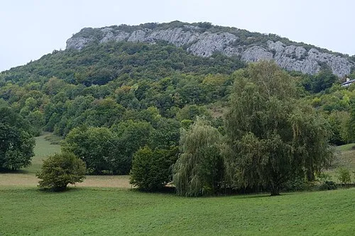 Montagne de Cessens Mountain, Entrelacs10 km E
-
Bois de Rothone Natural site, Ain9 km SW
-
Lac d'Armaille Lake, Ain9.1 km SW
-
Mont de la Charvaz Mountain, Billième8.9 km SE
-
Les Rousses River, Auvergne-Rhône-Alpes6.5 km N
Sources & licences
Data last updated: