
- Population
- 671,289
- 671.3K
- Elevation
- 416 m
- above sea level
- Local time
- UTC+01:00
- Europe/Paris · UTC+01:00
- Places inside
- 82
- listed under Ain
- Airports
- LYS Lyon Saint-Exupéry Airport52 km
- GVA Geneva International Airport60 km
About Ain
Ain is a district. Location: Auvergne-Rhône-Alpes, France. Population: 671,289.
Ain (; French: [ɛ̃] ; Arpitan: En) is a French department in the Auvergne-Rhône-Alpes region, Eastern France. Named after the Ain river, it is bordered by the Saône and Rhône rivers. Ain is on the country's eastern edge, on the Swiss border, where it borders the cantons of Geneva and Vaud. In 2023 it had a population of 679,344.
Source: Wikipedia · CC BY-SA 4.0
Photos of Ain
-
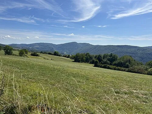
Crêt de Pont Lucas Destrem · CC BY-SA 4.0 -
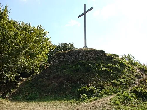
Mont Luisandre Classiccardinal · CC BY-SA 3.0 -
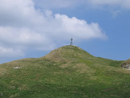
Le Reculet Krzysztof ' KrzyP ' Porowski · CC BY 2.5 pl -
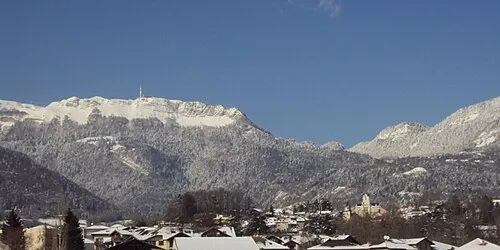
Petit Montrond Patrub01 · CC BY-SA 3.0


Places bordering Ain
- Canton of Vaud
- Canton of Geneva
- Rhône
- Saône-et-Loire
- Jura
- Upper Savoy
- Savoy
- Isère
Population of Ain over time
| 2015 | 631,877 | |
|---|---|---|
| 2017 | 643,350 | |
| 2018 | 647,634 | |
| 2019 | 652,432 | |
| 2020 | 657,856 | |
| 2021 | 663,202 | |
| 2022 | 671,289 | |
| 2023 | 679,344 |
Censuses and official estimates; source: Wikidata.
Climate of Ain
Best months for sightseeingBest months for sightseeing: June–September.
This month · November
A cold month
Day 8° · Night 2° · Rain 92 mm
- Hottest month
- July (day 25°)
- Coldest month
- January (night -2°)
- Wettest month
- October (101 mm)
- Driest month
- March (65 mm)
Bars: average monthly low and high temperature. Below: precipitation. Monthly averages for 1970–2000 at about 18 km resolution, adjusted for elevation. Highlighted months are mild and relatively dry. Source: WorldClim 2.1 (CC BY 4.0).
Show values as a table
| Month | Jan | Feb | Mar | Apr | May | Jun | Jul | Aug | Sep | Oct | Nov | Dec |
|---|---|---|---|---|---|---|---|---|---|---|---|---|
| Average high (°C) | 4° | 6° | 11° | 14° | 19° | 22° | 25° | 24° | 20° | 15° | 8° | 5° |
| Average low (°C) | -2° | -1° | 2° | 4° | 9° | 12° | 14° | 13° | 10° | 7° | 2° | -1° |
| Precipitation (mm) | 74 | 73 | 65 | 80 | 97 | 88 | 72 | 70 | 100 | 101 | 92 | 80 |
Other places to visit in this season: June July August September
How to get to Ain
The nearest airport is Lyon Saint-Exupéry Airport (LYS), 52 km to the south as the crow flies. The nearest large city is Villeurbanne, 57 km to the southwest.
Airports
- Lyon Saint-Exupéry Airport (LYS) Colombier-Saugnieu, Rhône 52 kmsouth
- Geneva International Airport (GVA) Geneva 60 kmeast
- Annecy Meythet airport (NCY) Annecy 65 kmsoutheast
Nearby large cities
- Villeurbanne Population: 131.4K 57 kmsouthwest
- Lyon Population: 520.8K 60 kmsouthwest
- Geneva Population: 201.7K 63 kmeast
- Lausanne Population: 139.1K 107 kmeast
- Saint-Etienne Population: 176.3K 110 kmsouthwest
Straight-line distances; road distances are longer. Airport data: OurAirports.
Day trips from Ain
Within 100 km: 167 historic and cultural sites, 630 natural sites, 285 lakes, rivers and coasts.
0–25 km51 places
- Étang des Vavres Lake 21 kmSW
- Nantua Lake Lake 20 kmE
- Étang Moulin Lake 20 kmW
- Étang de Chassagne Lake 22 kmSW
25–60 km275 places
- Parc de la Tête d'Or Natural site 57 kmSW
- Etang du Moulin de Vert Lake 53 kmE
- Etang du Moulin de Vert Lake 53 kmE
- Barrage du Rhône Lake 55 kmE
60–100 km756 places
- Lac de Joux Lake 90 kmNE
- Lake Leman Lake 93 kmE
- Lac Brenet Lake 95 kmNE
- Lac Aubonne Lake 88 kmNE
Straight-line distances.
Places in Ain
82 placesMountains & nature2
- Les Monts d'Ain · Mountain
- Val Chézery · Natural site
Lakes, rivers & coasts20
- Lac de Barterand · Lake
- Lacs des Hôpitaux · Lake
- Lake Sylans · Lake
- Nantua Lake · Lake
- Nizerand · River
- Renon · River
- Reyssouze · River
- Ruisseau de la Leschère · River
- Ruisseau de Loëse · River
- Ruisseau la Loëze · River
- Ruisseau le Reyssouzet · River
- Ruisseau les Ormes · River
- Ruisseau Moignans · River
- Salencon · River
- Save · River
- Suran · River
- Toison · River
- Valserine · River
- Veyle · River
- Vieux Jonc · River
Nature and heritage in Ain
Other regions in Auvergne-Rhône-Alpes
-
 Upper Savoy District, Auvergne-Rhône-Alpes87 km E
-
 Isère District, Auvergne-Rhône-Alpes118 km S
-
 Rhône District, Auvergne-Rhône-Alpes69 km SW
-
 Loire District, Auvergne-Rhône-Alpes104 km SW
-
 Savoy District, Auvergne-Rhône-Alpes119 km SE
Sources & licences
Data last updated: · 2 independent sources