Upper Savoy
Located in Auvergne-Rhône-Alpes, France Coordinates: 46°03′41″ N 6°27′13″ E
- Population
- 849,583
- 849.6K
- Elevation
- 494 m
- above sea level
- Local time
- UTC+01:00
- Europe/Paris · UTC+01:00
- Places inside
- 66
- listed under Upper Savoy
About Upper Savoy
Upper Savoy is a district. Location: Auvergne-Rhône-Alpes, France. Population: 849,583.
Haute-Savoie (French pronunciation: [ot savwa] ; Upper Savoy) is a department in the Auvergne-Rhône-Alpes region of Southeastern France, bordering both Switzerland and Italy. Its prefecture is Annecy. To the north is Lake Geneva; to the south and southeast are Mont Blanc and the Aravis mountain range. It holds its name from the Savoy historical region, as does the department of Savoie, located south of Haute-Savoie. In 2023, it had a population of 861,158.
Read more on Wikipedia Text: Wikipedia contributors · CC BY-SA 4.0 · shortened
At a glance
- Built
- 1860
- Area
- 4,388 km²
Source: Wikidata
In comparison
- 29 sights and natural places within 10 km Pointe d'Andey, Bonneville Castle
- Listed here: River: 23, Natural site: 20, Mountain: 12, Lake: 6
Airports nearest to Upper Savoy
- Annecy Meythet airport (NCY) Annecy 31 km
- Geneva International Airport (GVA) Geneva 33 km
- Chambéry Aix les Bains airport (CMF) Chambéry 65 km
Straight-line distance; airports with scheduled flights only. Source: OurAirports (public domain).
Places in Upper Savoy
66 places-
Arrondissement of Annecy Municipality294.8K
-
Arrondissement of Saint-Julien-en-Genevois Municipality199.8K
-
Arrondissement de Bonneville Municipality195.8K
-
Arrondissement of Thonon-les-Bains Municipality159.1K
-
Aiguille de Leschaux Mountain
-
Chablais Mountain
-
Chéran River
-
Dent du Lan Mountain
-
Dôme du Goûter Natural site
-
Dranse River
-
Dranse d'Abondance River
-
Dranse de Morzine River
-
Eau de Bérard River
-
Eau Morte River
-
Forêt de la Perrière Natural site
-
Forêt de Planbois Natural site
-
Forêt des Faux Natural site
-
Foron River
-
Genevois Mountain
-
Glacier d'Argentière Natural site
-
Glacier de Bionnassay Natural site
-
Glacier de la Frasse Natural site
-
Glacier de Leschaux Natural site
-
Glacier de Lognan Natural site
-
Glacier des Bossons Natural site
-
Glacier de Talèfre Natural site
-
Glacier de Trélatête Natural site
-
Glacier du Géant Natural site
-
Glacier du Mont Mallet Natural site
-
Glacier du Tour Natural site
-
Gorges de la Diosaz Natural site
-
Île des Cygnes Island
-
Lac d'Anthon Lake
-
Lac de Morillon Lake
-
Lac de Roy Lake
-
Lake Annecy Lake
-
Lake Anterne Lake
-
Lake Montriond Lake
-
La Vallée Blanche Natural site
-
Les Grands Mulets Mountain
-
Massif des Aiguilles Rouge Mountain
-
Mer de Glace Natural site
-
Montagne du Charbon Mountain
-
Mont Blanc Mountain
-
Mont Ruan Mountain
-
Monts Jovet Mountain
-
Morge River
-
Nant de Tamié River
-
Parmelan Mountain
-
Ruisseau Crenant River
-
Sommand Natural site
-
Tête Carrée Mountain
-
Torrent la Filière River
-
Torrent la Ménoge River
-
Torrent le Bon Nant River
-
Torrent le Borne River
-
Torrent le Brévon River
-
Torrent le Daudens River
-
Torrent le Foron River
-
Torrent le Giffre River
Nature and heritage in Upper Savoy
-
Mont de Vorès Mountain, Praz-sur-Arly
-
Aiguille Verte Mountain, Glières-Val-de-Borne
-
Montagne de Sulens Mountain, Les Clefs
-
Roche de Roux Mountain, Talloires-Montmin
-
Pointe Rousse Mountain, Samoëns
-
Aiguille de Roselette Mountain, Les Contamines-Montjoie
Nearby attractions & nature
Everything nearby-
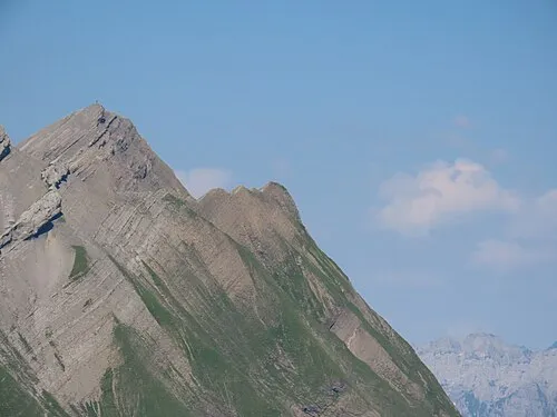 Pointe des Verres Mountain, La Giettaz19 km S
-
Rocher de la Balmaz Mountain, La Giettaz19 km S
-
Tête du Toré Mountain, La Giettaz23 km S
-
La Forêt Historic site, Jussy23 km NW
Sources & licences
Data last updated: · 2 independent sources