Perrier
Located in Livron-sur-Drôme, Arrondissement de Die Coordinates: 44°46′53″ N 4°50′07″ E
- Elevation
- 104 m
- above sea level
- Local time
- UTC+01:00
- Europe/Paris · UTC+01:00
- Airports
- GNB Grenoble Alpes Isère Airport75 km
- AVN Avignon Caumont airport97 km
About Perrier
Perrier is a village. Location: Livron-sur-Drôme, Arrondissement de Die. Elevation: 104 m. The best months to visit are May–September. The nearest airport is Grenoble Alpes Isère Airport (75 km). Nearby sights include Véoure and Mont Brian.
Photos of Perrier
-
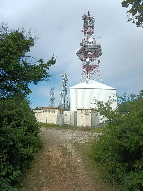
Mont Brian Blueberry-026 · CC BY-SA 4.0

Climate of Perrier
Best months for sightseeingBest months for sightseeing: May–September.
This month · November
Outside the best season
Day 12° · Night 5° · Rain 81 mm
- Hottest month
- July (day 29°)
- Coldest month
- January (night 1°)
- Wettest month
- October (125 mm)
- Driest month
- July (49 mm)
Bars: average monthly low and high temperature. Below: precipitation. Monthly averages for 1970–2000 at about 18 km resolution, adjusted for elevation. Highlighted months are mild and relatively dry. Source: WorldClim 2.1 (CC BY 4.0).
Show values as a table
| Month | Jan | Feb | Mar | Apr | May | Jun | Jul | Aug | Sep | Oct | Nov | Dec |
|---|---|---|---|---|---|---|---|---|---|---|---|---|
| Average high (°C) | 8° | 10° | 14° | 17° | 22° | 25° | 29° | 29° | 24° | 18° | 12° | 9° |
| Average low (°C) | 1° | 2° | 4° | 6° | 11° | 14° | 16° | 16° | 13° | 9° | 5° | 2° |
| Precipitation (mm) | 69 | 55 | 65 | 82 | 91 | 70 | 49 | 60 | 110 | 125 | 81 | 66 |
Other places to visit in this season: May June July August September
How to get to Perrier
The nearest airport is Grenoble Alpes Isère Airport (GNB), 75 km to the northeast as the crow flies. For international flights: Lyon Saint-Exupéry Airport (LYS) (107 km). The nearest large city is Saint-Etienne, 81 km to the northwest.
Airports
- Grenoble Alpes Isère Airport (GNB) Grenoble 75 kmnortheast
- Avignon Caumont airport (AVN) Avignon 97 kmsouth
- Lyon Saint-Exupéry Airport (LYS) Colombier-Saugnieu, Rhône 107 kmnorth
Nearby large cities
- Saint-Etienne Population: 176.3K 81 kmnorthwest
- Grenoble Population: 158.6K 82 kmnortheast
- Lyon Population: 520.8K 108 kmnorth
- Villeurbanne Population: 131.4K 109 kmnorth
- Nîmes Population: 148.2K 112 kmsouth
Straight-line distances; road distances are longer. Airport data: OurAirports.
Day trips from Perrier
Within 100 km: 156 historic and cultural sites, 864 natural sites, 223 lakes, rivers and coasts.
0–25 km51 places
- Pic de Rouverol Mountain 22 kmN
- Serre de la Chavas Mountain 21 kmN
- Serre du Sabot Mountain 20 kmN
- Le Pic Mountain 23 kmN
25–60 km401 places
- Alba-la-Romaine (Ardèche, France) -- Théâtre gallo-romain Historic site 31 kmSW
- Îles Margeries Island 42 kmS
- La Courbe Mountain 44 kmW
- Vercors Plateau Mountain 50 kmE
60–100 km791 places
- Lac Mort Lake 80 kmE
- Île d'Oiselet Island 83 kmS
- Île de la Piboulette Island 76 kmS
- Île de Miémar Island 80 kmS
Straight-line distances.
Nearby attractions & nature
Everything nearby-
Véoure River, Drôme3.4 km N
-
Mont Brian Mountain, Grâne6 km S
-
Eyrieux River, Drôme4.1 km NW
-
Mont Gier Mountain, Cliousclat7.7 km S
-
Drôme River, Drôme5.7 km W
-
Montpourchier Mountain, Mirmande10 km S
Sources & licences
Data last updated: