- Elevation
- 202 m
- above sea level
- Local time
- UTC+01:00
- Europe/Paris · UTC+01:00
- Airports
- GNB Grenoble Alpes Isère Airport31 km
- CMF Chambéry Aix les Bains airport50 km
About Torrent du Furon
Torrent du Furon is a river. Location: Isère, Auvergne-Rhône-Alpes. The best months to visit are May–June, August–September. The nearest airport is Grenoble Alpes Isère Airport (31 km). Nearby sights include Drac and La Dent du Loup.
Photos of Torrent du Furon
-
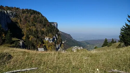
La Dent du Loup Isabel SBL · CC BY-SA 4.0 -
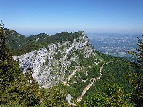
La Buffe This picture belongs to Gilbert Bohec Please credit : Gilbert Bohec / Wikimedia Commons / CC-BY-SA I'd appreciate if you · CC BY-SA 4.0 -
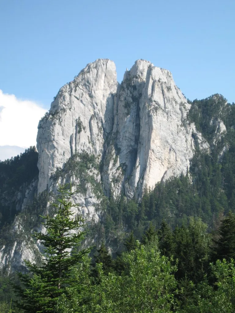
Les Trois Pucelles Nakor · CC BY-SA 3.0


Climate of Torrent du Furon
Best months for sightseeingBest months for sightseeing: May–June, August–September.
This month · November
A wet month
Day 12° · Night 5° · Rain 117 mm
- Hottest month
- July (day 29°)
- Coldest month
- January (night 1°)
- Wettest month
- November (117 mm)
- Driest month
- July (68 mm)
Bars: average monthly low and high temperature. Below: precipitation. Monthly averages for 1970–2000 at about 18 km resolution, adjusted for elevation. Highlighted months are mild and relatively dry. Source: WorldClim 2.1 (CC BY 4.0).
Show values as a table
| Month | Jan | Feb | Mar | Apr | May | Jun | Jul | Aug | Sep | Oct | Nov | Dec |
|---|---|---|---|---|---|---|---|---|---|---|---|---|
| Average high (°C) | 8° | 10° | 13° | 16° | 21° | 25° | 29° | 28° | 24° | 18° | 12° | 9° |
| Average low (°C) | 1° | 2° | 4° | 7° | 11° | 14° | 16° | 16° | 13° | 10° | 5° | 2° |
| Precipitation (mm) | 88 | 84 | 89 | 90 | 103 | 98 | 68 | 78 | 106 | 113 | 117 | 95 |
Other places to visit in this season: May June August September
How to get to Torrent du Furon
The nearest airport is Grenoble Alpes Isère Airport (GNB), 31 km to the northwest as the crow flies. For international flights: Lyon Saint-Exupéry Airport (LYS) (72 km). The nearest large city is Grenoble, 6 km to the southeast.
Airports
- Grenoble Alpes Isère Airport (GNB) Grenoble 31 kmnorthwest
- Chambéry Aix les Bains airport (CMF) Chambéry 50 kmnorth
- Lyon Saint-Exupéry Airport (LYS) Colombier-Saugnieu, Rhône 72 kmnorthwest
Nearby large cities
- Grenoble Population: 158.6K 6 kmsoutheast
- Villeurbanne Population: 131.4K 87 kmnorthwest
- Lyon Population: 520.8K 87 kmnorthwest
- Saint-Etienne Population: 176.3K 103 kmwest
- Geneva Population: 201.7K 116 kmnorth
Straight-line distances; road distances are longer. Airport data: OurAirports.
Day trips from Torrent du Furon
Within 100 km: 158 historic and cultural sites, 1,329 natural sites, 345 lakes, rivers and coasts.
0–25 km129 places
- Lac Mort Lake 23 kmSE
- Great Laffrey lake Lake 24 kmS
- Lac Blanc Lake 24 kmE
- Lac du Cozet Lake 22 kmE
25–60 km510 places
- St Alban Plage Beach 40 kmN
- Grande Île Island 38 kmN
- Petite Île Island 38 kmN
- Lac du Vallon Lake 38 kmSE
60–100 km1,193 places
- Parc de la Tête d'Or Natural site 89 kmNW
- Plage de Menthon Saint Bernard Beach 83 kmNE
- Plage d'Albigny Beach 85 kmNE
- Plage St Jorioz Beach 80 kmNE
Straight-line distances.
Nearest towns and villages
-
Sassenage Village, Arrondissement of Grenoble1.3 km S
-
Saint-Égrève Village, Arrondissement of Grenoble2.1 km NE
-
Sassenage Town, Sassenage0.5 km SW
-
Fontaine Village, Arrondissement of Grenoble3 km SE
-
Saint Egreve Town, Saint-Égrève2.2 km NE
-
Grenoble Village, Arrondissement of Grenoble5.7 km SE
Nearby attractions & nature
Everything nearby-
Drac River, France0.7 km E
-
La Dent du Loup Mountain, Engins3.4 km W
-
Les Charvets Mountain, Seyssinet-Pariset3.9 km S
-
Le Néron Mountain, Saint-Martin-le-Vinoux3.9 km NE
-
Le Jalla Mountain, Saint-Martin-le-Vinoux4.7 km E
-
Mont Rachais Mountain, La Tronche5.2 km E
-
Pointe de la Sure Mountain, Autrans-Méaudre en Vercors5.8 km W
-
Les Trois Pucelles Mountain, Saint-Nizier-du-Moucherotte6.3 km S
Sources & licences
Data last updated: