
- Population
- 1,291,380
- 1.3M
- Elevation
- 664 m
- above sea level
- Local time
- UTC+01:00
- Europe/Paris · UTC+01:00
- Places inside
- 143
- listed under Isère
- Airports
- GNB Grenoble Alpes Isère Airport45 km
- CMF Chambéry Aix les Bains airport53 km
About Isère
Isère is a district. Location: Auvergne-Rhône-Alpes, France. Population: 1,291,380.
Isère (US: ee-ZAIR; French: [izɛʁ] ; Arpitan: Isera; Occitan: Isèra, Occitan pronunciation: [iˈsɛɾa]) is a landlocked department in the southeastern French region of Auvergne-Rhône-Alpes. Named after the river Isère, it had a population of 1,298,990 in 2023. Its prefecture is Grenoble. It borders Rhône to the northwest, Ain to the north, Savoie to the east, Hautes-Alpes to the south, Drôme and Ardèche to the southwest and Loire to the west.
Source: Wikipedia · CC BY-SA 4.0
Photos of Isère
-
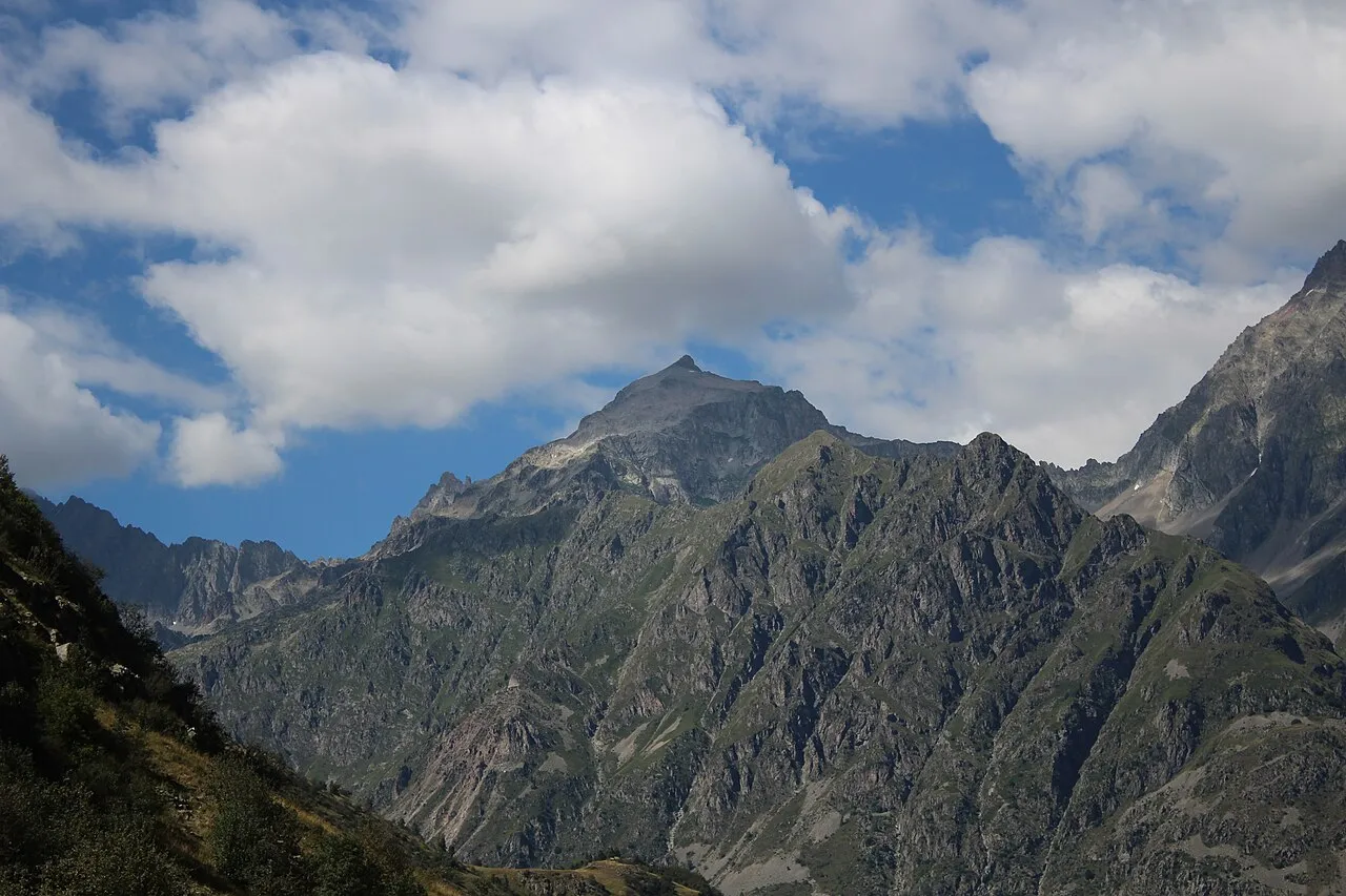
Pic Turbat Tartetatindu03 · CC BY-SA 4.0 -
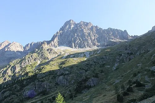
Pic des Souffles Raynaud Bannettes · CC BY-SA 4.0 -
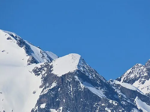
Mont Savoyat Rémih · CC BY-SA 4.0 -
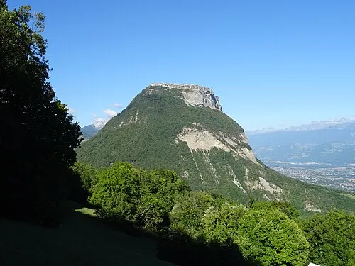
Mont Saint-Eynard Remontees · CC BY-SA 4.0 -
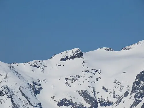
Pic de la Pyramide Rémih · CC BY-SA 4.0


Travel notes for Isère
From Wikivoyage
Isère is a department in the Auvergne-Rhône-Alpes region of France. Isère is the third-largest ski and winter destination in France, after Savoie and Haute-Savoie. It also hosts Coupe Icare, an annual festival of free flight, such as paragliding and hang-gliding, held at the world-renowned paragliding site at Lumbin. Grenoble has a dozen museums, and the European Synchrotron Radiation Facility (ESRF), an international research facility in Grenoble, that is open to visitors.
Understand+
History:
Isère is one of the original 83 departments created during the French Revolution. It was created from part of the former province of Dauphiné.
People:
Inhabitants of the department are called Isérois.
Geography:
Isère is part of the current region of Rhône-Alpes and is surrounded by the department of Rhône, Ain, Savoie, Hautes-Alpes, Drôme, Ardèche, and Loire.
Isère includes a part of the French Alps. The highest point in the department is the summit of La Meije at 3,987 meters. The Vercors Plateau dominates the west of the department.
Get in+
1 Grenoble Isère International Airport (GNB IATA).
Source: Wikivoyage · CC BY-SA 4.0 · abridged
Places bordering Isère
Population of Isère over time
| 2014 | 1,243,597 | |
|---|---|---|
| 2015 | 1,251,060 | |
| 2017 | 1,258,722 | |
| 2018 | 1,263,563 | |
| 2019 | 1,271,166 | |
| 2020 | 1,277,513 | |
| 2021 | 1,284,948 | |
| 2022 | 1,291,380 | |
| 2023 | 1,298,990 |
Censuses and official estimates; source: Wikidata.
Climate of Isère
Best months for sightseeingBest months for sightseeing: June–September.
This month · November
A wet month
Day 9° · Night 2° · Rain 117 mm
- Hottest month
- July (day 26°)
- Coldest month
- January (night -2°)
- Wettest month
- November (117 mm)
- Driest month
- July (68 mm)
Bars: average monthly low and high temperature. Below: precipitation. Monthly averages for 1970–2000 at about 18 km resolution, adjusted for elevation. Highlighted months are mild and relatively dry. Source: WorldClim 2.1 (CC BY 4.0).
Show values as a table
| Month | Jan | Feb | Mar | Apr | May | Jun | Jul | Aug | Sep | Oct | Nov | Dec |
|---|---|---|---|---|---|---|---|---|---|---|---|---|
| Average high (°C) | 5° | 7° | 10° | 13° | 18° | 22° | 26° | 25° | 21° | 15° | 9° | 6° |
| Average low (°C) | -2° | -1° | 1° | 4° | 8° | 11° | 13° | 13° | 10° | 7° | 2° | -1° |
| Precipitation (mm) | 88 | 84 | 89 | 90 | 103 | 98 | 68 | 78 | 106 | 113 | 117 | 95 |
Other places to visit in this season: June July August September
How to get to Isère
The nearest airport is Grenoble Alpes Isère Airport (GNB), 45 km to the northwest as the crow flies. For international flights: Lyon Saint-Exupéry Airport (LYS) (85 km). The nearest large city is Grenoble, 9 km to the west.
Airports
- Grenoble Alpes Isère Airport (GNB) Grenoble 45 kmnorthwest
- Chambéry Aix les Bains airport (CMF) Chambéry 53 kmnorth
- Lyon Saint-Exupéry Airport (LYS) Colombier-Saugnieu, Rhône 85 kmnorthwest
Nearby large cities
- Grenoble Population: 158.6K 9 kmwest
- Villeurbanne Population: 131.4K 100 kmnorthwest
- Lyon Population: 520.8K 101 kmnorthwest
- Saint-Etienne Population: 176.3K 117 kmwest
- Geneva Population: 201.7K 118 kmnorth
Straight-line distances; road distances are longer. Airport data: OurAirports.
Day trips from Isère
Within 100 km: 128 historic and cultural sites, 1,428 natural sites, 361 lakes, rivers and coasts.
0–25 km167 places
- Lac Mort Lake 15 kmS
- Lake Pierre-Châtel Lake 22 kmS
- Lac de Petichet Lake 21 kmS
- Lac de la Motte Lake 22 kmNE
25–60 km600 places
- St Alban Plage Beach 44 kmN
- Grande Île Island 42 kmN
- Petite Île Island 42 kmN
- Lac du Vallon Lake 26 kmSE
60–100 km1,150 places
- Clapes River 97 kmSE
- Plage de Menthon Saint Bernard Beach 82 kmN
- Plage d'Albigny Beach 86 kmN
- Plage St Jorioz Beach 80 kmN
Straight-line distances.
Places in Isère
143 placesMountains & nature3
- Sommet de l'Ailefroide · Mountain
- Tête de Lopet · Mountain
- Vallée de Graisivaudan · Natural site
Lakes, rivers & coasts20
- Ruisseau le Bréda · River
- Ruisseau le Guiers Mort · River
- Ruisseau le Pleyney · River
- Ruisseau le Suzon · River
- Ruisseau Rhéby · River
- Ruisseau Suse · River
- Sévenne · River
- Torrent Bielle · River
- Torrent de Saint-Oblas · River
- Torrent du Furon · River
- Torrent la Souloise · River
- Torrent le Rival · River
- Torrent le Veyton · River
- Valencize · River
- Valèze · River
- Varèze · River
- Véga · River
- Vénéon · River
- Vernaison · River
- Vésonne · River
Nature and heritage in Isère
Other regions in Auvergne-Rhône-Alpes


Sources & licences
Data last updated: · 2 independent sources