Arrondissement of Issoire
Located in Puy-de-Dôme, Auvergne-Rhône-Alpes Coordinates: 45°30′13″ N 2°59′00″ E
- Population
- 78,817
- 78.8K
- Elevation
- 1,147 m
- above sea level
- Local time
- UTC+01:00
- Europe/Paris · UTC+01:00
- Places inside
- 133
- listed under Arrondissement of Issoire
- Airports
- CFE Clermont-Ferrand Auvergne airport35 km
- AUR Aurillac airport81 km
About Arrondissement of Issoire
Arrondissement of Issoire is a municipality. Location: Puy-de-Dôme, Auvergne-Rhône-Alpes. Population: 78,817. Elevation: 1,147 m. The best months to visit are July–August. The nearest airport is Clermont-Ferrand Auvergne airport (35 km). Nearby sights include Ruisseau du Sault and Ruisseau de la Couze.
Photos of Arrondissement of Issoire
-
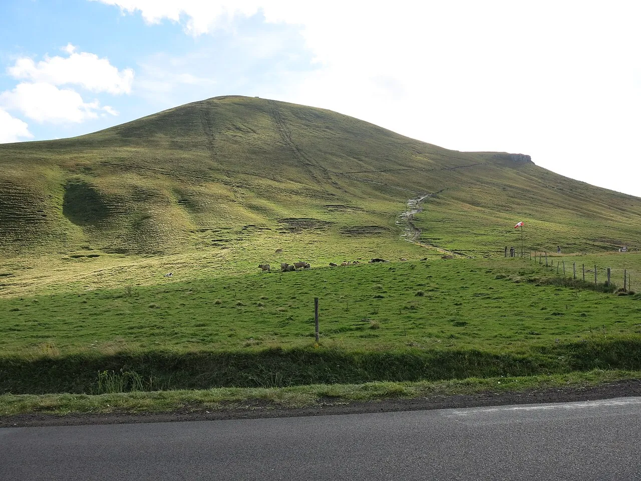
Puy de la Tache Tangopaso · Public domain -
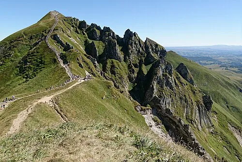
Puy de Sancy Marie-Lan Nguyen · CC BY 4.0 -
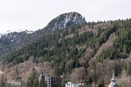
Le Capucin Pymouss · CC BY-SA 4.0 -
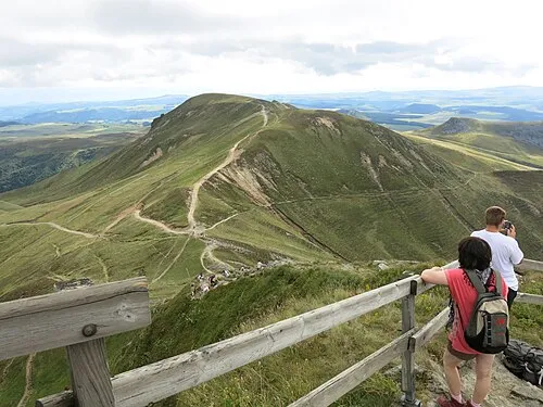
Puy Ferrand Tangopaso · Public domain -
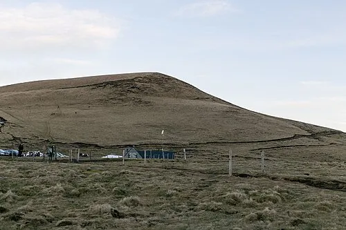
Puy de la Croix Morand Pymouss · CC BY-SA 4.0


Climate of Arrondissement of Issoire
Best months for sightseeingBest months for sightseeing: July–August.
This month · November
A cold month
Day 7° · Night -1° · Rain 78 mm
- Hottest month
- July (day 20°)
- Coldest month
- January (night -4°)
- Wettest month
- May (103 mm)
- Driest month
- March (58 mm)
Bars: average monthly low and high temperature. Below: precipitation. Monthly averages for 1970–2000 at about 18 km resolution, adjusted for elevation. Highlighted months are mild and relatively dry. Source: WorldClim 2.1 (CC BY 4.0).
Show values as a table
| Month | Jan | Feb | Mar | Apr | May | Jun | Jul | Aug | Sep | Oct | Nov | Dec |
|---|---|---|---|---|---|---|---|---|---|---|---|---|
| Average high (°C) | 3° | 4° | 7° | 9° | 14° | 17° | 20° | 20° | 17° | 12° | 7° | 4° |
| Average low (°C) | -4° | -3° | -2° | 0° | 4° | 7° | 9° | 9° | 7° | 4° | -1° | -3° |
| Precipitation (mm) | 72 | 63 | 58 | 73 | 103 | 90 | 67 | 83 | 86 | 92 | 78 | 75 |
How to get to Arrondissement of Issoire
The nearest airport is Clermont-Ferrand Auvergne airport (CFE), 35 km to the northeast as the crow flies. The nearest large city is Clermont-Ferrand, 32 km to the north.
Airports
- Clermont-Ferrand Auvergne airport (CFE) Clermont-Ferrand 35 kmnortheast
- Aurillac airport (AUR) Aurillac 81 kmsouthwest
- Rodez–Aveyron Airport (RDZ) Rodez/Marcillac 128 kmsouth
Nearby large cities
- Clermont-Ferrand Population: 147.9K 32 kmnorth
- Saint-Etienne Population: 176.3K 110 kmeast
- Limoges Population: 141.2K 140 kmwest
- Lyon Population: 520.8K 148 kmeast
- Villeurbanne Population: 131.4K 151 kmeast
Straight-line distances; road distances are longer. Airport data: OurAirports.
Day trips from Arrondissement of Issoire
Within 100 km: 157 historic and cultural sites, 539 natural sites, 250 lakes, rivers and coasts.
0–25 km133 places
- Lac de Servière Lake 19 kmNW
- Lac Pavin Lake 7 kmW
- Lac de Montcineyre Lake 8 kmSW
- Lac de la Landie Lake 19 kmSW
25–60 km289 places
- Étang de Tix Lake 53 kmNW
- Lac de Tazenat Lake 53 kmN
- Étang de la Ramade Lake 54 kmNW
- Étang Neuf Lake 59 kmNW
60–100 km524 places
- Puy Bien Mountain 61 kmNE
- Vassivière Island 93 kmW
- Ancien îlot Gambetta Island 77 kmSW
- Étang de Taysse Lake 88 kmW
Straight-line distances.
Arrondissement of Issoire and similar cities
Side by side with cities of similar size in the same country: population, elevation and climate.
| Measure | Arrondissement of Issoire | La Rochelle | Pau | Créteil |
|---|---|---|---|---|
| Population | 78.8K | 76.8K | 82.7K | 84.8K |
| Elevation | 1,147 m | 13 m | 219 m | 49 m |
| Summer day (hottest month) | 20° | 25° | 25° | 25° |
| Winter night (coldest month) | -4° | 3° | 4° | 2° |
| Annual rainfall | 940 mm | 769 mm | 1,304 mm | 632 mm |
| Best months | Jul–Aug | Jun–Sep | Jun–Sep | May–Sep |
| Distance | — | 330 km | 361 km | 368 km |
Climate values are 1970–2000 monthly averages; straight-line distance.
Places in Arrondissement of Issoire
133 places- 1 Issoire 14.7K
- 2 Brassac-les-Mines 3.3K
- 3 Auzat-la-Combelle 2.1K
- 4 Saint-Germain-Lembron 2K
- 5 La Bourboule 1.8K
- 6 Plauzat 1.6K
- 7 Besse-et-Saint-Anastaise 1.5K
- 8 Champeix 1.3K
- 9 Mont-Dore 1.3K
- 10 Sauxillanges 1.2K
- 11 Coudes 1.2K
- 12 Saint-Sauves-d'Auvergne 1.1K
- 13 Le Breuil-sur-Couze 1.1K
- 14 Gelles 965
- 15 Saint-Babel 949
- 16 Aulhat-Flat 908
- 17 Charbonnier-les-Mines 896
- 18 Perrier 893
- 19 Rochefort-Montagne 876
- 20 Montaigut-le-Blanc 860
- 21 Parent 841
- 22 Orbeil 839
- 23 Nébouzat 834
- 24 Neschers 832
- 25 Le Vernet-Chaméane 826
- 26 Tauves 787
- 27 Olby 778
- 28 Saint-Nectaire 728
- 29 Mazaye 727
- 30 Ceyssat 692
- 31 Le Broc 678
- 32 Lamontgie 652
- 33 La Tour-d'Auvergne 644
- 34 Jumeaux 640
- 35 Brenat 617
- 36 Sugères 607
- 37 Saint-Yvoine 589
- 38 Murol 587
- 39 Saint-Rémy-de-Chargnat 568
- 40 Nonette-Orsonnette 563
- 41 Ardes 538
- 42 Parentignat 523
- 43 Meilhaud 515
- 44 Les Deux-Rives 509
- 45 Solignat 491
- 46 Ludesse 485
- 47 Sauvagnat-Sainte-Marthe 482
- 48 Murat-le-Quaire 476
- 49 Saint-Diéry 476
- 50 Saint-Bonnet-près-Orcival 474
- 51 Saint-Pierre-Roche 447
- 52 Beaulieu 442
- 53 Bagnols 440
- 54 Perpezat 427
- 55 Chadeleuf 425
- 56 Vernines 423
- 57 Chambon-sur-Lac 410
- 58 Saint-Vincent 410
- 59 Antoingt 392
- 60 Moriat 367
Bar: population relative to the most populous place in this list.
Nearby attractions & nature
Everything nearby-
Ruisseau du Sault River, Puy-de-Dôme3.2 km E
-
Ruisseau de la Couze River, Puy-de-Dôme5.4 km NE
-
Couze River, Puy-de-Dôme5.5 km NE
-
Lac de Bourdouze Lake, Puy-de-Dôme5.9 km SW
-
Ruisseau Fredet River, Puy-de-Dôme7.1 km N
-
Lac Pavin Lake, Puy-de-Dôme7.5 km W
-
Lac de Montcineyre Lake, Puy-de-Dôme8.4 km SW
-
Lac de Chambon Lake, Puy-de-Dôme8.9 km NW
Sources & licences
Data last updated: