Arrondissement of Riom
Located in Puy-de-Dôme, Auvergne-Rhône-Alpes Coordinates: 45°58′47″ N 2°50′47″ E
- Population
- 137,711
- 137.7K
- Elevation
- 521 m
- above sea level
- Local time
- UTC+01:00
- Europe/Paris · UTC+01:00
- Places inside
- 155
- listed under Arrondissement of Riom
- Airports
- CFE Clermont-Ferrand Auvergne airport33 km
- AUR Aurillac airport125 km
About Arrondissement of Riom
Arrondissement of Riom is a municipality. Location: Puy-de-Dôme, Auvergne-Rhône-Alpes. Population: 137,711. Elevation: 521 m. The best months to visit are June–September. The nearest airport is Clermont-Ferrand Auvergne airport (33 km). Nearby sights include Ruisseau Morgon and Ruisseau Chalamont.
Photos of Arrondissement of Riom
-
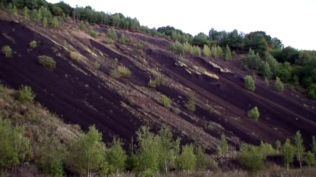
Puy de la Nugère Nord Fcarcena01 · CC BY-SA 3.0 -
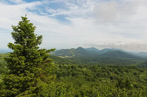
Puy de la Coquille Sud Another one of my pictures: This photograph was taken by Medium69 · CC BY-SA 4.0 -
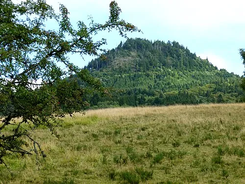
Puy Chopine Gegeours · CC BY-SA 3.0 -
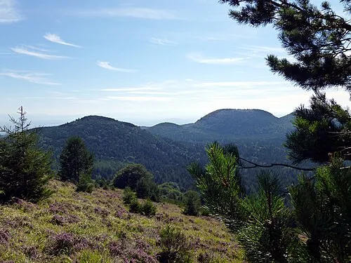
Puy de Chaumont Gegeours · CC BY-SA 3.0 -
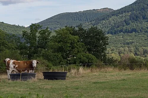
Puy de Jume Pymouss · CC BY-SA 4.0


Climate of Arrondissement of Riom
Best months for sightseeingBest months for sightseeing: June–September.
This month · November
A cold month
Day 10° · Night 3° · Rain 61 mm
- Hottest month
- August (day 24°)
- Coldest month
- January (night 0°)
- Wettest month
- May (91 mm)
- Driest month
- March (45 mm)
Bars: average monthly low and high temperature. Below: precipitation. Monthly averages for 1970–2000 at about 18 km resolution, adjusted for elevation. Highlighted months are mild and relatively dry. Source: WorldClim 2.1 (CC BY 4.0).
Show values as a table
| Month | Jan | Feb | Mar | Apr | May | Jun | Jul | Aug | Sep | Oct | Nov | Dec |
|---|---|---|---|---|---|---|---|---|---|---|---|---|
| Average high (°C) | 7° | 8° | 11° | 13° | 18° | 21° | 24° | 24° | 20° | 16° | 10° | 7° |
| Average low (°C) | 0° | 0° | 2° | 4° | 8° | 11° | 13° | 13° | 10° | 7° | 3° | 1° |
| Precipitation (mm) | 54 | 48 | 45 | 58 | 91 | 83 | 63 | 82 | 77 | 72 | 61 | 58 |
Other places to visit in this season: June July August September
How to get to Arrondissement of Riom
The nearest airport is Clermont-Ferrand Auvergne airport (CFE), 33 km to the southeast as the crow flies. The nearest large city is Clermont-Ferrand, 29 km to the southeast.
Airports
- Clermont-Ferrand Auvergne airport (CFE) Clermont-Ferrand 33 kmsoutheast
- Aurillac airport (AUR) Aurillac 125 kmsouth
- Limoges Airport (LIG) Limoges/Bellegarde 130 kmwest
Nearby large cities
- Clermont-Ferrand Population: 147.9K 29 kmsoutheast
- Limoges Population: 141.2K 125 kmwest
- Saint-Etienne Population: 176.3K 135 kmsoutheast
- Lyon Population: 520.8K 158 kmeast
- Villeurbanne Population: 131.4K 160 kmeast
Straight-line distances; road distances are longer. Airport data: OurAirports.
Day trips from Arrondissement of Riom
Within 100 km: 90 historic and cultural sites, 440 natural sites, 244 lakes, rivers and coasts.
0–25 km61 places
- Lac de Tazenat Lake 11 kmE
- Étang Neuf Lake 23 kmW
- L'Étang Grand Lake 11 kmSE
- Étang de Chancelade Lake 18 kmW
25–60 km261 places
- Étang de Tix Lake 29 kmSW
- Lac de Servière Lake 37 kmS
- Étang de la Ramade Lake 39 kmSW
- Étang de Pinaud Lake 50 kmW
60–100 km452 places
- Puy Bien Mountain 70 kmE
- Vassivière Island 79 kmW
- Étang de Saint-Bonnet Lake 76 kmN
- Étang du Pondy Lake 92 kmN
Straight-line distances.
Arrondissement of Riom and similar cities
Side by side with cities of similar size in the same country: population, elevation and climate.
| Measure | Arrondissement of Riom | Paris 12 Reuilly | Paris 11 Popincourt | Paris 14 Observatoire |
|---|---|---|---|---|
| Population | 137.7K | 138K | 138.2K | 136.5K |
| Elevation | 521 m | 46 m | 43 m | 70 m |
| Summer day (hottest month) | 24° | 25° | 25° | 25° |
| Winter night (coldest month) | 0° | 2° | 2° | 2° |
| Annual rainfall | 792 mm | 641 mm | 641 mm | 643 mm |
| Best months | Jun–Sep | May–Sep | May–Sep | Jun–Sep |
| Distance | — | 320 km | 322 km | 320 km |
Climate values are 1970–2000 monthly averages; straight-line distance.
Places in Arrondissement of Riom
155 places- 1 Riom 19K
- 2 Châtel-Guyon 6.2K
- 3 Volvic 4.4K
- 4 Mozac 3.9K
- 5 Saint-Éloy-les-Mines 3.7K
- 6 Maringues 3.1K
- 7 Aigueperse 2.7K
- 8 Ennezat 2.5K
- 9 Sayat 2.3K
- 10 Combronde 2.2K
- 11 Les Martres-d'Artière 2.2K
- 12 Saint-Bonnet-près-Riom 2.1K
- 13 Saint-Beauzire 2.1K
- 14 Saint-Georges-de-Mons 2K
- 15 Chambaron sur Morge 1.7K
- 16 Charbonnières-les-Varennes 1.7K
- 17 Saint-Ours 1.7K
- 18 Chappes 1.7K
- 19 Ménétrol 1.6K
- 20 Randan 1.6K
- 21 Les Ancizes-Comps 1.6K
- 22 Enval 1.5K
- 23 Manzat 1.4K
- 24 Saint-Gervais-d'Auvergne 1.3K
- 25 Marsat 1.3K
- 26 Loubeyrat 1.3K
- 27 Beauregard-Vendon 1.2K
- 28 Malauzat 1.1K
- 29 Malintrat 1.1K
- 30 Effiat 1.1K
- 31 Luzillat 1.1K
- 32 Pionsat 1.1K
- 33 Chapdes-Beaufort 1.1K
- 34 Charbonnières-les-Vieilles 1.1K
- 35 Saint-Sylvestre-Pragoulin 1.1K
- 36 Messeix 1K
- 37 Montaigut-en-Combraille 987
- 38 Bromont-Lamothe 974
- 39 Chanat-la-Mouteyre 948
- 40 Thuret 925
- 41 Lussat 919
- 42 Youx 918
- 43 Artonne 890
- 44 Aubiat 882
- 45 Saint-Ignat 880
- 46 Bourg-Lastic 877
- 47 Saint-Priest-Bramefant 868
- 48 Giat 826
- 49 Pontgibaud 755
- 50 Limons 739
- 51 Saint-Priest-des-Champs 718
- 52 Martres-sur-Morge 667
- 53 Pontaumur 659
- 54 Pessat-Villeneuve 656
- 55 Entraigues 655
- 56 Saint-Laure 647
- 57 Le Cheix-sur-Morge 641
- 58 La Goutelle 622
- 59 Davayat 603
- 60 Surat 567
Bar: population relative to the most populous place in this list.
Nearby attractions & nature
Everything nearby-
Ruisseau Morgon River, Puy-de-Dôme5.5 km E
-
Ruisseau Chalamont River, Puy-de-Dôme5.8 km W
-
Sioulet River, Puy-de-Dôme8.4 km SW
-
Lac de Tazenat Lake, Puy-de-Dôme11 km E
-
L'Étang Grand Lake, Puy-de-Dôme11 km SE
-
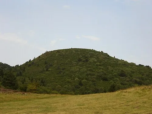 Le Petit Suchet Mountain, Orcines23 km SE
-
Monts Dômes Mountain, Puy-de-Dôme25 km S
-
Bois de Pionsat Natural site, Puy-de-Dôme14 km NW
Sources & licences
Data last updated: