Arrondissement of Lyon
Located in Rhône, Auvergne-Rhône-Alpes Coordinates: 45°44′02″ N 4°49′47″ E
- Population
- 1,648,903
- 1.6M
- Elevation
- 166 m
- above sea level
- Local time
- UTC+01:00
- Europe/Paris · UTC+01:00
- Places inside
- 134
- listed under Arrondissement of Lyon
- Airports
- LYS Lyon Saint-Exupéry Airport20 km
- GNB Grenoble Alpes Isère Airport57 km
About Arrondissement of Lyon
Arrondissement of Lyon is a municipality. Location: Rhône, Auvergne-Rhône-Alpes. Population: 1,648,903. Elevation: 166 m. The best months to visit are May–September. The nearest airport is Lyon Saint-Exupéry Airport (20 km). Nearby sights include Saône and Yzeron.
Photos of Arrondissement of Lyon
-
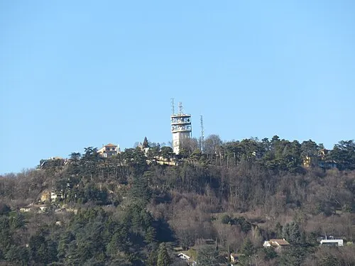
Mont Cindre Sebleouf · CC BY-SA 4.0 -
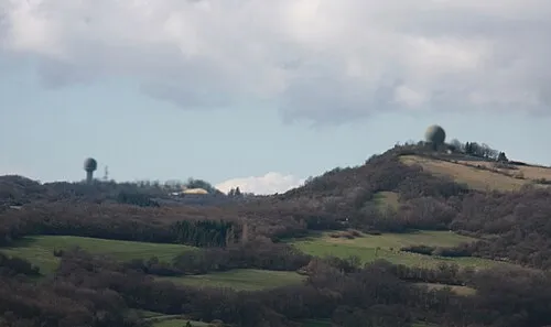
Mont Verdun Otourly · CC BY-SA 3.0 -
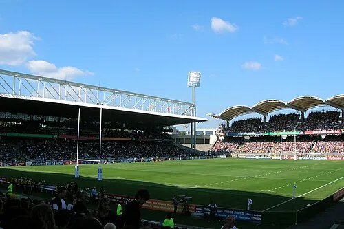
Stade de Gerland TwoWings · Public domain


Climate of Arrondissement of Lyon
Best months for sightseeingBest months for sightseeing: May–September.
This month · November
A cold month
Day 11° · Night 4° · Rain 72 mm
- Hottest month
- July (day 27°)
- Coldest month
- January (night 1°)
- Wettest month
- October (89 mm)
- Driest month
- February (50 mm)
Bars: average monthly low and high temperature. Below: precipitation. Monthly averages for 1970–2000 at about 18 km resolution, adjusted for elevation. Highlighted months are mild and relatively dry. Source: WorldClim 2.1 (CC BY 4.0).
Show values as a table
| Month | Jan | Feb | Mar | Apr | May | Jun | Jul | Aug | Sep | Oct | Nov | Dec |
|---|---|---|---|---|---|---|---|---|---|---|---|---|
| Average high (°C) | 7° | 9° | 13° | 15° | 20° | 24° | 27° | 27° | 22° | 17° | 11° | 8° |
| Average low (°C) | 1° | 2° | 4° | 6° | 10° | 14° | 16° | 16° | 12° | 9° | 4° | 2° |
| Precipitation (mm) | 54 | 50 | 54 | 70 | 85 | 80 | 62 | 70 | 87 | 89 | 72 | 56 |
Other places to visit in this season: May June July August September
How to get to Arrondissement of Lyon
The nearest airport is Lyon Saint-Exupéry Airport (LYS), 20 km to the east as the crow flies. The nearest large city is Lyon, 2 km to the northeast.
Airports
- Lyon Saint-Exupéry Airport (LYS) Colombier-Saugnieu, Rhône 20 kmeast
- Grenoble Alpes Isère Airport (GNB) Grenoble 57 kmsoutheast
- Chambéry Aix les Bains airport (CMF) Chambéry 83 kmeast
Nearby large cities
- Lyon Population: 520.8K 2 kmnortheast
- Villeurbanne Population: 131.4K 5 kmnortheast
- Saint-Etienne Population: 176.3K 48 kmsouthwest
- Grenoble Population: 158.6K 93 kmsoutheast
- Geneva Population: 201.7K 114 kmnortheast
Straight-line distances; road distances are longer. Airport data: OurAirports.
Day trips from Arrondissement of Lyon
Within 100 km: 175 historic and cultural sites, 645 natural sites, 269 lakes, rivers and coasts.
0–25 km90 places
- Parc de la Tête d'Or Natural site 5 kmN
- Mont d'Or Mountain 13 kmN
- Monts du Lyonnais Mountain 25 kmW
- Bois Saillard Natural site 21 kmN
25–60 km326 places
- Étang des Vavres Lake 43 kmNE
- Étang de Tabouret Lake 44 kmE
- Lac de Save Lake 49 kmE
- Étang de Ry Lake 35 kmE
60–100 km673 places
- Puy Bien Mountain 89 kmW
- Bois Dieu Natural site 79 kmNW
- Laire River 100 kmNE
- St Alban Plage Beach 78 kmE
Straight-line distances.
Arrondissement of Lyon and similar cities
Side by side with cities of similar size in the same country: population, elevation and climate.
| Measure | Arrondissement of Lyon | Paris | Marseille |
|---|---|---|---|
| Population | 1.6M | 2.1M | 877.2K |
| Elevation | 166 m | 42 m | 28 m |
| Summer day (hottest month) | 27° | 25° | 29° |
| Winter night (coldest month) | 1° | 2° | 5° |
| Annual rainfall | 829 mm | 641 mm | 602 mm |
| Best months | May–Sep | May–Sep | May–Jun, Sep–Oct |
| Distance | — | 394 km | 274 km |
Climate values are 1970–2000 monthly averages; straight-line distance.
Places in Arrondissement of Lyon
134 places- 1 Lyon 515.7K
- 2 Villeurbanne 149K
- 3 Vénissieux 65.4K
- 4 Vaulx-en-Velin 48.5K
- 5 Saint-Priest 45.8K
- 6 Caluire-et-Cuire 42.9K
- 7 Bron 41.1K
- 8 Meyzieu 33K
- 9 Rillieux-la-Pape 29.9K
- 10 Décines-Charpieu 27.9K
- 11 Oullins-Pierre-Bénite 26.5K
- 12 Tassin-la-Demi-Lune 22.4K
- 13 Sainte-Foy-lès-Lyon 22K
- 14 Saint-Genis-Laval 21.5K
- 15 Givors 19.3K
- 16 Saint-Fons 18.6K
- 17 Écully 18.1K
- 18 Francheville 14.3K
- 19 Mions 13.2K
- 20 Genas 12.6K
- 21 Brignais 11.3K
- 22 Corbas 11.2K
- 23 Craponne 11.2K
- 24 Chassieu 10.2K
- 25 Feyzin 9.9K
- 26 Grigny-sur-Rhône 9.6K
- 27 Dardilly 8.6K
- 28 Irigny 8.6K
- 29 Chaponost 8.6K
- 30 Neuville-sur-Saône 7.4K
- 31 Fontaines-sur-Saône 7K
- 32 Saint-Bonnet-de-Mure 6.8K
- 33 Saint-Didier-au-Mont-d'Or 6.6K
- 34 La Mulatière 6.3K
- 35 Brindas 6.1K
- 36 Sathonay-Camp 5.9K
- 37 Jonage 5.8K
- 38 Mornant 5.7K
- 39 Saint-Symphorien-d'Ozon 5.7K
- 40 Grézieu-la-Varenne 5.6K
- 41 Champagne-au-Mont-d'Or 5.6K
- 42 Vaugneray 5.6K
- 43 Saint-Cyr-au-Mont-d'Or 5.5K
- 44 Genay 5.4K
- 45 Ternay 5.4K
- 46 Saint-Laurent-de-Mure 5.4K
- 47 Charbonnières-les-Bains 5K
- 48 Saint-Genis-les-Ollières 4.9K
- 49 Vernaison 4.9K
- 50 Charly 4.5K
- 51 Saint-Pierre-de-Chandieu 4.5K
- 52 Soucieu-en-Jarrest 4.5K
- 53 Millery 4.3K
- 54 Chaponnay 4.2K
- 55 Communay 4.2K
- 56 Chabanière 4.2K
- 57 Pusignan 4.1K
- 58 La Tour-de-Salvagny 4.1K
- 59 Collonges-au-Mont-d'Or 4.1K
- 60 Beauvallon 4K
Bar: population relative to the most populous place in this list.
Nearby attractions & nature
Everything nearby-
Saône River, Rhône1.2 km SW
-
Yzeron River, Rhône5 km W
-
Ruisseau de Ponterle River, Rhône5.2 km W
-
Ruisseau le Furon River, Rhône9.3 km SW
-
Ruisseau l'Ozon River, Rhône11 km S
-
Ruisseau Luine River, Rhône12 km S
-
Merdanson River, Rhône13 km SW
-
Mornantay River, Rhône15 km S
Sources & licences
Data last updated: