Allinges
Located in Arrondissement of Thonon-les-Bains, Upper Savoy Coordinates: 46°20′06″ N 6°27′48″ E
- Population
- 4,433
- 4.4K
- Elevation
- 544 m
- above sea level
- Local time
- UTC+01:00
- Europe/Paris · UTC+01:00
- Places inside
- 5
- listed under Allinges
- Airports
- GVA Geneva International Airport29 km
- NCY Annecy Meythet airport53 km
About Allinges
Allinges is a village. Location: Arrondissement of Thonon-les-Bains, Upper Savoy. Population: 4,433. Elevation: 544 m. The best months to visit are June–August. The nearest airport is Geneva International Airport (29 km). Nearby sights include Abbaye du Petit-Lieu and Basilique Saint-François-de-Sales.
Photos of Allinges
-
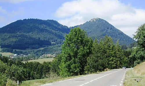
Mont Forchat Claude PIARD · CC BY-SA 4.0

Climate of Allinges
Best months for sightseeingBest months for sightseeing: June–August.
This month · November
A cold month
Day 8° · Night 2° · Rain 96 mm
- Hottest month
- July (day 24°)
- Coldest month
- January (night -1°)
- Wettest month
- June (111 mm)
- Driest month
- March (72 mm)
Bars: average monthly low and high temperature. Below: precipitation. Monthly averages for 1970–2000 at about 18 km resolution, adjusted for elevation. Highlighted months are mild and relatively dry. Source: WorldClim 2.1 (CC BY 4.0).
Show values as a table
| Month | Jan | Feb | Mar | Apr | May | Jun | Jul | Aug | Sep | Oct | Nov | Dec |
|---|---|---|---|---|---|---|---|---|---|---|---|---|
| Average high (°C) | 4° | 6° | 9° | 12° | 17° | 20° | 24° | 23° | 19° | 14° | 8° | 5° |
| Average low (°C) | -1° | -1° | 1° | 4° | 8° | 11° | 13° | 13° | 10° | 7° | 2° | 0° |
| Precipitation (mm) | 82 | 81 | 72 | 78 | 91 | 111 | 89 | 87 | 102 | 99 | 96 | 90 |
How to get to Allinges
The nearest airport is Geneva International Airport (GVA), 29 km to the west as the crow flies. The nearest large city is Lausanne, 24 km to the northeast.
Airports
- Geneva International Airport (GVA) Geneva 29 kmwest
- Annecy Meythet airport (NCY) Annecy 53 kmsouthwest
- Chambéry Aix les Bains airport (CMF) Chambéry 90 kmsouthwest
Nearby large cities
- Lausanne Population: 139.1K 24 kmnortheast
- Geneva Population: 201.7K 29 kmsouthwest
- Bern Population: 121.6K 102 kmnortheast
- Besançon Population: 128.4K 107 kmnorth
- Villeurbanne Population: 131.4K 138 kmsouthwest
Straight-line distances; road distances are longer. Airport data: OurAirports.
Day trips from Allinges
Within 100 km: 157 historic and cultural sites, 2,678 natural sites, 433 lakes, rivers and coasts.
0–25 km125 places
- Lake Leman Lake 11 kmN
- Lac Aubonne Lake 22 kmN
- Le Léman Lake 16 kmN
- Signal de Bougy Mountain 19 kmNW
25–60 km1,109 places
- Ile de Salagnon Island 34 kmE
- Lac de Joux Lake 37 kmN
- Lac de Fully Lake 52 kmE
- Lac de Derborence Lake 58 kmE
60–100 km2,034 places
- Sankt Petersinsel Island 97 kmNE
- Ile d'Ogoz Island 63 kmNE
- Lake Wohlen Lake 96 kmNE
- Schwarzsee Lake 73 kmNE
Straight-line distances.
Places in Allinges
5 placesBar: population relative to the most populous place in this list.
Cities & villages4
- Commelinges · Village
- Les Bougeries · Village
- Mésinges · Village
- Noyer · Village
Nearby attractions & nature
Everything nearby-
Abbaye du Petit-Lieu Historic site, Perrignier3.6 km SW
-
Basilique Saint-François-de-Sales Attraction, Thonon-les-Bains4.4 km N
-
Mont d'Hermon Mountain, Lyaud5.7 km E
-
Mont Forchat Mountain, Lullin7.1 km S
-
Forêt de Planbois Natural site, Upper Savoy5.5 km SW
-
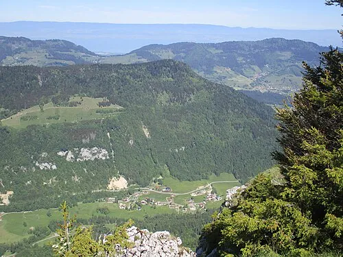 Les Trables Mountain, Lullin8.5 km SE
Sources & licences
Data last updated: