Arrondissement of Lure
Located in Haute-Saône, Bourgogne-Franche-Comté Coordinates: 47°45′45″ N 6°27′15″ E
- Population
- 106,255
- 106.3K
- Elevation
- 306 m
- above sea level
- Local time
- UTC+01:00
- Europe/Paris · UTC+01:00
- Places inside
- 190
- listed under Arrondissement of Lure
- Airports
- BSL EuroAirport Basel–Mulhouse–Freiburg82 km
- DLE Dole Tavaux Airport112 km
About Arrondissement of Lure
Arrondissement of Lure is a municipality. Location: Haute-Saône, Bourgogne-Franche-Comté. Population: 106,255. Elevation: 306 m. The best months to visit are May–September. The nearest airport is EuroAirport Basel–Mulhouse–Freiburg (82 km). Nearby sights include Bois des Franches Communes and Breuchin.
Photos of Arrondissement of Lure
-
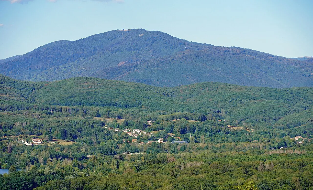
La Planche des Belles Filles A.BourgeoisP · CC BY-SA 4.0 -
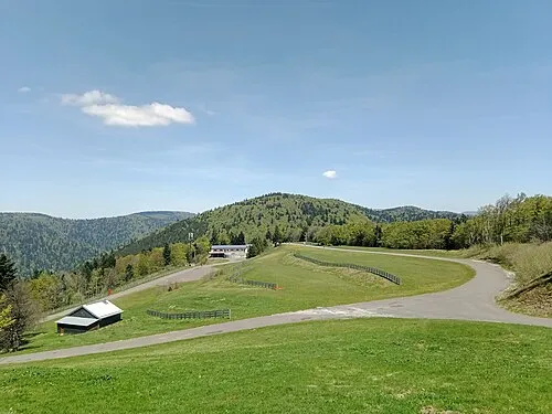
Ballon Saint-Antoine Rémih · CC BY-SA 4.0 -
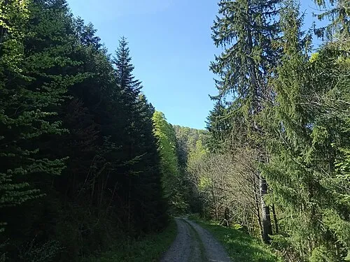
Tête des Fougères Rémih · CC BY-SA 4.0 -
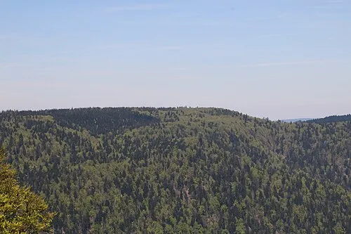
Plateau de Bravouse Rémih · CC BY-SA 4.0 -
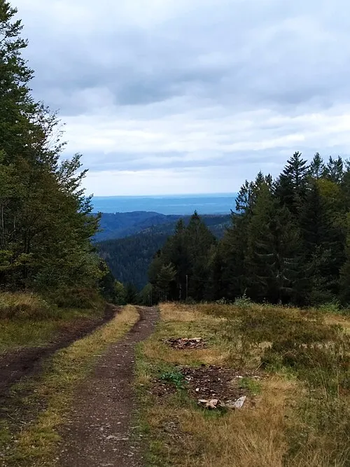
Le Ballon PARMENTIER Sébastien · CC BY-SA 4.0


Climate of Arrondissement of Lure
Best months for sightseeingBest months for sightseeing: May–September.
This month · November
A wet month
Day 9° · Night 1° · Rain 103 mm
- Hottest month
- July (day 25°)
- Coldest month
- January (night -2°)
- Wettest month
- December (105 mm)
- Driest month
- March (75 mm)
Bars: average monthly low and high temperature. Below: precipitation. Monthly averages for 1970–2000 at about 18 km resolution, adjusted for elevation. Highlighted months are mild and relatively dry. Source: WorldClim 2.1 (CC BY 4.0).
Show values as a table
| Month | Jan | Feb | Mar | Apr | May | Jun | Jul | Aug | Sep | Oct | Nov | Dec |
|---|---|---|---|---|---|---|---|---|---|---|---|---|
| Average high (°C) | 5° | 7° | 11° | 14° | 19° | 22° | 25° | 25° | 20° | 15° | 9° | 5° |
| Average low (°C) | -2° | -2° | 1° | 3° | 8° | 11° | 13° | 12° | 9° | 5° | 1° | -1° |
| Precipitation (mm) | 90 | 83 | 75 | 75 | 94 | 96 | 84 | 75 | 86 | 92 | 103 | 105 |
Other places to visit in this season: May June July August September
How to get to Arrondissement of Lure
The nearest airport is EuroAirport Basel–Mulhouse–Freiburg (BSL), 82 km to the east as the crow flies. The nearest large city is Mulhouse, 66 km to the east.
Airports
- EuroAirport Basel–Mulhouse–Freiburg (BSL) Bâle / Mulhouse 82 kmeast
- Dole Tavaux Airport (DLE) Dole 112 kmsouthwest
- Strasbourg Airport (SXB) Strasbourg 123 kmnortheast
Nearby large cities
- Mulhouse Population: 111.4K 66 kmeast
- Besançon Population: 128.4K 66 kmsouthwest
- Basel Population: 177.6K 87 kmeast
- Nancy Population: 105.1K 104 kmnorth
- Freiburg im Breisgau Population: 237.5K 108 kmeast
Straight-line distances; road distances are longer. Airport data: OurAirports.
Day trips from Arrondissement of Lure
Within 100 km: 290 historic and cultural sites, 756 natural sites, 187 lakes, rivers and coasts.
0–25 km28 places
- Mont Jarroz Mountain 9 kmSW
- Les Bois de Saulnot Natural site 23 kmSE
- Forêt de Saint-Antoine Natural site 24 kmE
- Bois du Rey Natural site 20 kmN
25–60 km366 places
- Pisciculture Lake 59 kmSE
- Pisciculture Lake 59 kmSE
- La Faulx d'Enson Mountain 58 kmSE
- Préhisto-Parc de Réclère Natural site 57 kmSE
60–100 km839 places
- Sankt Petersinsel Island 93 kmSE
- Lake Neuchâtel Lake 98 kmS
- Lake Biel Lake 93 kmSE
- Häftli Lake 96 kmSE
Straight-line distances.
Arrondissement of Lure and similar cities
Side by side with cities of similar size in the same country: population, elevation and climate.
| Measure | Arrondissement of Lure | Nancy | Boulogne-Billancourt | Caen |
|---|---|---|---|---|
| Population | 106.3K | 105.1K | 108.8K | 110.6K |
| Elevation | 306 m | 212 m | 35 m | 21 m |
| Summer day (hottest month) | 25° | 24° | 25° | 23° |
| Winter night (coldest month) | -2° | -1° | 2° | 3° |
| Annual rainfall | 1,058 mm | 789 mm | 632 mm | 754 mm |
| Best months | May–Sep | Jun–Sep | May–Sep | Jun–Sep |
| Distance | — | 104 km | 335 km | 528 km |
Climate values are 1970–2000 monthly averages; straight-line distance.
Places in Arrondissement of Lure
190 places- 121 Granges-la-Ville 189
- 122 Corravillers 188
- 123 Verlans 183
- 124 Secenans 179
- 125 La Villedieu-en-Fontenette 175
- 126 Genevreuille 169
- 127 Magnivray 169
- 128 Amont-et-Effreney 166
- 129 Sainte-Marie-en-Chaux 165
- 130 Montessaux 164
- 131 Écromagny 156
- 132 Aillevans 154
- 133 Mélecey 149
- 134 Ainvelle 148
- 135 Belverne 145
- 136 Cuve 145
- 137 La Proiselière-et-Langle 145
- 138 La Voivre 144
- 139 Anjeux 143
- 140 Villers-la-Ville 142
- 141 Les Fessey 139
- 142 Les Magny 139
- 143 Fontenois-la-Ville 136
- 144 Belmont 135
- 145 Villers-sur-Saulnot 135
- 146 Saint-Sulpice 133
- 147 Bassigney 132
- 148 Fleurey-lès-Saint-Loup 132
- 149 Linexert 131
- 150 Courmont 129
- 151 Longevelle 128
- 152 Châtenois 127
- 153 Servigney 124
- 154 Villargent 122
- 155 Francalmont 121
- 156 La Vergenne 120
- 157 Betoncourt-lès-Brotte 119
- 158 Alaincourt 116
- 159 Rignovelle 110
- 160 Magny-Jobert 109
- 161 Pont-du-Bois 109
- 162 La Corbière 106
- 163 Esmoulières 96
- 164 Autrey-le-Vay 90
- 165 Beveuge 83
- 166 Belfahy 80
- 167 La Rosière 80
- 168 Saint-Ferjeux 78
- 169 Ambiévillers 75
- 170 La Creuse 75
- 171 Montdoré 72
- 172 Plainemont 70
- 173 Pont-sur-l'Ognon 69
- 174 Ormoiche 66
- 175 Grammont 64
- 176 Le Val-de-Gouhenans 64
- 177 Châteney 59
- 178 Creveney 59
- 179 Beulotte-Saint-Laurent 58
- 180 Oppenans 56
Bar: population relative to the most populous place in this list.
Nearby attractions & nature
Everything nearby-
Bois des Franches Communes Natural site, Haute-Saône5.2 km S
-
Breuchin River, Haute-Saône13 km W
-
Bois de Conflans Natural site, Haute-Saône16 km W
-
Forêt de Saint-Antoine Natural site, Haute-Saône24 km E
-
Bois de Nan Natural site, Haute-Saône25 km SE
-
Forêt de Grange Natural site, Haute-Saône22 km SE
-
Combeauté River, Haute-Saône19 km NW
-
Bois du Lyaumont Natural site, Haute-Saône25 km NW
Sources & licences
Data last updated: