Arrondissement of Saint-Claude
Located in Jura, Bourgogne-Franche-Comté Coordinates: 46°27′06″ N 5°52′45″ E
- Population
- 48,083
- 48.1K
- Elevation
- 480 m
- above sea level
- Local time
- UTC+01:00
- Europe/Paris · UTC+01:00
- Places inside
- 55
- listed under Arrondissement of Saint-Claude
- Airports
- GVA Geneva International Airport30 km
- NCY Annecy Meythet airport61 km
About Arrondissement of Saint-Claude
Arrondissement of Saint-Claude is a municipality. Location: Jura, Bourgogne-Franche-Comté. Population: 48,083. Elevation: 480 m. The best months to visit are June–September. The nearest airport is Geneva International Airport (30 km). Nearby sights include Ruisseau la Pissevieille and Bois de la Sourde.
Photos of Arrondissement of Saint-Claude
-
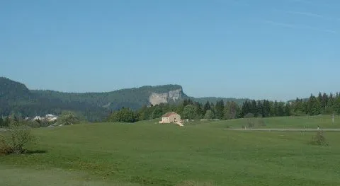
Mont Fier FrancoisFC · CC BY-SA 3.0 -
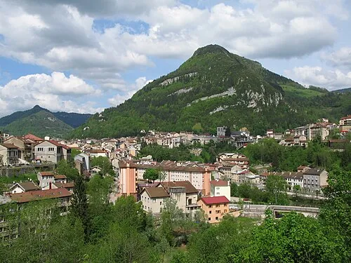
Mont Bayard Julien Bertrand · Public domain


Climate of Arrondissement of Saint-Claude
Best months for sightseeingBest months for sightseeing: June–September.
This month · November
A wet month
Day 9° · Night 3° · Rain 127 mm
- Hottest month
- July (day 24°)
- Coldest month
- January (night -1°)
- Wettest month
- November (127 mm)
- Driest month
- August (94 mm)
Bars: average monthly low and high temperature. Below: precipitation. Monthly averages for 1970–2000 at about 18 km resolution, adjusted for elevation. Highlighted months are mild and relatively dry. Source: WorldClim 2.1 (CC BY 4.0).
Show values as a table
| Month | Jan | Feb | Mar | Apr | May | Jun | Jul | Aug | Sep | Oct | Nov | Dec |
|---|---|---|---|---|---|---|---|---|---|---|---|---|
| Average high (°C) | 5° | 6° | 10° | 13° | 18° | 21° | 24° | 24° | 20° | 15° | 9° | 6° |
| Average low (°C) | -1° | 0° | 2° | 4° | 9° | 12° | 14° | 14° | 11° | 8° | 3° | 1° |
| Precipitation (mm) | 114 | 111 | 96 | 100 | 114 | 119 | 98 | 94 | 116 | 117 | 127 | 126 |
Other places to visit in this season: June July August September
How to get to Arrondissement of Saint-Claude
The nearest airport is Geneva International Airport (GVA), 30 km to the southeast as the crow flies. The nearest large city is Geneva, 35 km to the southeast.
Airports
- Geneva International Airport (GVA) Geneva 30 kmsoutheast
- Annecy Meythet airport (NCY) Annecy 61 kmsouth
- Dole Tavaux Airport (DLE) Dole 74 kmnorthwest
Nearby large cities
- Geneva Population: 201.7K 35 kmsoutheast
- Lausanne Population: 139.1K 58 kmeast
- Besançon Population: 128.4K 89 kmnorth
- Villeurbanne Population: 131.4K 109 kmsouthwest
- Lyon Population: 520.8K 112 kmsouthwest
Straight-line distances; road distances are longer. Airport data: OurAirports.
Day trips from Arrondissement of Saint-Claude
Within 100 km: 199 historic and cultural sites, 1,137 natural sites, 303 lakes, rivers and coasts.
0–25 km64 places
- La Barillette Mountain 19 kmE
- Pointe de Poêle Chaud Mountain 18 kmE
- Pointe de Fin Château Mountain 18 kmE
- Mont Pelé Mountain 21 kmE
25–60 km264 places
- Lac de Joux Lake 38 kmNE
- Lake Leman Lake 45 kmE
- Lac Brenet Lake 42 kmNE
- Etang du Moulin de Vert Lake 32 kmS
60–100 km1,311 places
- Ile de Salagnon Island 77 kmE
- Ile d'Ogoz Island 98 kmE
- Lake Neuchâtel Lake 93 kmNE
- Lac de la Gruyère Lake 96 kmE
Straight-line distances.
Places in Arrondissement of Saint-Claude
55 places- 1 Saint-Claude 9.5K
- 2 Hauts de Bienne 5.4K
- 3 Les Rousses 3.5K
- 4 Lavans-lès-Saint-Claude 2.5K
- 5 Coteaux du Lizon 2.4K
- 6 Morbier 2.3K
- 7 Moirans-en-Montagne 2.1K
- 8 Saint-Laurent-en-Grandvaux 1.8K
- 9 Bois-d'Amont 1.7K
- 10 Prémanon 1.2K
- 11 Longchaumois 1.2K
- 12 Chassal-Molinges 1.1K
- 13 Viry 938
- 14 Septmoncel les Molunes 843
- 15 Nanchez 800
- 16 Vaux-lès-Saint-Claude 699
- 17 Lavancia-Epercy 655
- 18 Grande-Rivière Château 630
- 19 Lamoura 630
- 20 Villard-Saint-Sauveur 618
- 21 Bellefontaine 545
- 22 La Chaux-du-Dombief 530
- 23 Ravilloles 488
- 24 Fort-du-Plasne 442
- 25 Villards-d'Héria 425
- 26 Meussia 424
- 27 La Chaumusse 407
- 28 Lac-des-Rouges-Truites 396
- 29 Avignon-lès-Saint-Claude 393
- 30 Lect 353
- 31 La Pesse 349
- 32 Saint-Pierre 341
- 33 Maisod 328
- 34 Les Bouchoux 318
- 35 Étival 307
- 36 Charchilla 275
- 37 Jeurre 271
- 38 Lajoux 250
- 39 Crenans 239
- 40 Rogna 226
- 41 Chancia 222
- 42 Leschères 211
- 43 Les Crozets 202
- 44 Martigna 199
- 45 La Rixouse 191
- 46 Les Moussières 171
- 47 Montcusel 163
- 48 Choux 118
- 49 Larrivoire 109
- 50 Coyron 74
- 51 Coyrière 65
- 52 Bellecombe 64
- 53 Coiserette 53
- 54 Châtel-de-Joux 51
- 55 Vulvoz 19
Bar: population relative to the most populous place in this list.
Nearby attractions & nature
Everything nearby-
Ruisseau la Pissevieille River, Jura1.1 km E
-
Bois de la Sourde Natural site, Jura2.3 km NE
-
Le Frênois Natural site, Jura5.1 km SE
-
Forêt d'Avignon Natural site, Jura5.5 km SW
-
Forêt de Prénovel Natural site, Jura9.3 km N
-
Forêt de la Crochère Natural site, Jura12 km NW
-
Forêt de la Joux Natural site, Jura12 km NW
-
Forêt de la Joux Devant Natural site, Jura12 km NE
Sources & licences
Data last updated: